.jpg)
The Albion Meadows above Alta are the best place to enjoy the spectacular show of wildflowers that Utah has to offer. The trail features more wildflowers than you can shake a stick at, and scenic peaks. We try to make it up there at least once every year, often times multiple times of the year trying to catch the peak wildflower bloom. I think we were about a week early from the peak this time, however we still got to enjoy a lot of wonderful flowers.

Quick Details:
Length: We did a 3.6 balloon, however there are shorter balloon, out and back, and loop options.
Trail Type: Balloon, or out and back. Quite a few options including a much shorter loop if you pay to use the Summer Road.
Difficulty: DR3. It was a bit of a climb, but not too bad.
Elevation Gain: About 680 feet for what we did.
Restroom: There are porta pottys by the fee station, pit toilets at various trailheads, and flush toilets down at the Albion Base.
Dogs? No. Little Cottonwood Canyon is watershed.
Other Info:
To Get Here:
Drive to the top of Little Cottonwood Canyon. Find parking below the fee station and walk up the Summer Road. There is no use fee to walk up the road. If you want to shave off just under a mile (round trip), you can pay the $12.00 fee (as of 2024) and park at the lower lot. Or, shave off even more and park higher up (while also paying the use fee).

The mouth of Little Cottonwood Canyon (Passenger Seat Photography (PSP)).

Oh, the Granite Trailhead is open again (PSP). I guess they aren’t shutting it down completely yet.

I never noticed you could get a glimpse of Hidden Peak from the road (PSP)

Collins Gulch with Mount Baldy (PSP).

There is a line to get up to the Summer Road today (PSP). When the wildflowers start popping, the area gets busy. They mitigate it by watching the parking lots, and when they are full, they only allow additional cars up when other cars come down. Today the wait appeared to be about 5-10 minutes. Anyway, I was expecting that and had planned on walking up the Summer Road today anyway.

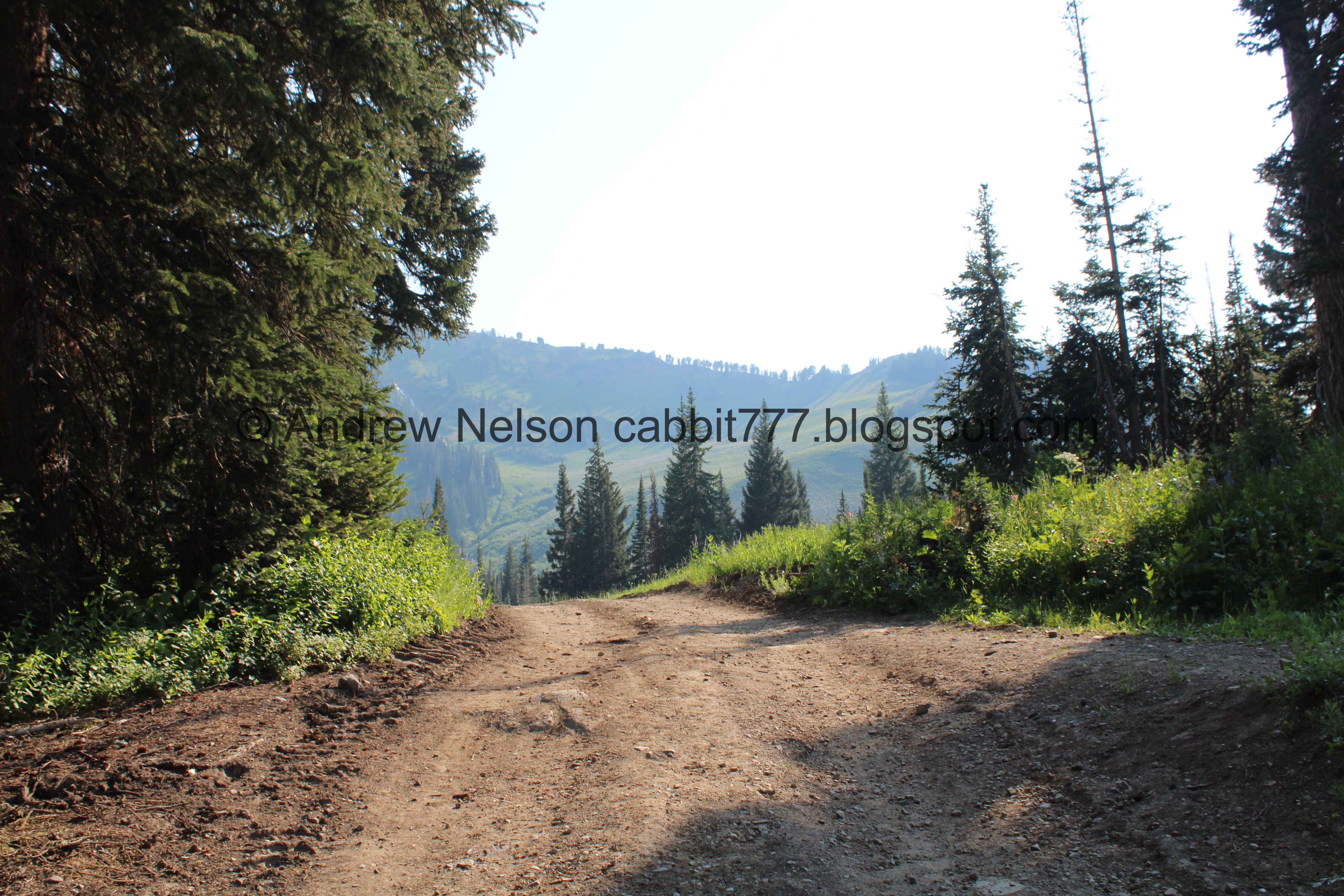
View down canyon.

The fee station.
The Trail:

On to the Summer Road, on foot today!

Geraniums.

The Summer Road.
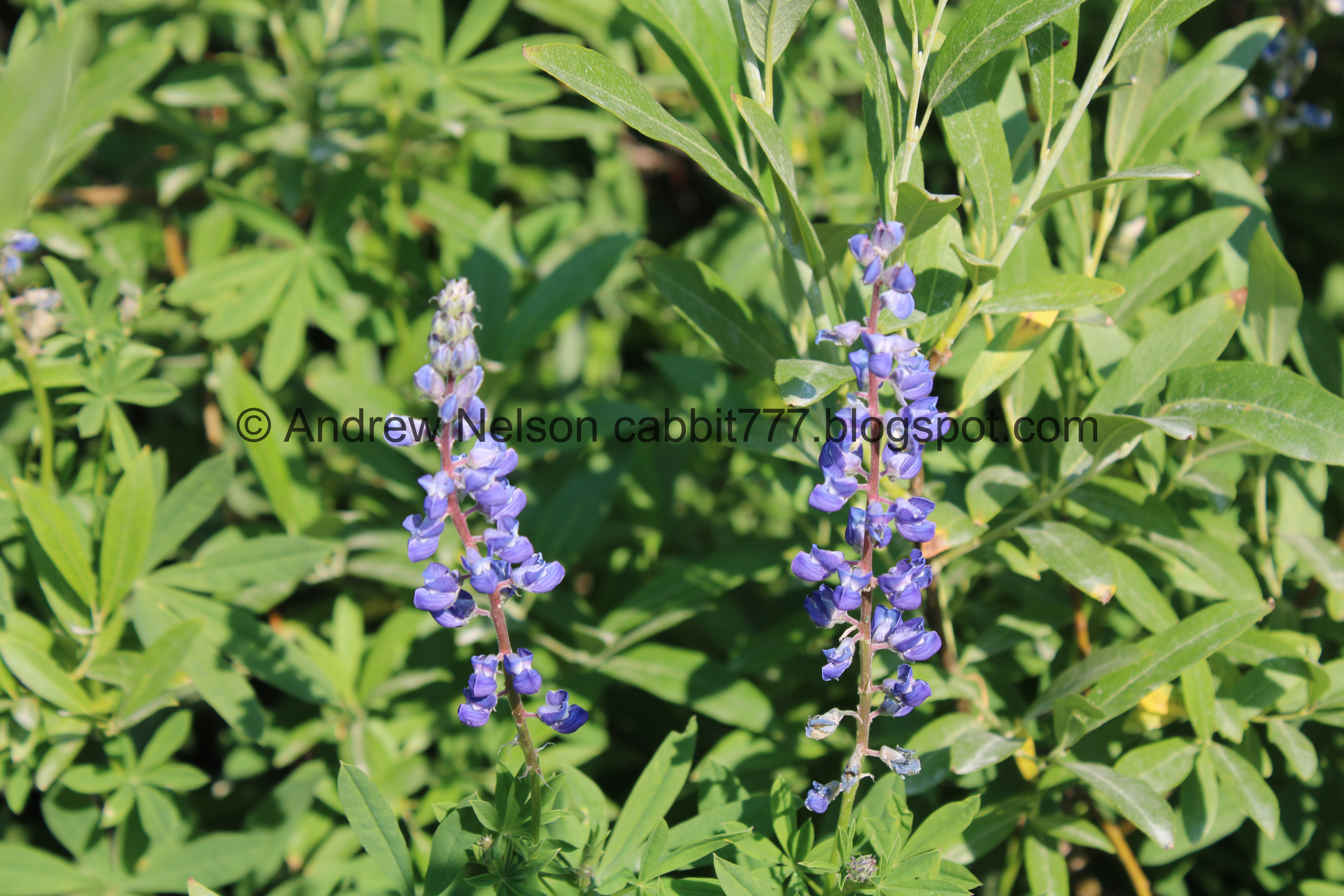
Lupine.

Monkshood.

White bog orchid.

Continuing up the Summer Road.

Purple monkey flowers.

The Summer Road again.

Weird berries.


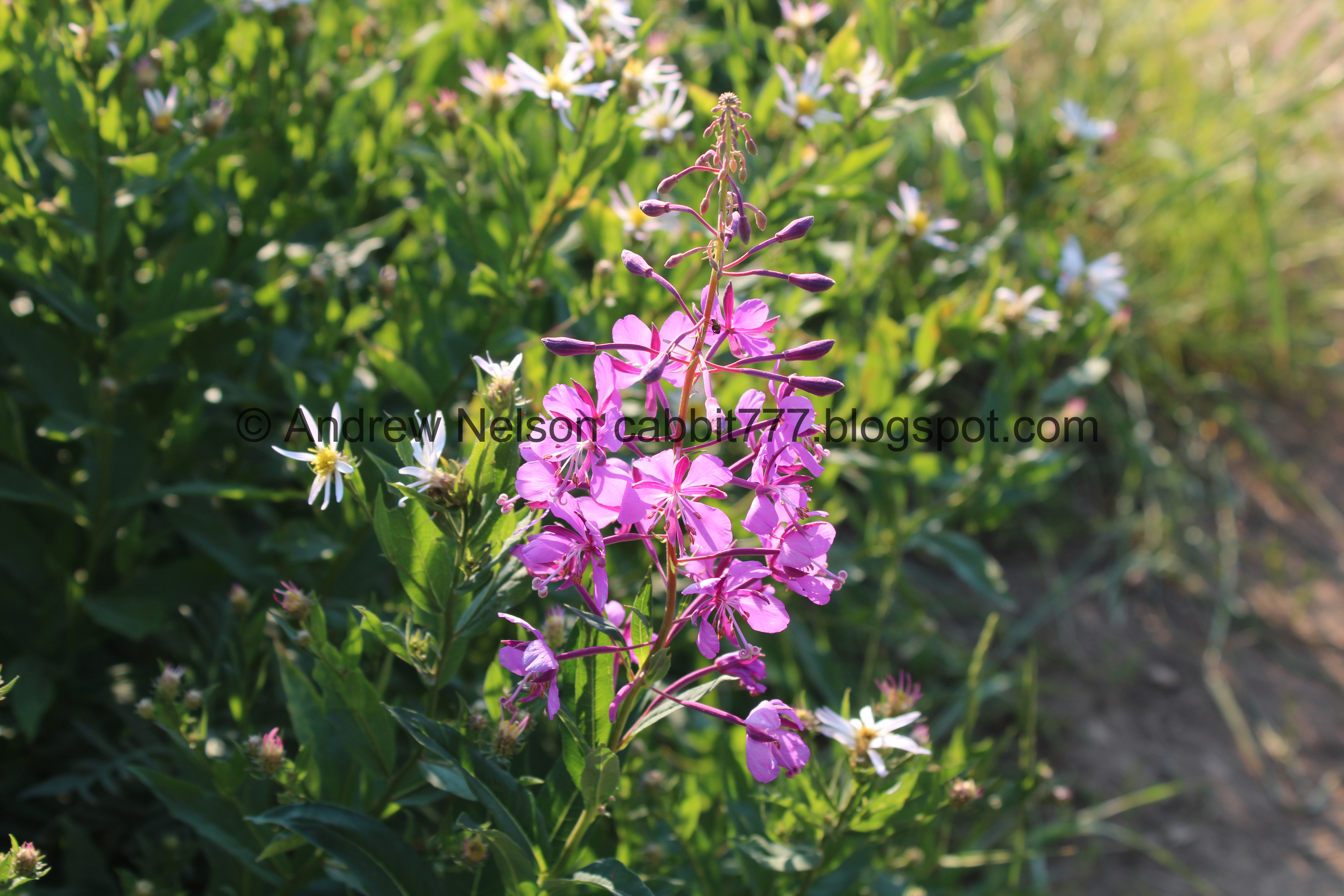
Fireweeds.

Yellow columbines.

Just under a half mile later, and at the first hairpin turn is the turn off for the Albion Meadows. As I mentioned, there is a small parking lot just below here, but it seems a little silly to pay $12 bucks to shave a little under a mile off. However, as I get older, my attitude towards that may change.

Old trailhead sign.
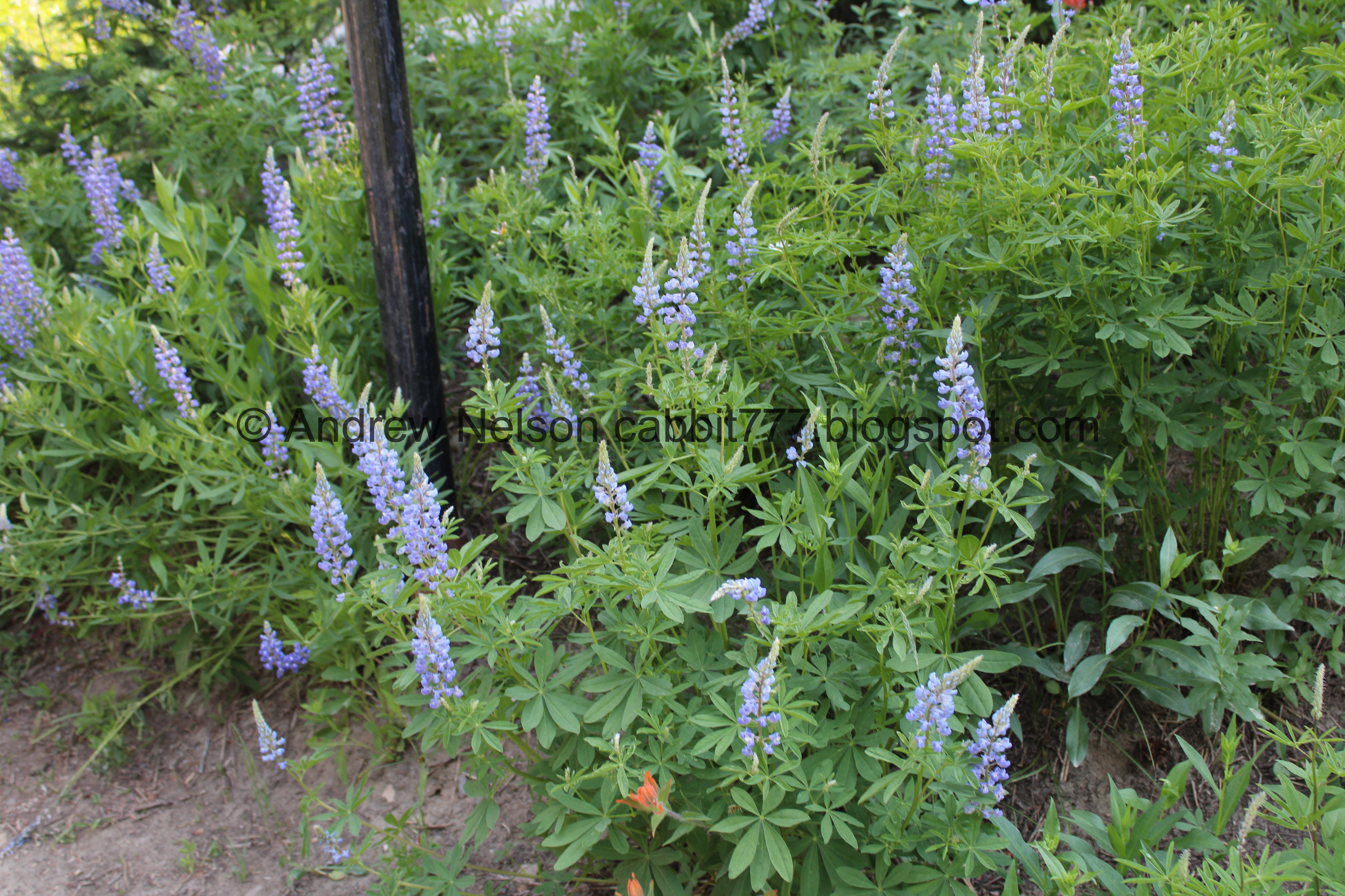
Lots of lupine.


Various shades of paintbrush.
Short steep hill.

Loads and loads of paintbrush! I think we might have chosen a good day to come up here!

Loads of lupine.

Hiking beneath the Sunnyside Chairlift.

Paintbrush.

The Catherine Pass Trailhead is above that rock outcrop.

The Sunnyside Chairlift.

Big hole, with a silly little no step sign. I think the cones were sufficient.

At about 6/10ths of a mile the trail joins the main trail from Albion Base. You want to hang left, and continue uphill.

Lupine.

Paintbrush and daisies.

Another steep little hill. Oi.

Before long, you come to another split. I prefer to go up the the right and down to the left. I have always referred the right as the southern meadows trail, but I learned today it is called Home Run.

Sugarloaf Peak and Greeley Hill.

Another split. Forward takes you to the Snake Pit Trail, which we have not done yet, but I am a little interested in it. left is the Home Run Trail, that will take us through the meadows.

Devils Castle and Sugarloaf Peak.


Arnica.

Devils Castle and Sugarloaf Peak again.

Lupine.

Greeley Hill.

Little yellow flower.

Butterfly.

Lupine and paintbrush.

Paintbrush and lupine.

Lupine.

Paintbrush.

Geraniums.


Various shades of paintbrush.

Paintbrush.

The first little switchback. As far as switchbacks go, these are not bad at all.

Arnica.

Snow maker.

Another daisy like flower.

Geraniums

Arnica.

Jacobs ladder.

Fireweed.

Lots of them.

A bunch of them on this next switchback.

With the peaks above.

With Devils Castle.

Closer.

A bunch with Devils Castle. I really like fireweeds if you can’t tell.

Another one.

Flowers with the view back down.

Some mint, with a large bumblebee.

Peaks above.

Flowers on the hill.

Lupine.

Lots of it.


Particularly colorful spot.

Continuing up the trail.

Some bright red paintbrush.
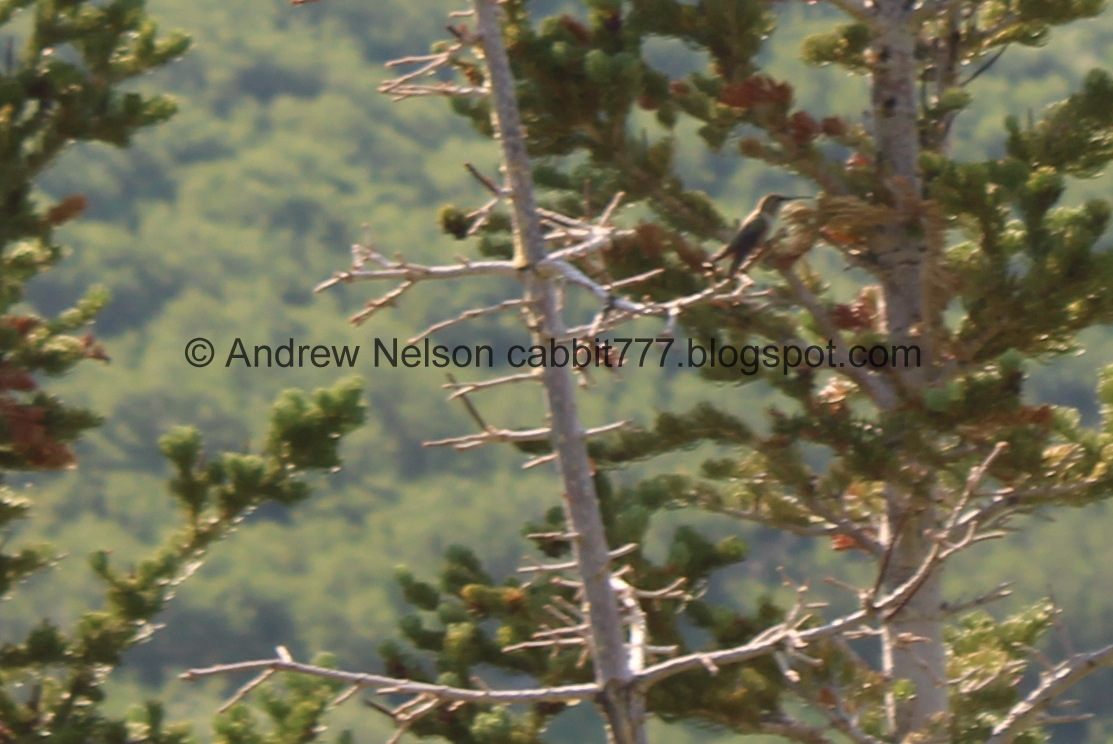
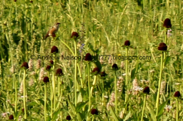
I actually managed to capture one of the hummingbirds. Man they are fast!

Mine tailings.


Arnica.

The peaks again.

Adorable little potgut squirrel.

Peaks again.
.jpg)
Panoramic, with Devils Castle, Sugarloaf Peak, and Greeley Hill.

Little Cottonwood Creek below.

Paintbrush.

Monkshood.

Paintbrush.


Columbines.

Daisy like flowers.

You can see several spots where they have rerouted this trail. The old trail looks to be filling in quite nicely.

The gully with the creek in it.

Another snow maker.

Geraniums.

Lupine.

Lots of paintbrush.

Paintbrush, lupine, and geraniums.

Below Alfs, there is an option for a much shorter loop, by flipping around to the left here, but it does bypass the main hill. We continued forward.

The next trail split we want to hang a left towards Alfs. Right goes up to Germania Pass.

Devils Castle.


Different shades of paintbrush.

Lupine.

Alfs. This is only open during the ski season. It kind of surprises me that they don’t take advantage of summer, or at least wildflower season. I would totally stop in for a sammach and a beer in the middle of my hike!

Old microwave reflector tower.

At the corner of Alfs you come to the next trail split. You can do a shorter loop that does include the main hill by continuing forward and up the dirt access road. You will then see a trail split of to the left before the gate. We decided to do the longer loop option, and continued to the right.

Alfs again. Alfs, and several other features around Alta, is named after a famous skier named Alf Engen.

Fireweed.

The peaks and the Supreme chairlift.

A patch of snow still hanging on.

Little Cottonwood Creek.

Starting to hit some forested area.

Another snow maker. This one looks pretty new.

Flowers growing on a boulder.

The trail goes through the woods for a minute.

The creek again.

Columbines.

Nice little bench to rest on and enjoy the views. It looks like it was a chairlift bench.

The creek again.

A nice little waterfall.

Short boardwalk section through a marsh.

Monkshood.

A bunch of white bog orchids.

A bunch of elephant heads. I have noticed in general if you see an elephant head, you will likely see the white bog orchids. They seem to like the same conditions.

More elephant heads.

The creek again.

Elephant heads.

For the main loop we did you want to hang left. You do have longer loop options hanging right. I just wanted to run up a little ways to see if I could find a shooting star/ I removed that mileage of this short spur from what I reported above.

White bog orchids.

Daisy and paintbrush.

Monkshood.

Some corn lilies that have bloomed. They are neat, but not spectacular.

Elephant head and white bog orchid.

Columbine.

Pretty yellow flowers.


Paintbrush.


Monkshood.

Twin springs.

Bright red paintbrush.

One of the little springs.

More forest.

Little marshy area.
Sadly, no shooting stars today. It might be just a little too early for them. There are a bunch of elephant heads though.

White bog orchid.

More purple monkey flowers.


More elephant heads.
Alright, I guess we will head back to the loop.

Big boulders.

Paintbrush.

The little springs again.

Monkshood.

Flower covered boulder.

Elephant head.

Again.

White bog orchid.

Again.

Back to the main loop.


Monkshood.

No idea what these are. They look like the plant that had berries we saw earlier.

Monkshood.

Yellow monkey flowers.

Little closer.

Approaching the Cecret Lake Trailhead overflow lot. Here we are going to swing left. If you still have a ton of energy you can add Cecret Lake. It will only add an additional 1.5 miles out and back.

Western coneflower. This is about as much as they bloom, sometimes a little bit more, but I have never seen the entire cone covered in the little petals.

Skirting around the overflow lot.

Just after the restrooms, and before the main Cecret Lake Trailhead lot is this thinner trail called Catherine’s To Cecret Lake Connector. This will bring us back to the meadows.

A sign reminding you to protect the meadows.

Lupine.

A larkspur just starting to bloom. I successfully got a larkspur to grow in my garden this year (though a smaller species). It makes me happy and I hope it comes back next year.

Loads and loads of lupine.

Continuing down the thinner trail.

Paintbrush.

Lupine and paintbrush.

Paintbrush and lupine.

Little bridge over a small stream.

The little stream.

Bearing Tree. An old method of defining property boundaries.

Continuing along.

Lots of lupine.

The trail.

Catherine Pass. We hiked up there last week.

There are 3 or 4 of this little gravel parts that appear to allow water to passthrough without flooding the trail.


Paintbrush.

From here we will need to follow along the Summer Road to the left for just a quick second.
Also, I am not 100% sure, but I am pretty sure the original Catherine Pass Trailhead was right around here somewhere. If you study the trailhead sign, it is obvious the trailhead was moved at some point. I don’t know when it happened but definitely before we started hiking up here.

Catherine Pass again.

Maybe ~20 feet later you come to the next trail split. You want to go left and head down the access road towards Alfs. You can go right if you want, but that is more walking along the Summer Road which doesn’t sound very pleasant.

A little stream.

More arnica.

Geraniums.

Devils Castle.

Catherine Pass again.
.jpg)
Panoramic. Lets see, Mount Wolverine, Catherine Pass, Point Supreme, East Castle, and Devils Castle.

Just a little ways down you will come to this access gate. It is pretty easy to get around.

The peaks and some forest.

Larkspur.

Germania Pass.

Larkspur.

Continuing along the access road.

Western coneflowers.

Forest.

The trail to the top of the meadows. If you are done climbing, you can continue down the service road towards Alfs and return via the main trail, or back down Home Run.

Alfs below, this is where the medium length loop option I mentioned before connects.

Continuing up towards the Catherine Pass Trailhead.

Alfs below again.

More larkspur.

Forget me nots.

Larkspur.

Jacobs ladder.

Geraniums.

Lupine.

A more purple larkspur.

Continuing up towards the Catherine Pass Trailhead.

Geraniums and daisy like flowers.

Larkspur.

Western coneflower.

Almost to the Catherine Pass Trailhead. Looks like they are doing some kind of restoration on the side here.

White geranium and Jacobs ladder.

Lupine.

Some purple larkspur next to some blue larkspur.

The top. Phew. Right will head to the Catherine Pass Trailhead. Left will head back down into the meadows. This particular trail is fairly new, like in just the last few years new.

Directional sign.


Larkspur.

This sign is new. It tells you how to get a great shot up here without disturbing the flowers.

Heading back down.

Purple larkspur.

Continuing down the hill.

One of several photo pull outs. Be sure to use these for those awesome photos with the wildflowers instead of trampling flowers to get that perfect instagram shot.

The meadows are definitely not quite at prime yet.

Paintbrush.

Lupine, arnica, and geraniums.

Larkspur.

Arnica.

View down.

Purple larkspur and peaks.

Just the peaks.

View down again.

Some kind of mint.

The peaks again.

A couple steeper sections, but not too bad.


Different shades of paintbrush.

Western coneflower. This is about as much as I have seen them bloom, however, bumblebees love them!

The peaks again.

With some larkspur.

More larkspur.

Geranium.

Flower lined trail.

Lots of paintbrush.


Closer.

Some pale ones.

The 2nd switchback.

The peaks again.

With some larkspur.

Continuing down. The wildflowers just do not respect the rope boundary. I joke, but that is better than humans not respecting the rope boundary.

Lupine.

Looking back up the hill towards the Catherine Pass Trailhead.

Jacobs ladder.

Fireweeds and some mint.

View down again.

The peaks and some larkspur.
Caught another hummingbird.

Geraniums.


Nice mix.

Paintbrush.

Different shades of paintbrush, and larkspur.

Fireweed.

With the peaks.

Another nice mix.
Another fireweed. Yay, today was a good fireweed day.

View down.

Another switchback.

A nice patch of fireweed.

Another one.

With the view down.


Fireweeds.

With devils Castle.

Lots of fireweeds.


Another hummingbird.

Fireweed.

With the peaks.

Lots of fireweed.

Closer.

With a ladybug.

Another one with the peaks.

A nice patch.

Arnica.

Where the trail joins the main Upper Albion Meadows Trail.

Looking back up towards the patch of fireweeds.

Mine tailings across the way.

The main trail is nice and wide. It was/is an old access road.

Arnica.

With the peaks.

White flowers.

More fireweeds.


Couple different shades of paintbrush.

Lupine and peaks.

Geraniums and paintbrush.

Back to where the Homerun Trail splits off of the Upper Meadows Trail. Right will get us back to the road.

Paintbrush.

Geraniums.

Another trail split. Left will take you down to the Albion Base (which will get you back, but with more climbing), and forward will get us back to the Summer Road.


Lots of lupine.

The microwave reflector tower again.

Rock outcrop. The Catherine Pass Trailhead is on top of it.

Continuing down.

Paintbrush.

Penstemon.

Bluebells.

Looking back toward Greeley Hill.

Paintbrush.

Lupine.

Small side stream.

Lupine.

Paintbrush.

Back down to the Summer Road.

View down canyon.

Fireweeds.

Continuing down the Summer Road.

Hitting some aspens.

Back down to the fee station, and the main Little Cottonwood Road.

View down canyon.

View back up into the basin.

View down canyon.

Weird berries.

Heading back down the canyon (PSP).

View down the perfect U shaped canyon (PSP).
Well, we were a little early for the prime bloom, but obviously we saw tons of wildflowers today. It was a good day for fireweeds too! It was a little busy, but not crazy busy yet. I would imagine next week it is going to start being crazy busy. I am going with 9 out of 10 squirrels today,
As for difficulty, there are a couple steep parts, but it isn’t too bad. DR3.
Dogs are not allowed in Little Cottonwood Canyon due to watershed restrictions.

No comments:
Post a Comment