.jpg)
I have been itching to get out to Antelope Island for a couple weeks now, but with this bizarre (actually probably closer to what used to be normal) winter it just wasn’t happening until now. Final a weekend on a day well after the previous storm, so I was hoping the trails were mostly dried out, and they were.
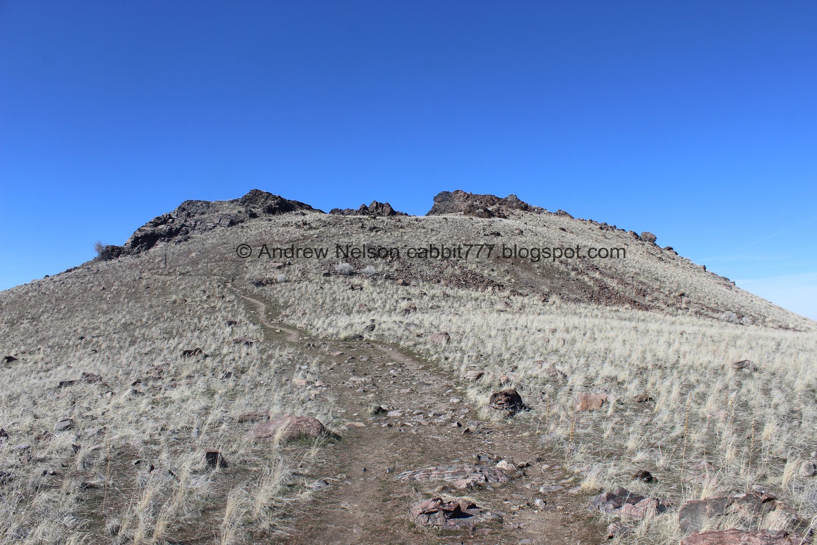
Dooley Knob from the Antelope Island spine.

Me at the top of Dooley Knob
Quick Details:
Length: About 2.4 miles out and back We did about 2.54 with a couple extra spurs. (the signs lead you to believe it is 2.6 - 2.8).
Trail Type: Out and Back, Spur
Difficulty: DR4 there are some sections that are quite the climb!
Elevation Gain: 754 feet
Restroom: There is a pit toilette at the lower parking lot.
Dogs? Yes, but must be on leash at all times.
Other Info: Fee Area $10.00 Per car.
Not recommended on a hot summer day. There is absolutely no shade at all.
To Get Here:
Head to Antelope Island. After crossing the causeway take the left fork (signs for Fielding Garr Ranch). After about .7 miles take the first left (again signs for the ranch). Go about 5.2 miles and turn right. Signs for Frary peak Trail. Head up the steep road to the upper parking lot.

Crossing the causeway we can see the bizarre shallow Great Salt Lake and it's wacky shoreline (PSP (Passenger Seat Photography)).

The causeway (PSP).

I love that you can see the difference in color from the fresh water entering the north section.

Antelope Island Sign (PSP).

Some bison (PSP).

Another bison (PSP).

Frary Peak and I am pretty sure our destination for the day, Dooley Knob is there on the right hand side (PSP).

The side road up to the trailhead is thin, and steep, but at least it is paved (PSP).

Dooley Knob from below.
The Trail:

Trailhead Sign. This sign says it is a .6 miles spur, after following the Frary Peak Trail .7 miles 1.3 miles total. But, my pedometer app put it at about 1.2 miles total.

Onto the trail!
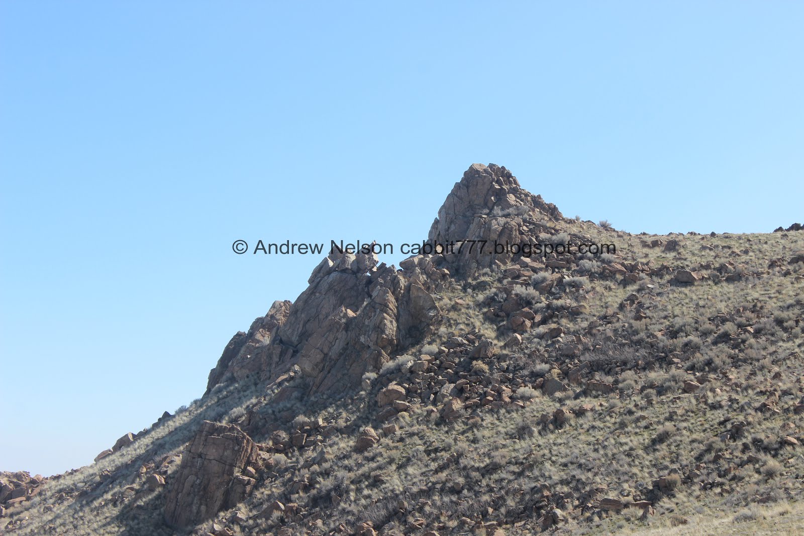
Neat rock formation with a little window.

The trail immediately gets you climbing. It is also very rocky though here.

Before long we are already quite a ways up above the parking lot.

Fun rocks.

It would seem a lot of people had the same idea I did today. We don’t often have to wait very long at the fee station, but the Island is hopping today! Guess I can't blame them. Only the 2nd nice weekend of the year so far.

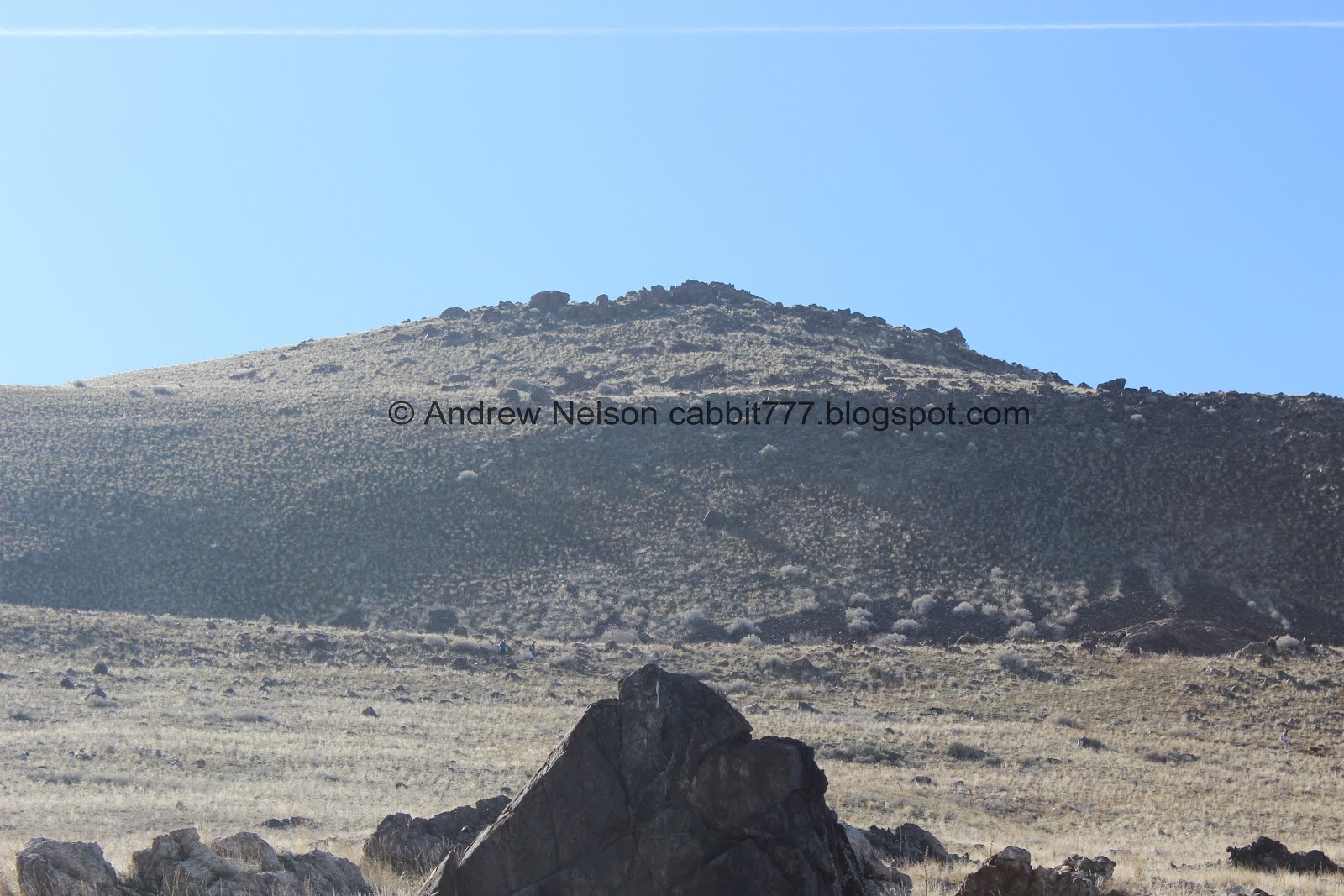
We can see Beacon Knob from here. Also a great hike, longer, but quite a bit easier.

The lake appears to be a little higher than last time we were out here when we did the South Island Trail.

Ho boy. This trail is quite the climb!

Another fun rock outcropping.

Oi, more up!

The lake again.

Another really rocky part.

Hooray! A nice flat section for a minute.

Whew! We are really up there already.

Quick Panoramic.

Short climb up to the next ridge.

Another fun rock outcropping.

The lake again.

Frary Peak.

You can just make out Dooley Knob peaking up over the hills.

More climbing.

I tend to psych myself out, and this section appeared a lot worse than it actually was. I was a little nervous, but in hindsight, it was not bad at all and didn’t even bother me at all on the way down.

Frary Peak again.

Looking down.

Eventually the trail starts to level out again.

The trail split. My pedometer put this at about .74 miles, so pretty close to what the TH sigh said. Left will continue towards Frary Peak, right will go to Dooley Knob.

This sign says it is an additional .7 miles to Dooley Knob (the previous one said .6). But, my pedometer app put it at about .5.

After another long climb you are rewarded with another flat section along the Antelope Island Spine.

Dooley Knob.

Now we can see the other side of the island and lake. White Rock Bay below.

White Rock Bay again. With Buffalo Point to the right, and Elephant Head Point to the left.

Another outcropping. We will explore this more on the way down.

Dooley Knob. It looks a lot more tough than it really is.

Buffalo Point again.

Random cairn.

Looking back along the spine with Frary Peak.

The closer we get to Dooley Knob to less formidable it seems. I can do this.

Getting closer, on to the final push.

Onto the thin switchbacks.

Frary Peak again.

Yay! Almost to the top. For the most part the switch backs weren’t that bad actually.

Now we just need to get into the boulders.

One final little climb.

The parking lot below. Our car is so tiny from up here!

The extremely high view was starting to get to me (fear of heights) so I decided I had gone far enough and deemed this my result for a minute while I caught my breath. Little did I know the end was seriously only like 20 more feet haha. So I sucked it up and kept going.

Landis is almost to the top.

Beacon Knob to the north seems a lot lower than Dooley Knob from here.

View to the east.

View to the west. Elephant Head, White Rock Bay and Buffalo Point.
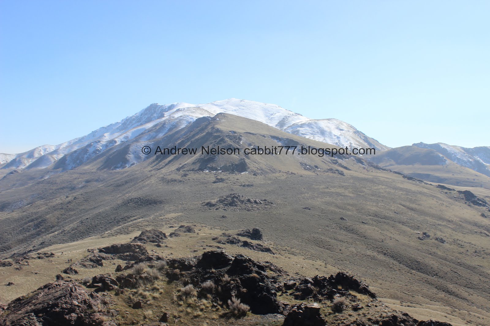
View to the south along the spine to Frary Peak.
I took a 3D 360 but it looks like google has removed the feature to share those. That’s a shame.

Me at the top. I guess technically you could scramble up on top of these boulders a few feet, but, This is good enough for me. I am pretty darned proud of myself! I struggled a couple times, but managed to push through and made it to the top!
Like I said, my pedometer put it at 1.2 miles. I am pretty sure we made it to the end, if there was more to go it involved boulder scrambling. But honestly, this looked like the top to me.
Well, that was fun, the views are absolutely incredible! And I love that we managed to have it to ourselves for the entire time we were here. But, it was time to head on back.

We did manage to see some snow near the top.

Fun boulders.

Heading back down.

Back down the switchbacks. See, not too bad.

Back along the wide spine.

The haze is so thick it is hard to make out downtown.

White Rock Bay again.

Now that we have made it to the peak, I decided we could check out some of the short spur trails.

Looking back towards Dooley Knob. Another group made it to the top.

Elephant Head. Doesn’t much look like an elephant head from here.

This little spur trail offers a great view of White Rock Bay.

Dooley Knob again.

The east side again. I still think the river that is the lake down here seems wider than last year.

With the moon.

Just below the trail split we start heading down again.

View down the hill side.

Frary Peak again.

We decided to check out this next rock outcropping.

Just a short side trail out to it.

A nice view as well.

Looking up towards Dooley Knob again.

The flat section before the long walk down.

The lower rock outcropping. It doesn’t look like you can get out to it, but maybe I am wrong.

The middle rock outcropping. We decided to not go out to this one.

Last little bit of down.

Very rocky!
Dooley Knob again.

The lower outcropping again.

Back down to the parking lot with another view of Dooley Knob.


Heading back down the hill (PSP). That is definitely a steep descent!

Dooley Knob from the lower parking lot.

The lower parking lot has a trailhead for the Mountain View Trail which is a long flat trail that follows the road along the east side of the island. We might have to check that out some time.
After this we decided to continue south along the road and explore the island some more.

As we continued on towards Fielding Garr Ranch we found a random porcupine in a tree.
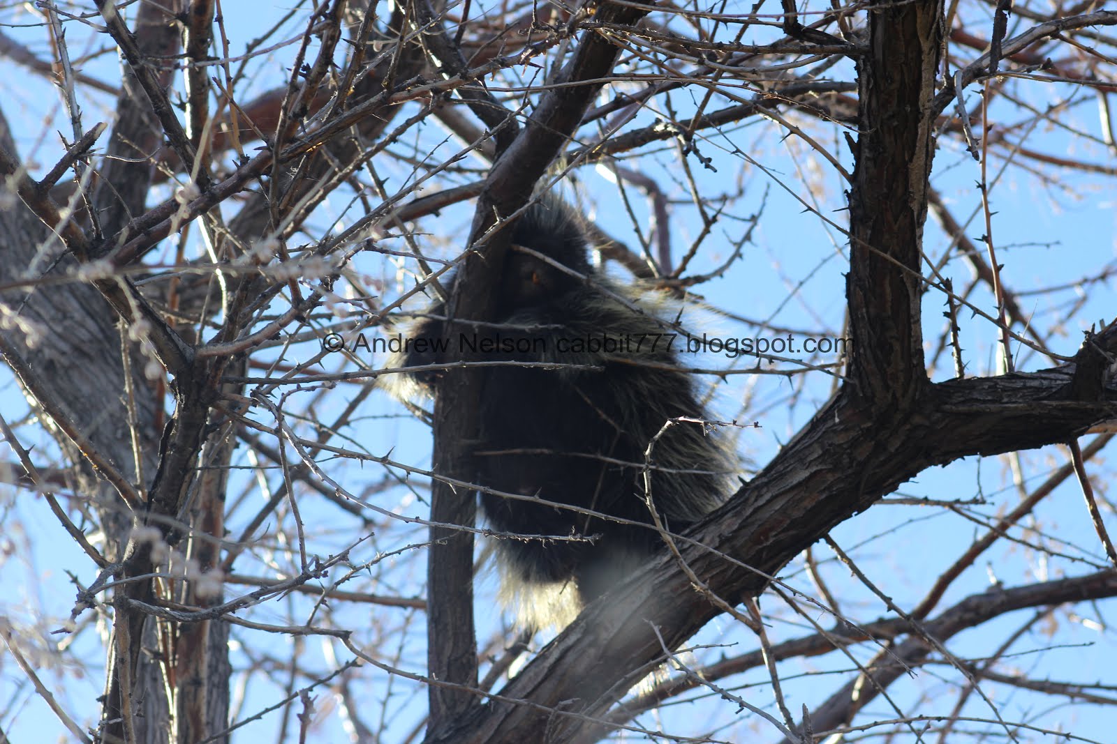
Cute little guy!

I was a little worried he was dead until he started moving around. Phew, just snoozing in the sun.

Bison (PSP).

Downtown SLC.

The Sentry. Another amazing trail on the island.

heading back north now, more bison (PSP).

Dooley Knob again (PSP).

Downtown again (PSP).

More bison (PSP).

Nearing the north end of the island the lake is significantly wider (PSP).

The causeway (PSP).

Downtown from the causeway (PSP).

From a little further down (PSP). This image make it seem as though SLC is on the waterfront.

Lake edge (PSP).

Millions of birds (PSP).

Birds and SLC (PSP).

Looking back towards the island (PSP).

Panoramic (PSP).

On the way in I noticed a trailhead and wanted to see if there was any information about it. I did not find any new information, but did find this hawk.

I think it was a northern harrier.

I noticed these guys last minute so the picture isn’t great, but I think they are sandhill cranes (PSP).
Wow! That was an amazing adventure! Or maybe it has just been a while since I have been able to get out and explore. Either way, this trail was great, I struggled through a couple sections, only to realize there was not a problem, and going down those spots didn’t bother me. The island was more crowded that I have seen in a while, and that certainly spilled over to this trail, but, we got the knob to ourselves for quite a while. I really did enjoy this trail. I can’t decide if I like this one, Beacon Knob, or The Sentry best, but I really did like it. Going with 10 out of 10 Squirrels.
As for difficulty, This trail certainly had some UP sections, but there were a few good sections of flat spaced out enough that it wasn’t too bad.
Dogs are allowed, but must remain on leash at all times. Not only because well, it's the rule, but also know there are predators on the island so it's for safety as well.

No comments:
Post a Comment