.jpg)

Quick Details:
Length: About .8 miles to the lake and .8 around the lake. For a total 2.4 mile balloon.
Trail Type: Balloon or out and back.
Difficulty: DR3. It’s short and a fairly gradual climb.
Elevation Gain: About 240 feet.
Restroom: There is a pit toilet in the parking lot.
Dogs? Yes, leashed. Please clean up after your furry friend.
Other Info: Fee Area. $6.00 3 day pass which must be displayed if stopping at any trailhead. (just passing through, no fee). I recommend bringing cash (with exact change) or a check as, unless you stop by the ranger station it is self service.
To Get Here:
From Kamas, take the Mirror Lake Highway about 35 miles up from the final turn in Kamas. You will pass Bald Mountain Pass, and Mirror Lake. The trailhead is on the left and is signed so you shouldn’t miss it.

The wildlife overpass at Parleys Summit is now open and appears to be a complete success (PSP (Passenger Seat Photography)).

Jordanelle appears to be back up to full again (PSP).

Entering the Uintas (PSP).

This always gives me a little chuckle (PSP). From what I have read, its all just a big joke. No nudists running around.

Super green and pretty up here (PSP).

I love the forest up here (PSP).

The Provo River (PSP).

I used to think this was Bald Mountain you can see as you near the top but it is actually Mount Watson.

As we approach Bald Mountain Pass we start seeing a little bit more snow (PSP). Still not quite as much as I was expecting to see considering the long winter we had this year. The pass didn’t open until June 24th this year, just a short 13 days ago.

Bald Mountain (PSP).

The pass (PSP). At 10,759 feet this is the highest paved mountain pass in the state.

Mirror Lake (PSP).
The Trail:

Finally reached the trailhead.

Across the street is Hayden Peak.

Holy glacier lilies batman.

The trail is rocky at times but is pretty easy going for the most part.


Pretty forest.

Glacier lilies and some other flower I haven’t identified yet.


Forest again.


A lot of the rocky places are like natural (or slightly assisted anyway) staircases.

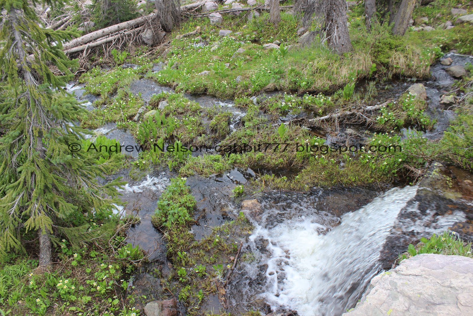
Whoa! Last time we hiked up here (3 years and 6 days ago) this was just a trickle. This winter has made for great waterfalls, and great wildflowers.

It’s not a very big waterfall, but it is pretty.

Little clearing with a peak in the background.

The lovely creek.

Rocky trail.

Rocky hill.

Another clearing with a tiny little pond.

Peak above. I know we are near both Lofty and Scout Peaks, but I am not sure if this is either of them.

Rocky area. It almost looks like it just rained rocks through here.

This boulder has been worn down by years of hikers.


I love this stone bridge.


Nice little waterfall back there. We decided to explore it a little more on the way down.


Nice little cascade here.
By the way this is the worst of the climb and it’s not even bad.

Looking out across the woods towards Hayden Pass.

.
The creek again.

Different looking paintbrush.

Nice clear water.

I think these are white marsh marigolds.

Little tree island.

Pretty creek again.

More wildflowers.

Trail split. Ruth Lake is to the right. I am still trying to figure out where left goes, all I can figure is it is a direct route to Camp Steiner, or it might go to that peak. I don’t know.

Another rock bridge to the alternate path. I don’t remember this being here last time, but that doesn’t mean it wasn’t.

I am sad to see they retired the fancy old sign that used to be here. It was really neat. You can see it from my previous trip up here.

Pretty clearing below the peaks. Looking at google earth I think that is Lofty Peak. We hiked on the other side of it on the Lofty Lake Loop.

I still am not sure if this peak is named, and if it is, what it is.

I thought we had already reach the pond, and well, we have reached a pond, but last time this was just a marshy area.

There were a TON of frogs croaking in there. Never did see one though.
Landis did take a video so you can hear them croaking.

More marsh marigolds.

Lovely little flooded marsh.

I think I finally figured out what these are: lanceleaf springbeauty.

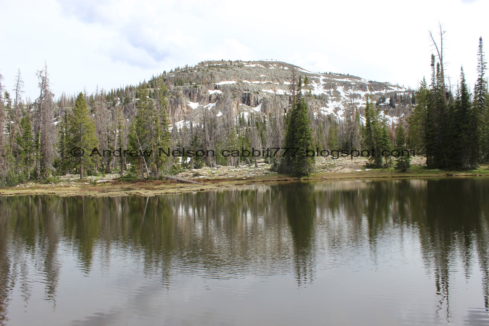
Now we have reached the pond. Don’t mistake this for the lake. I mean, it’s pretty and all, but Ruth Lake is quite large, so be sure to keep going. This is a good sign you are almost there though.

More marsh marigolds.

It does seem a little bigger than last time though.

More glacier lilies and lanceleaf springbeauties.

With the unnamed peak.

So far the trail has been pretty dry, but we did hit this muddy part. There was an alternate trail around it though.

On the north end of the pond with a nice reflection of Hayden Peak.

First glimpse of Ruth Lake.

I love how a lot of the rocks and cliffs along this trail have almost perfect square fractures. I don’t know what would cause that, but it is neat. I will have a few more examples shortly.

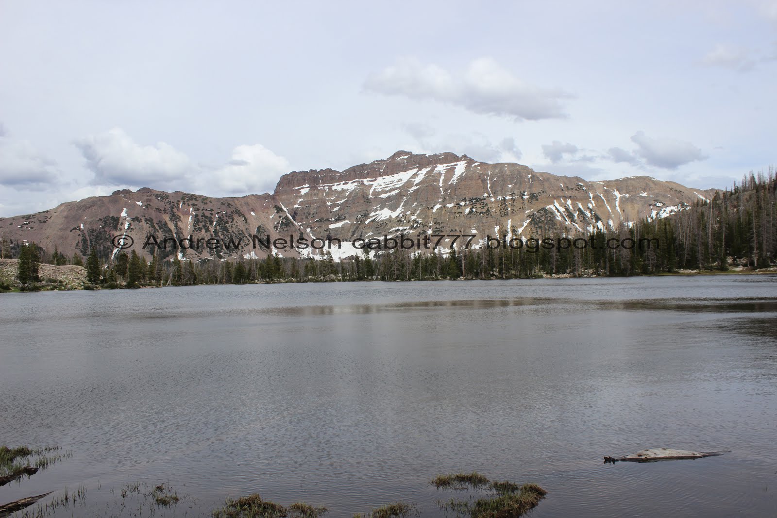
We have made it to Ruth Lake!

The lake with Lofty Peak above.
Last time we were here we went around to the right, in search of one of the surrounding lakes (which we never quite found) and we ended up connecting to the Lofty Lake Loop trail. So, today we decided to go left.

Crossing the outlet is probably normally pretty easy, but there is also a pretty sturdy bridge too.

A pass between the peaks. I am sure it is named, but I don’t know what it is.

Panoramic.

There is a tent up there. I guess they have a nice view, but with the wind it must kind of suck.

Lofty Peak above Ruth Lake.

The trail was flooded out here, but we did find a way around it. I should have taken this as a sign of what’s to come. oi.

Hayden Peak to the south.

Unnamed peak to the west.

I thought we might see snow on the trail today. Honestly, I thought we would have seen a bit more though.

The lake again.

Another panoramic.

A lovely wooded section.

Lofty Peak again.

Neat pillar on the side of it.

More forest.

Another wet muddy area. It wasn’t too bad though.

One of the inlets.

The main trail is forward here, but I thought I could hear a waterfall so we took the left split. It really didn't add too much.

Getting into more snow.

Snow bridge.

Nice little cascade back there. I considered going up a ways to get a better look, but didn’t feel like tromping through snow right now.

Flooded area, we had to work our way downstream just a smidge.

Looking back towards the lake.

Back down to the lake. We can now see Kletting Peak to the south.

Still a little bit muddy, but not too bad.

The lake again.

A stream of marsh marigolds. This is neat seeing them fill the entire stream bed.

A little closer.


More of the square rocks and cliffs.

Little boulder field you have to cross.

The lake again. Starting to see Hayden Peak to the right. Kletting to the left.

I am getting better at identifying flowers. I thought this was a buttercup. I think it is a white globe flower, which is in the buttercup family.

Little spring.

The lake again.


With some flowers.

A lot of water coming down across that boulder.

More square rocks.

Itty bitty pond next to the lake.

At the far end of the lake getting a nice view of Kletting and Hayden Peaks.

Another panoramic.
It was just a smidge too windy to get a good reflection picture, but this isn’t bad.

Multiple spring/run off channels joining.
Hayden Peak again.

With some wildflowers.

The lake again.

Another little spring.
Here at the northeast end of the lake the trail does continue up above. We did that last time but today, with our first trip up in the high Uintas of the year, we both realized we were experiencing very mild symptoms of elevation sickness. So we thought it was best to just head on back.

Another inlet.

From the other direction.

More marsh marigolds.

I love the way the snow creates stripes on the unnamed peak.

Another panoramic.

Pass above. I don’t know if it is named, but we hiked through there last time.

Rocky hill.

The lake again.

Nearing the south end of the lake with the pile of logs near the outlet.

Neat curved tree.

From the south or front end of the lake.
Now we just have a short 8/10ths of a mile back to the trailhead.

Glacier Lilies and Lofty Peak.

Back down to the little pond and Hayden Peak.

I can’t remember ever seeing a glacier lily sprawled out liked that before. Weird.
The pond and the unnamed peak.

The marshy pond again.

Back down to the rocky clearing.

One of the interpretive signs. I knew snowshoe hares changed from brown to white in winter, but I didn’t know grouse did it as well. Neat.

The upper rock bridge that leads to the side trail.

The creek.

Another interpretive sign. We have seen both pikas and marmots before, but not on this trail today.

Aww, that is a shame. The amazing cairn isn’t there anymore. But, it has been a few years so, I guess I shouldn’t be surprised.

Panoramic of the peaks across the way.

Another meadow.

Down to the rock bridge. I still love this thing and thank whoever created it.

We decided to see if we get get a little closer to the waterfall. Since this is a rocky segment, I didn’t feel too bad going off trail.

It was a rather fun adventure finding the perfect path up to it.

Wow! This is really pretty.

Where it extends across a boulder.

Pretty waterfall.

The lower section.

The upper section.

Super pretty.

Heading back down to the trail.

Rock lined path over the boulders. It really is easy to keep on the main path.

Rocky hill.

More of the lanceleaf springbeauties.

Another interpretive sign.

Pretty clearing.

Back down to the lower waterfall.
With the stream below.

From below.

With some flowers.

Rock stairs.

Another interpretive sign.

Pretty forest.

More lanceleaf springbeauties.

Hayden Peak.

Back down to the trailhead.

Back down the road (PSP).

Bald Mountain looks so much neater from this angle (PSP).

Bald Mountain and Reids Peak (PSP).

Bald Mountain again (PSP).
Bonus Quick Stop At Moosehorn Lake

We decided to do a quick stop at Moosehorn Lake. This was a short walk out from the parking area.

Overflow.

Moosehorn Lake is just below Bald Mountain which makes it pretty scenic.

Panoramic.

More marsh marigolds.

Back over Bald Mountain Pass (PSP).

I think this is Notch Mountain (PSP).

We made a quick stop at Provo River Falls. More on that here.

Then we were back on the highway (PSP).

Deer! (PSP).

Pretty valley (PSP).

Nearing the mouth of the canyon (PSP).

Fun clouds (PSP).

The wildlife overpass at Parleys Summit (PSP).


Heading down Parleys (PSP).
I really enjoyed this hike. It was so quiet and peaceful. Serene and scenic. The lake was beautiful. The waterfalls were nice, the wildflowers were great. I absolutely love the Uintas. The trail was fairly quiet and we saw a few people on the way in and out, but for the most part had the lake to ourselves today, which was a nice bonus. 10 out of 10 squirrels.
As for difficulty, This one is fairly easy with a gradual elevation gain, but is high elevation which may cause some symptoms of elevation sickness. I would rate it as DR3, but the the elevation I am going to bump it up to DR4.
Dogs are allowed, but must remained leashed. Please clean up after your furry friend.

No comments:
Post a Comment