.jpg)
Dimple Dell Regional Park is a huge gully in Sandy that has been set aside as open space. It has a huge mess of trails. We have done most of the main trails, and now I am working on some of the smaller loops.
I attempted to do this loop 2 weeks ago, however the official trail as mapped out by the city, is not signed properly and we ended up doing a different route all together. We got a later start today so I wanted something shorter and decided I would give this another go. There is a huge web of trails throughout the park and without signs in the right places, it can be difficult to navigate. I had to find some reference points to nearby stuff to ensure I was taking the correct turn offs, and unfortunately had to pull up the map on my phone several times to ensure we stayed on the right path. But it was a nice trail.

Quick Details:
Length: The loop itself is about 1.2 miles. We added about a 9/10ths of a mile out and back spur, cause it was shorter than anticipated, total 2.10 miles. I would wager it would be about 2.25 miles if you did it from Granite Park.
Trail Type: Loop, loop with spur. Balloon option from other trailheads.
Difficulty: It’s pretty easy going without too much of a climb. DR3
Elevation Gain: We did about 196 feet. I would guess the loop is about 3/4 of that.
Restroom: Not at this trailhead. The nearby Granite Park has one, or the Wrangler TH, or worse case, there is a Smiths nearby.
Dogs? Yes, leashed.
Other Info: Here is a somewhat helpful map (outside link). Also, no official parking lot, street side parking only here.
To Get Here:
It is about 180 feet east of 2505 East Sego Lily Dr. It is not an established trailhead, but definitely an established neighborhood connector. Called the Aqueduct Access.
From the north, take i15 to 90th South. head east to 13th east, turn right. Go about a mile and turn left on Sego Lily Dr. Go about 2 miles, and park on the road. Do not block the gate.
From the south, take i15 to 106th South. head east to 13th east, turn left. Go about a half mile and turn right on Sego Lily Dr. Go about 2 miles, and park on the road. Do not block the gate.
The Trail:

There is an opening between properties on the right hand side. Just a reminder, do not block the gate, or you could be towed.

Pedestrian access.

Pile of bark. Looks like they are doing another layer of bark on some of the trails.

We will start out on the North Rim Trail. From my research, the easiest way to find the loop would be from the west. So we went right.

Nice view of Lone Peak from the other direction.

Oof. It is super, super hazy today. I am glad we didn’t do anything too strenuous today.

Continuing along the North Rim Trail.

There were a few off-shoots before the one we actually needed, but this is the west end of the loop about a quarter miles down. I used 2375 east to the north as my point of reference so I could confirm I took the right split using google maps on my phone.

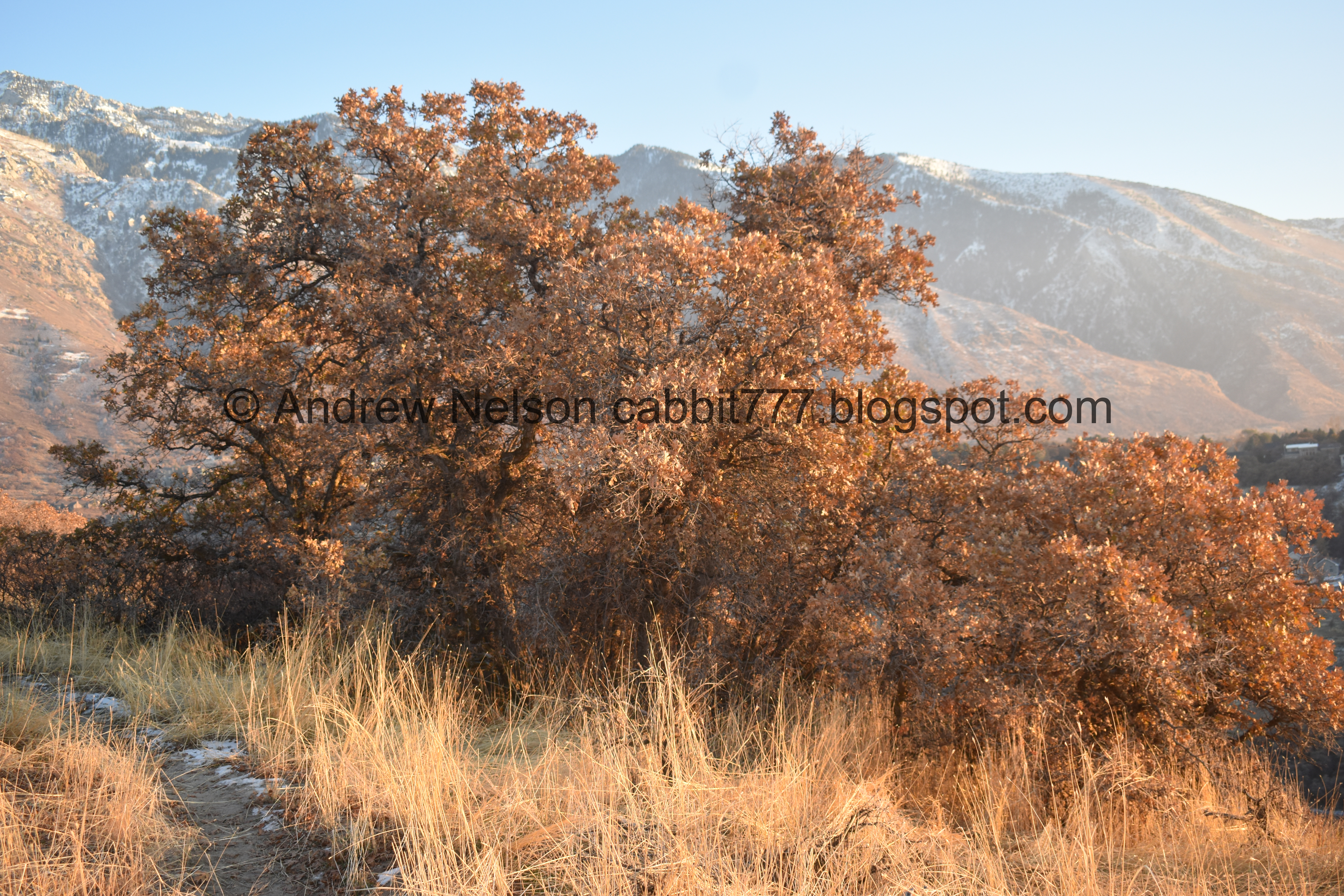
The trail with Mount Jordan. Almost the entire trail is this beach sand. It is widely believed that this “thirsty soil” is where the city of Sandy got it’s name.

Little bit of color.

These sand dunes are wind blown sands from the shores of ancient Lake Bonneville.

Hiking through this beach sand is a little rough, but not too bad.

I mentioned giant mess of trails right? Lots of random trail splits.

We got off course just a little bit here, I’d say less than a 10th of a mile, but with the help of having google maps in my pocket, I quickly got us back on track. I had to pull it up a couple times to make sure stayed on the path that I wanted to do though.

Back on the right path.

Couple patches of snow. Not enough to make this a muddy mess.

Looking back at the hazy air. Yuck.

Mount Jordan again.
.jpg)
Panoramic.

Then we are hiking next to this random fence for a bit.

I really enjoy the view on this trail.

Little Cottonwood Canyon.

The major connector trail we took last time, since it is signed as the Fox Point Loop. The mapped trail crosses this and picks up on the other side.

Mount Jordan and some color.

Looking across the gully.
More color.
.jpg)
Another panoramic.

You pass by a few revegetation areas. Just stay on the trail and you’ll be fine.
Mount Jordan again.

Still walking through the sand.

Mountains to the south.
.jpg)
Panoramic.

Passing a pipe of some sort.

The trail is a little thinner through here, but still easy to follow.

Mount Jordan again.

Here is the north end of the loop, which lets you out onto the North Rim Trail just at the edge of the revegetation area.

This ended up being a little shorter than anticipated, so we decided to continue along this unnamed trail. I was fairly certain it led to Granite Park so I figured we’d add that, so long as it wasn’t too long.

Some thick scrub oak for a minute.

Still beach sand.

Little Cottonwood Canyon.

Bell Canyon.

Back on the North Rim Trail for a minute.

Fading light on Mount Jordan.

The North Rim Trail, and fading light on the mountains.

Back on another side trail that leads to Granite Park.

Last bit of light hitting the top of Mount Jordan.

The trail thins a bit through some scrub oak.

We made it to a trail split where we could see Granite Park. Neither of us had a desire to actually go to it, and it was starting to get dark so we decided to turn around here. I would estimate it is about another .15 miles to the actual parking lot. A little longer if you decide to use the North Rim Trail completely from there.


Last light on the mountains to the north and south.

Mount Jordan again.
.jpg)
Panoramic.

North Rim Trail again.

Back on the side trail, and back to beach sand.

Another restoration area.

Some more color hanging on.

This sign has to be super old as you would have to drive quite a ways from the nearest point I can think of that could access the park. However, looking at the history of the area, it looks like the lot behind this was vacant until 2017. So maybe not that old.

Back on the North Rim Trail where the Fox Point Loop popped us out. So now we are just completing the loop.

Kind of a meh sunset tonight.

Looking south towards the Jordan Narrows with some haze.

Looking back at Mount Jordan.

Back to the Aqueduct Connector.

The giant pile of bark ready to be spread on the trails.

Back to where we parked.

This thing was making a lot of noise. Apparently it is a high pressure aqueduct. I wonder if this is why Dry Creek randomly dries up in the gully below.

Eh, little bit of sunset.

Some on the way home (Passenger Seat Photography (PSP)).
Well that was a fun adventure. I am glad I came back and tracked down the actual trail. It was a lot more enjoyable than what we did the other week. Plus, other than the parts along the North Rim Trail it was pretty deserted. I also really enjoyed the views. I am going to remove a star due to the confusing mess of trails, and lack of signage/sign on the wrong trail. 8 out of 10 squirrels.
As for difficulty, this one is pretty easy going without too much climbing. DR3.
Dogs are allowed, but should remain leashed at all times.

1 comment:
Such a beautiful post, I want to share a testimony on how Dr itua healing herbs cure me.
The worst time has passed”However, it is true that there are more improvements than before...because of the rising numbers of people living with HIV in the state of Nevada. How could they stigmatize all of them? Therefore everything becomes a little easier and we start to share everything... We also started to invite and visit each other in a community. You know, it is six years since I started taking antiretroviral drugs...Yet whatever problems I face, the worst time has passed
When I was evicted from the family home by my mother, my father rented a small room for me. But my mother and brothers believed that having HIV was my own fault – and that I deserved to be punished...I also considered myself unworthy and without hope... But I have a child and eventually I convinced myself to live for my child’s sake.
My mother knew nothing [about HIV]. She didn’t understand anything. Do you know why? She didn’t have [the chance] to go out of the house and communicate with society. However, my father does interact with the community. I know his friends are mature and dignified in africa america. So he has a better understanding than her.
My father came call me on a sadfull day sitting on my couch about a friend of his from africa who introduce him to Dr Itua herbal cure in africa in which he advise we should purchase his herbal medicine to cure my hiv so we did and Dr Itua prescribed I should drink the herbal medicine for two weeks to cure although we were so curious about the whole thing ,I finished the herbal medicine like he advised then he talked to me to visit my nearest clinic for check up I did and now I'm totally cured from Hiv my father was my rock and I and my family are now happy together also Dr Itua has be helpful in my community ever since he cure my Hiv and my tinnitus so why I'm leaving my story on here today is to reach out someone out here to hope on God and never give up no matter the situation you that you are facing especially through this pandemic seasons which has really taught us all on how we should be helpful to each other and cherish one another.
Dr Itua cures the following diseases..... Herpes,Liver cancer,Throat cancerLeukemia. ,Alzheimer's disease,Chronic Diarrhea,Copd,Parkinson,Als,Adrenocortical carcinoma Infectious mononucleosis.
Intestinal cancer,Uterine cancer,Fibroid,Bladder cancer,Hiv,Esophageal cancer,Gallbladder cancer,Kidney cancer,Hpv,Lung cancer,Melanoma,Mesothelioma,Multiple myeloma,Oral cancer,Sinus cancer,Hepatitis A,B/C,Skin cancer,Soft tissue sarcoma,Spinal cancer,Stomach cancer,Vaginal cancer,Tinnitus,Vulvar cancer,
Testicular cancer ,Thyroid Cancer.
You can contact Dr Itua Herbal Center on E-Mail: drituaherbalcenter@gmail.com.
Post a Comment