.jpg)
The Fox Point loop in Dimple Dell Park is another nice loop that offers some great views of the mountains, as well as Dimple Dell itself. It features some nice forest, and some desert landscapes to explore. This loop is probably better explored from the Mount Jordan Trailhead (aka the East Trailhead) or Granite Park. Cause it is about 1.88 miles from the Wrangler Trailhead. For some reason I thought it was closer when I decided on this trail. Anyway, we had another very wet weekend and I just wanted to do something that wasn’t going to be super muddy, so I thought this was a good option.
Another issue I had today, is we did not do what I was expecting to do today. There is some discrepancy between the web of trails in the park that some routes have been established and mapped, and where the city has decided to put a sign in. So, we did a little more than expected today. But, I might come back and try to do what we had planned.

Quick Details:
Length: We did a 5.26 miles balloon, but as I mentioned there are shorter options.
Trail Type: Balloon, out and back, loop options.
Difficulty: DR3
Elevation Gain: About 650 feet.
Restroom: Yes, but it appears to close in the winter. However the nearby Smiths has a restroom.
Dogs? Yes, leashed.
Other Info: Here is a somewhat helpful map (outside link).
To Get Here:
Take 106th South to 13th east turn left, Go north for about 1200 feet then turn right*. Go another 300 feet and you will see the Wrangler TH on the right.
*if you pass Smiths on 13th East, you went to far, but go ahead and turn into their parking lot and head south it’ll get there too.

Some purple fall colors in the parking lot.
The Trail:

Trailhead Kiosk.

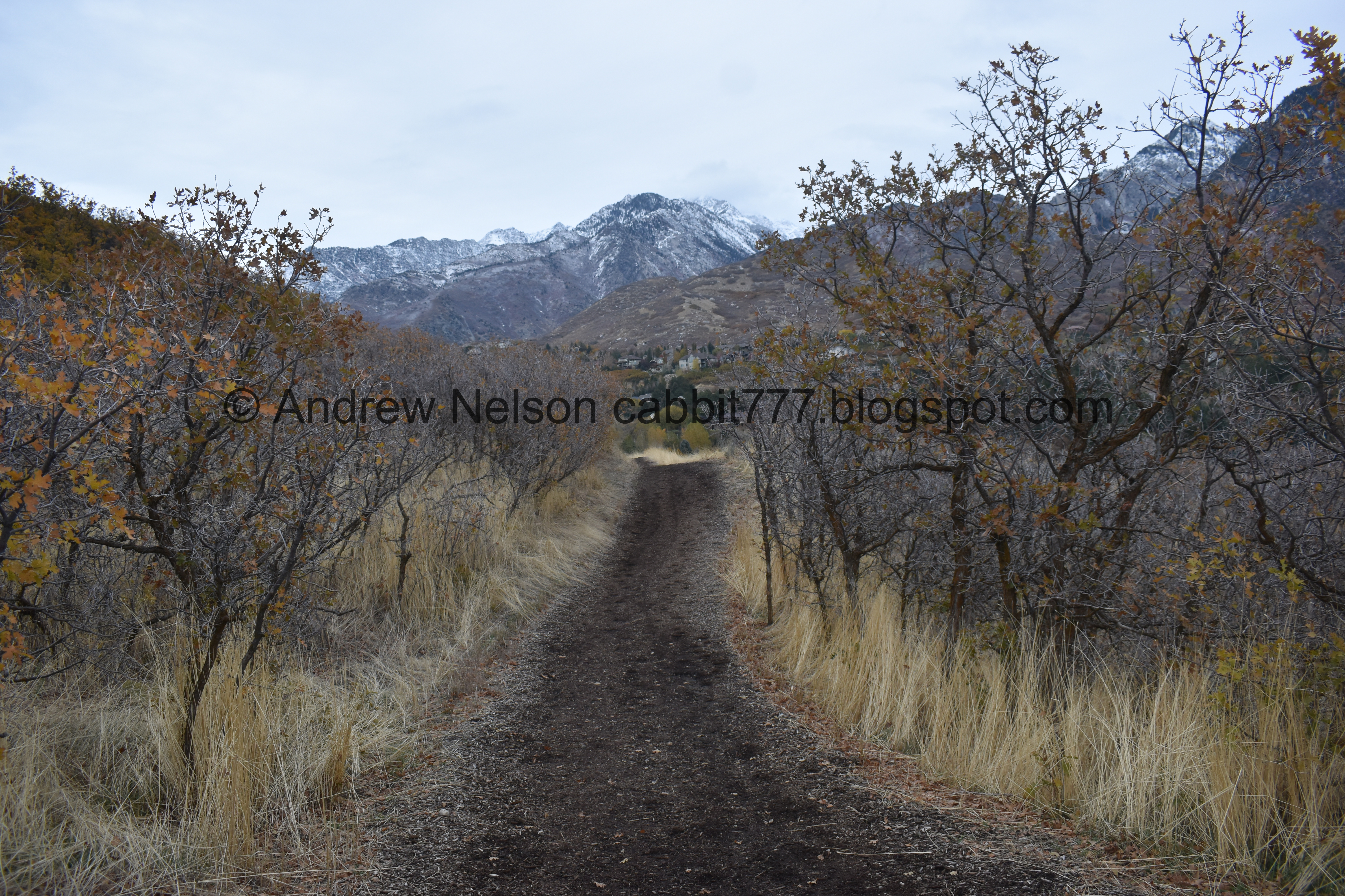
However, If you do this from the Wrangler Trailhead you will head east from the parking lot.
Also, this was a big reason I decided on the trail, I thought the bark lined trail would mean no mud. I was right.

Nice view of Mount Jordan.

Looking across the gulley. Little bit of color left.

We’ll take the North Rim Trail out to Fox Point.

Some nice fall color. Also to show that you will be walking adjacent to peoples backyards for a bit.

Mount Jordan again.

Passing by Flanders Point Loop.

Fun cloud cover.

Flanders Ln.
.jpg)
Panoramic of Mount Jordan.
Lets see, Little Cottonwood Canyon to the left, Bell Canyon, Dry Canyons, Rocky Mouth Canyon, Big Willow Canyon, Little Willow Canyon, Bear Canyon and Corner Canyon on the right.

The other end of Flanders Point Loop.

Looking into the gulley again.

Looking back west, across the valley.

Some fall color hanging on below Mount Jordan.


More color.
.jpg)
Mount Jordan and Steep Mountain.

Mount Jordan and the gully.

Down in the gully.


Another patch of color.

A pair of mountain bluebirds played chase with us for a little bit. More like we kept getting too close, and they kept flying along the trail in the direction we were walking. Sorry guys.

Little digital crop.
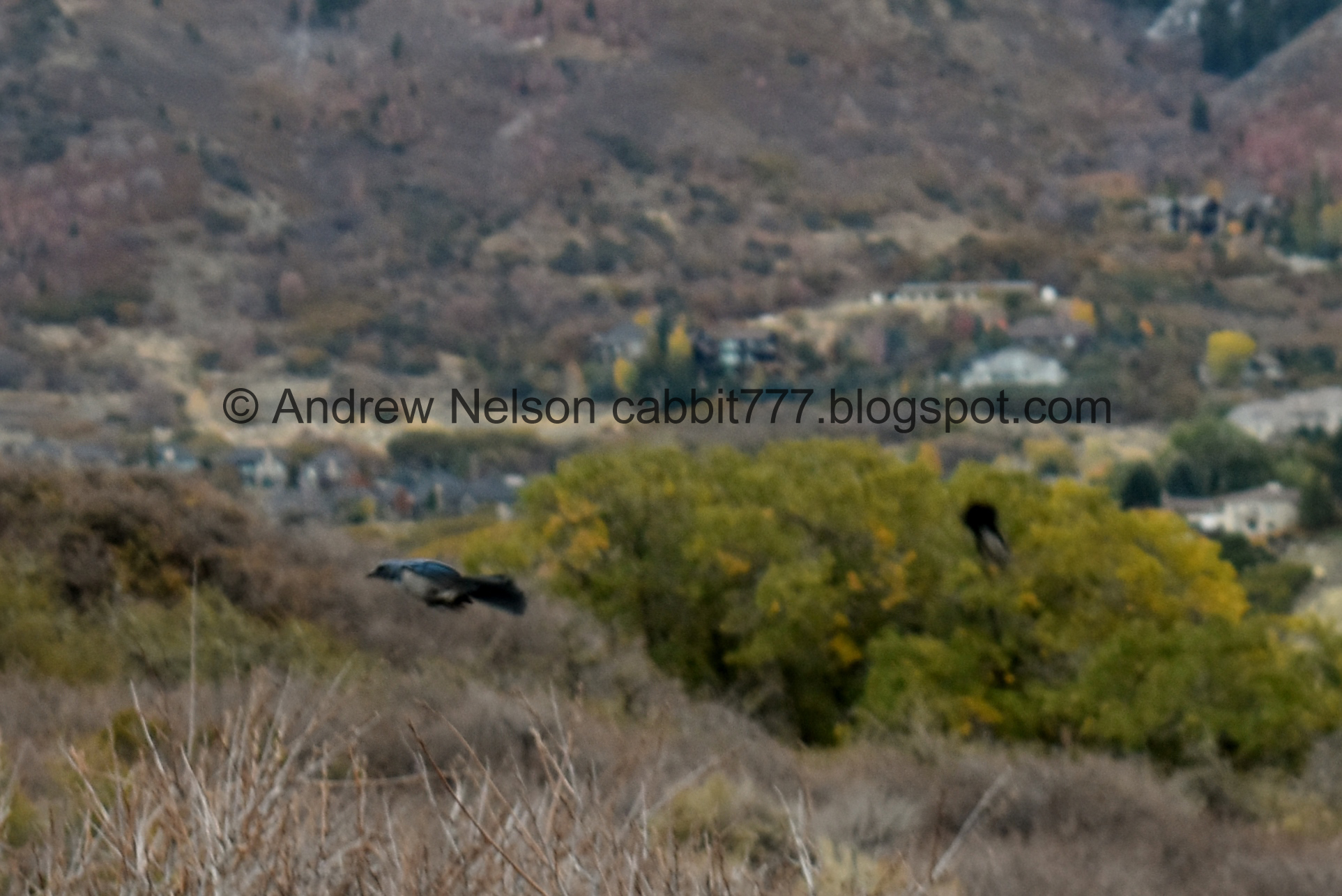
Taking off.

Better shot of the pair.

This one was a little less skittish than the other one.

Another patch of color.

Looking down into the gully.

The trail.

I thought we were done with the bluebirds, but apparently not!
Mount Jordan again.

The trail below Little Cottonwood Canyon.

There is a little bit of climbing, but not too bad.

There are a lot of sandy patches through here. The leading theory as to where Sandy City got it's name is due to the "thirsty soil".

At about 1.8 miles we finally reached the turn off, well the signed turnoff. The loop I had planned on was the previous turn off I guess. Actually more like 3 or so turn offs before.

Somebody left a little jack o lantern.

However this trail seemed like a main trail, so it seemed right.

This thinner trail passes across the trail we are on. Looking back to the map, I am pretty sure that is the trail I was meant to be on. But, as I mentioned, big web of trails so it can get a bit confusing. I was using this map from the city. Looking back on it, it looks like we took a connector trail down to the Sego Lily Trail and then up some random trail.

The mountain and the gully.

Looking down to the Dimple Dell Road Trailhead. You can do the Centennial Loop from there. It might even be a better option for this loop.

Looking into the gully again.

Looking to the west.

This was a lot more down than I was planning to do today.

Into the gully.

More splashes of color.

With the mountain.

The gully.

Some color and more down. Eep! We have to climb back up.

Now we are on the Sego Lily Trail.
Also a nice wide trail.

I think the pond is hiding amongst those trees.
.jpg)
Another panoramic.

Some color on the hills above.

Well hello there deer!

Little Cottonwood Canyon and Bell Canyon.

It looks like a vehicle has been through here at some point. Not necessarily bad, could have been a service worker.

It just seems to keep going.

Some falling color.

Well, it is not signed, but we called it and decided that we would head up on this split.

It’s not as wide as the Sego Lily Trail but it seems pretty established.

Some color.

Looking back into the gully.

Getting a little thinner, but still strong.

More color.

Mountains and gully again.
.jpg)
Another panoramic.

North towards Sunrise Point.

A super sandy part. This is a bit more tough to hike through.

The gully below.

The final push.

Whew! We finally made it back to the North Rim Trail. Now we just have to head back west.

The North Rim Trail again.

Mountains to the north.
.jpg)
Another panoramic.

Color and mountains.

The trail again. I think this is the high point.
.jpg)
Another panoramic.

Low clouds out west.

More sand dunes.
.jpg)
Another panoramic.

Eventually you swing back to the west as the canyon elbows.

When we picked up the loop. It ended up being about a mile and a half. I would wager the loop I intended to do would be pretty similar.

Looking back towards the mountains with a little bit of color.

Aqueduct Access. I didn’t go see if street parking was discouraged, but I think this would be the shortest access to this particular loop. Approximately 2605 E. Sego Lily Way. A quick glimpse at google street view does not appear to have any no parking signs. Edit: We ended up doing the actual loop from here a little later.

View across the valley again.

Closer look at the Oquirrh Mountains.

Kennecott.

Back to the east with some color.

Another sandy section.

Some dog prints and some deer prints.

View down with some color.

The Jordan Narrows at the south end of the valley, with Point of the Mountain on the left.


Little bit of color.

The valley again.

They have left this long lot from the end of Highland Drive to here, and there have been talks about continuing highland drive across a new bridge over Dimple Dell. It seems like the locals are completely against the idea, but the city may still move forward with it one day. Personally I hope it doesn’t happen, ever. We have so few wild areas of this size.

View down again.

Back down to the trailhead.

I still love the creative way they reused old tires to designate the parking spaces.

Ooh, they are going to renovate some of the trailheads.

We stopped by Smiths to use the restrooms and pick up dinner, and got to see a nice sunset starting from the parking lot.

Little more intense heading home (Passenger Seat Photography (PSP)).
Well, that was a little bit more than I had planned but it was mostly pretty mild and had some great views. I also enjoyed that it was not muddy after a wet weekend. It also was not very crowded which is always a plus. 7 out of 10 squirrels. Losing 3 because the official city map does not match where the city placed its sign.
As for difficulty, the north rim trail was not bad, but the loop we did did go down pretty sharply, and back up was a little steep. But those were short, so DR3.
Dogs are allowed, but should remain leashed at all times.

No comments:
Post a Comment