Ladyfinger Point is a short trail on the northern tip of Antelope Island. The trail features some great views of The Great Salt Lake and surrounding mountains. It is a short, easy trail that does require a little bit of boulder scrambling. So it is a great option for kids.
We are currently recovering from the plague so we just wanted a couple easy options to do today along with our scenic drive so this seemed like a good option. Plus it’s been a few years since we have done it.
Quick Details:
Length: About a half mile out and back, with further exploration options.
Trail Type: Out and back, rough loop options.
Difficulty: DR3. Its short and fairly flat, but there is a bit of a scramble.
Elevation Gain: About 8 feet.
Restroom: Pit toilets. There are flush toilets at the nearby visitor center and running water to wash up with if your prefer.
Dogs? Yes, Leashed.
Other Info: Fee area. $15.00 per car to access the island.
To Get Here:
As the causeway enters the island you are met with a crossroad, go right. Continue along for about 6/10ths of a mile and turn right into the Ladyfinger Point Campground/Trailhead. Park towards the north end.
The Trail:
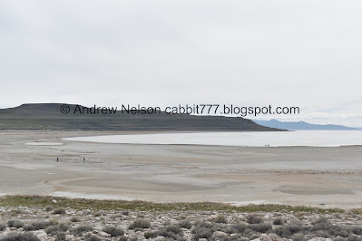
Bridger Bay.
Trailhead sign.
Pretty easy going trail.
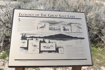
It is not a dead sea. Here are just a few examples of the wildlife you might see on the Great Salt Lake. I have seen most, if not all of these.
The trail starts out super flat with a desert landscape.
Bridger Bay again.
First wildflowers of the year! Hello cuties.
The point.
Brine Flies. They are harmless and even strive to avoid contact with you so not a nuisance at all. And they help clean the water as well as provide food for birds.
Continuing along.
The pups having the time of their lives.
The rocky peak.
Desert parsley.
With a butterfly.
Fun rock formation with Egg Island in the background.
It’s like an alien planet.
I don’t remember these cemented steps.
So alien.
Looking towards the east.
Fun rocks.
From the side.
Bridger Bay again.
There was a trail split here and in the moment I assumed the lower trail just went to this bench. But now that I am really thinking about it, I think that is the way we previously did this trail and today was the first time we did the actually intended trail.
Lizard!
To the east again.
Rocks.
I was a little surprised at how well the pups took to scrambling.
Some really dedicated person built a spiral.
Cropped in a little closer.
Looking north.
I thought about scrambling down to the beach again, but we decided we were taking it easy today so we decided to turn back.
I love the colors.
A particularly strong solar halo.
The actual top. Looks like there used to be a marker of some kind up there. I wanted to scramble up there and see the actual view but you know, when you have dogs with minds of their own sometimes things don’t go as planned.
More rocks.
Fun formation.
Looking back towards the parking lot.
This bench has seen better days.
Bridger Bay again.
Fun rocks.
Making our way through them.
I wonder if there is any geological significance about both of these boulders splitting, or if its just a coincidence.
More desert parsley.
To the east again.
Egg Island again.
Bridger Bay again.
The solar halo again.
Sage brush.
A look back at the peak again.
Well that was fun! And just the right amount of exertion for us today. I kind of wanted to go down to the shore but meh. I am kind of pleased we finally managed to stumble upon the main trail today haha. It was also fun to be reminded about how odd the trail is and how fun it it. There were people, but once we hit the rocky section most of them disappeared. 9 out of 10 squirrels today.
As for difficulty, it is super short and not much of a climb, but a little bit of scrambling. DR3.
Dogs are allowed, but must remain leashed.
.jpg)


No comments:
Post a Comment