The Jungle Trail in Corner Canyon is a fun trail built with little adventurers in mind. It features a beautiful forest setting following Corner Canyon Creek along with some natural obstacles you will need to navigate through. Including low hanging tree arches, log steps, etc. It is a really fun trail to explore, and I imagine it would be absolutely incredible for kids! We’ve done it before via the Carolina Hills Trailhead but it’s neat.
This was not my first choice today. After a long winter I have been just itching to get into the mountains, but avalanche danger is still super high, so I am not risking that. However it looked like the snow had receded enough to enjoy Corner Canyon. However the trail I wanted to do was closed due to muddy conditions. So we did this instead.
Quick Details:
Length: we did a 2.22 mile balloon with spur. To just do the balloon would probably be closer to 1.8 miles. Or you can do an even shorter loop from the Carolina Hills Trailhead.
Trail Type: Balloon with spur, balloon, out and back, connector option.
Difficulty: DR3. It’s a bit of a climb, but not too bad.
Elevation Gain: We did about 419 feet. It would be a little less just doing the Jungle Loop.
Restroom: It looks like there are year round restrooms at Andy Ballard Arena adjacent to the trailhead.
Dogs? Yes, Leashed so long as you stay below the Bonneville Shore Trail (BST).
Other Info:
To Get Here:
Take i15 to the Bangerter Hwy exit and head east. Go about a half mile and turn left onto 13800 S. Take that 1.7 miles it will curve to the north. Turn right on 1300 E. Immediately turn left on Highland Dr. Go about .4 miles and turn into the parking lot. You want to park near the northern end.
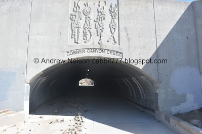
Look for the tunnel under Highland Drive. The trails on either side will get you down to it.
I have been amused for the past few weeks that the point of Point of the Mountain has thawed before the rest of it (Passenger Seat Photography (PSP)).
Mount Jordan (PSP).
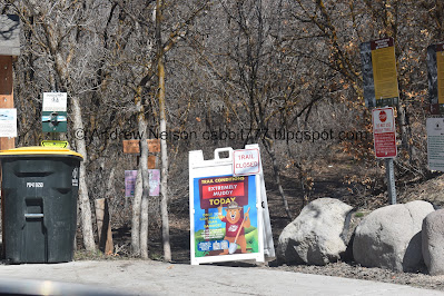
My original plan was to hike to Ghost Falls from the Coyote Hollow Trailhead. However, as you can see it was closed due to extremely muddy conditions. Poop. I was afraid of that. So I thought we’d check out the Lower Canyon Trailhead.
The Trail:
It looks like the trail was recently closed, but it looks thoroughly dry so we pressed on with the idea that if it gets muddy we will definitely turn around.
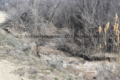
WHOA!!! I have never seen this creek this high! It is a tiny creek normally so this is pretty crazy.
Oh.. oh my. It looks like the creek flooded the tunnel previously. That must be why the trail was closed.
You know it is odd, I have been hearing all about Emigration Creek flooding due to the record breaking snowpack this year, but I have not heard a peep about this one. I guess it must not be causing any damage so it is not news worthy.
I love the artwork on this side of the tunnel under Highland Dr.
More debris from the flooding.
I’m guessing this culvert might have gotten clogged. But, Emigration receded with the cooler weather, so this probably receded as well.
The high creek.
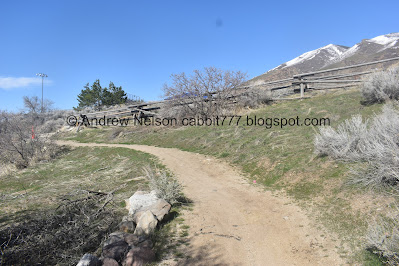
We’re following the Lower Corner Canyon Road, so the trail is nice and wide.
The first crossing. Looking upstream.
Downstream.
Continuing up. This winter has been so rough that this is the first real climb we have done in a little bit and we are certainly feeling it.
The creek again.
The lowest access point to the Jungle Trail.
There are a lot of these signs to direct fast downhill bikes to the left, everybody else to the right. Which matches general etiquette going up. But coming down is a little counterintuitive. Going down you have to stay to the left.
Another crossing. Upstream.
Downstream.
View up.
The water rushing into this weird water diversion thingy.
More forest.
I think I mention this every time we come here, but this is the only place we have visited that has poison ivy warning signs. I am sure it exists elsewhere too, but we haven’t seen it.
Big mess of trees.
Below the 3rd crossing. Wow!
Quick video.
Upstream.
The upper entrance to the Jungle Trail. We’ll come back to that. This is about 9/10th’s of a mile up. We decided to continue up to the crossroads.
Continuing along.
Little side stream.
The crossroads. Note: Dogs cannot go above this.
The silica pit.
Heading back down.
Again.
Nice bench under a tree.
Before long we were back to the top of the Jungle Trail.
“This trail is for the young and adventurous to experience the natural environment.
Hikers will be required to climb, stoop, bend, duck, crawl, scamper & wiggle to get through this trail.
Side effects may include creaky joints, bumped heads, scratches, sore back, knees and hips. USE AT OWN RISK.”
I know the sign is a bit tongue in cheek, but it is not kidding either haha.
A lot of the trees through here are quite misshapen, which is what helps make the trail as fun as it is.
Fun trees.
More fun trees.
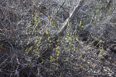
Some green starting to come out. Ahh, it makes me so happy. It means Spring is coming.
More forest.
A spot where the creek flooded.
Fun stepping logs.
Little stick structure.
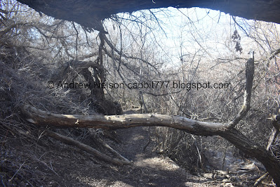
A big tree you have to duck under.
Signs reminding you to stay on the trail.
More stepping blocks.
Another stick structure. This looks like it’s been damaged a bit, probably from wind.
From the other side.
With all the dead leaves the trail was a bit hard to follow at a few parts, but I managed to get us back on track when we lost it.
More forest.
I particularly liked this natural arch.
More greenery coming in.
Another fun set of stepping stumps. With an unfortunate dead deer.
In case you are dumb like us, hold your breath. Blech.
Then the this trail rises up on a steeper slope. I struggled with this a little bit, but managed to power through it.
Before long the Jungle Trail ends and you will be on the Creekview Trail for a bit.
Another quick section along a steeper slope. Again I managed.
Starting to head downhill.
Some switchbacks.
We went down this new connector towards the Carolina Hills trailhead. You can stay on the Creekside trail for a little longer if desired. Either way it will be about the same length. Unless you started from Carolina Hills.
This used to be a fast downhill bike path, but it was converted to hikers only to make the kid friendly Jungle Trail a little shorter.
Back on the Lower Corner Canyon Road.
Remember to stay to the left as counter intuitive as it is. Again, this is unique to this trail as it is shared with a fast downhill bike path that rides downhill to the right.
Before long you reach the bottom of the Creekside Trail, and the original loop.
The mountains on the other side of the valley.
You can see The Claw from here.
The creek again.
The Jungle Trail bypasses the upper 2 crossings. This is just above the final lower crossing.
Continuing down.
The valley below.
The creek again.
I am still leaning towards this being a trail use counter, but it does look a little different from others I have seen, so it might be something else.
Back to the tunnel under Highland Dr.
Inside with all the debris pushed down from the flooding.
Where they put sandbags down to guide the creek back to its bed.
The other side of the tunnel. I love the horse mural.
The final climb back to the parking lot.
Trailhead sign.
View across the valley.
Aww, look a cute little lone baby cloud.
Antelope Island.
Closer look at The Claw as we head home (PSP).
Well, it wasn’t what I had planned today but honestly I was just super happy to get out of the city and into the mountains, kind of. It wasn’t terribly busy today. And the flooding has subsided for now which is good. The Jungle Trail is a fun, silly little trail that has some neat old trees. The Lower Corner Canyon road/trail is a pretty little climb as well. 8 out of 10 squirrels.
As for difficulty, its a pretty mild climb, but the obstacles can be a little rough. DR3.
Dogs are allowed, leashed. But keep in mind you are skirting watershed so be sure not to go above the Bonneville Shoreline Trail.
.jpg)












No comments:
Post a Comment