.jpg)
Farmington Bay WMA is a large wildlife management area that is a great place to go birding. There are a number of ponds and dikes to explore the area. The area also allows fantastic views of the mountains.

Quick Details:
Length: We did 2.58 miles out and back but it keep going, you can even go all the way around unit 2 for a nice longer loop.
Trail Type: Out and back, loop options.
Difficulty: DR3. It’s completely flat and had packed dirt.
Elevation Gain: NA
Restroom: Yes, there is a pit toilet near the north entrance.
Dogs? Seasonal. From September 25th to Feb 28th
Other Info: This particular trail is closed March 1st to July 31st.
The dirt road between Goose Egg Island and Turpin Unit is only open to cars From September 25th to Feb 28th, so if it is outside that window it will add about 2 miles each way.
To Get Here:
This is located behind the Great Salt Lake Nature Center You will want to take exit 322 in Farmington. Immediate take the first right on to the frontage rd. Then take the first right onto Glovers Ln and head over i15. Go about 1.4 miles and turn left on 1325 west. If you hit the Nature Center you went too far.

The West Davis Corridor is finally open (Passenger Seat Photography (PSP)).

Some unexpected deer off to the side of Glovers Ln. (PSP).

The new bridge over the West Davis Corridor (PSP). I have no idea why they decided a traffic circle was needed up there but they did. Be sure to take the 2nd exit to stay on Glovers Ln.

We took a quick break at the information/rest area near the beginning of the north entrance where I took a shot of the weird radio tower.

After the rest area the dike road becomes dirt (PSP). It has a lot of potholes and a few rough spots, but for the most part it is fine and any car should be okay on it. Just take it slow.

Wall of smog out west (PSP).

We just passed Goose Egg Island (PSP). Quick reminder, this part of the road is closed to motor vehicles after February 28th. I wonder if they will allow it on the 29th this year since it is leap year and all.

Great blue heron silhouette (PSP).

We made it to the Turpin Unit parking lot and finally saw a hawk.


Looks like a northern harrier.
The Trail:

So yea, this trail is closed during nesting and brood rearing season.
Due to how quickly birds move I kept the telephoto lens on for most of this, which makes some shots a little weird.

This trail is an extension of the main dike on the west side of Unit 2.

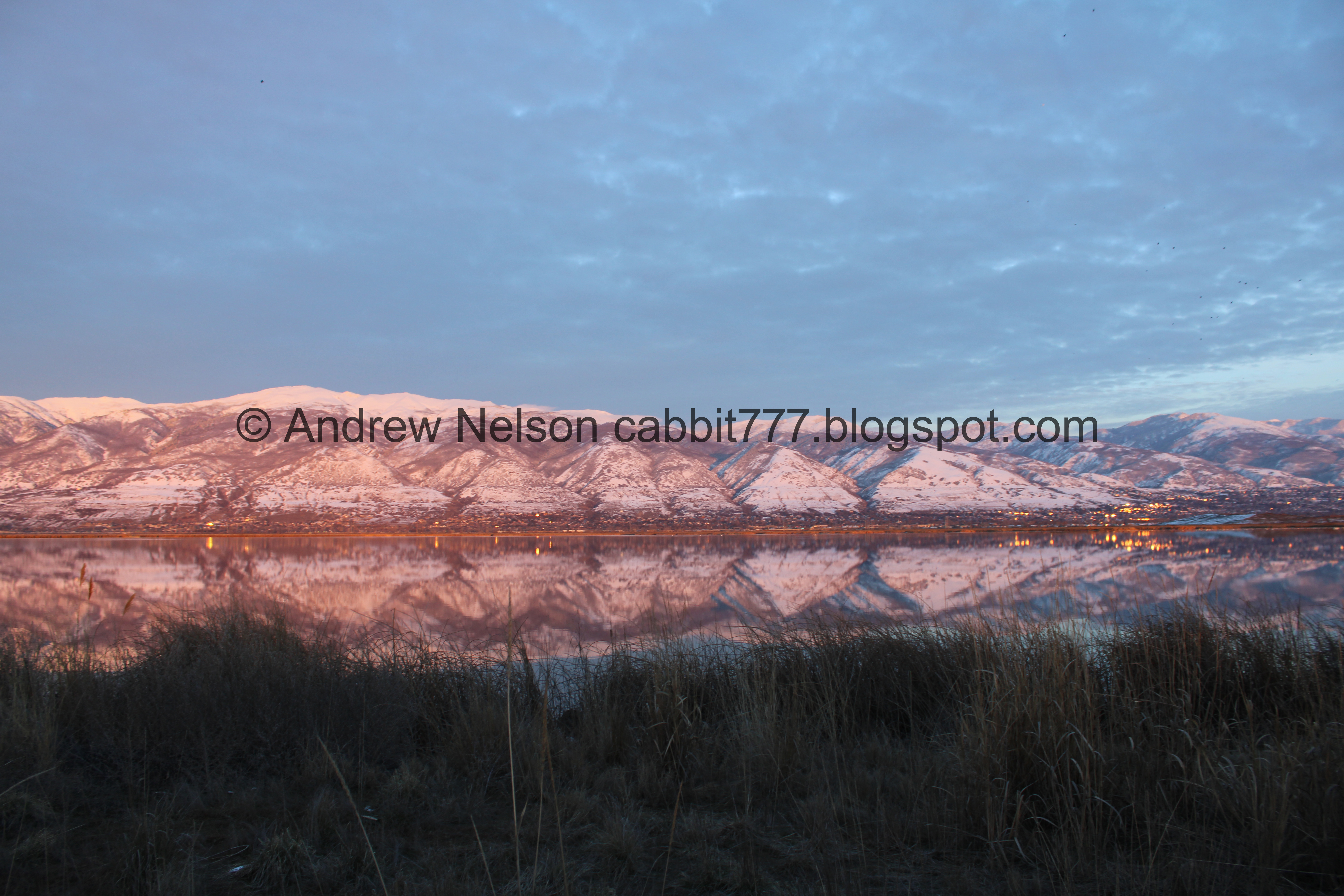
Snowy mountains reflecting off of Unit 2.

The wall of smog out west again.

Continuing along. Unit 2 to the left, and a canal to the right.

Mueller Park.

More mountain reflection.

Antelope Island to the west.

Panoramic of the whole island.

Well, we are not having much luck with the birds today, so I switched back to my regular lens for a second to get the mountains.
.jpg)
Panoramic.

Continuing along the dike.

Swans.

Great blue herons on an old branch.

One flew off.

Fun clouds.

With a bunch of crows. Holy crap, where are all of these crows coming from?

The herons again.

And he’s off.

And then there were none. I thought it was out in the pond far enough that we were not a disturbance, but apparently not.

Looking back north with Ben Lomond in the distance.

More swans.

The Kennecott Smelter Stack out west. Better viewed from the Great Salt Lake State Park.

Mountain reflection again.

Landis wandered out onto this boat ramp.

Continuing along the dike.

More fun clouds.

Antelope Island again.

We can see the airport from here.

More fun clouds.

Mueller Park again.

The smog wall out west again.

I think that is Mount Olympus peeking up above the Davis point of the mountain.

Another hawk.

Looks like another northern harrier.

Here the trail goes over the culvert, which offers a little loop going back on the other side of the culvert. Or a super long loop around Turpin Unit if desired. Today we decided to keep heading south instead.

Before long the dike turns to the east and we decided it was probably a good turn around spot. You can keep going around Unit 2 for a longer loop, but we were not up for that today. So, we decided to head on back.
You know, even good wildlife spots sometimes just fail. You cannot predict what the wildlife will do. You win some, you lose some.

Heading back north.

Mountains.


Red-winged blackbird.

Really showing of those red wings. Super pretty bird.

Ben Lomond again.

More swans.

A lot more crows. Seriously, where the hell are they all coming from?

Ben Lomond again.

Red-winged blackbird.

More mountains.
Reflection.
.jpg)
Panoramic.

Antelope Island again.

Window reflections.


These seagulls were really upset with this particular crow.

A pretty decent sunset.


Some color in the clouds.

More.

Antelope Island.

More sunset.

A lone little cloud to the south.

Tractor in the parking lot.

Another look at the sunset. I like the way this one turned out.

Another good one.

Then the sunset is about done.


Some color to the north.
.jpg)
Panoramic of Antelope Island.

The mountains above Unit 1.

Antelope Island again.

The gate across the dike we just walked.

The tractor again.

Heading back down the main dike road (PSP).

Goose Egg Island (PSP).
Well, the birds were very shy today. That is probably the worst luck we have ever had out here. However it was still pretty and a nice little walk. Plus with the game and all it wasn’t very busy, which is always nice. I’m going with 7 squirrels today since we didn’t have much luck.
As for difficulty, it is flat and hard packed dirt. DR3.
Dog are allowed, leashed from September 25th to Feb 28th, they are not allowed the rest of the year.

No comments:
Post a Comment