.jpg)
Rocky Mouth Waterfall is a scenic waterfall in Sandy. The short trail features nice views, a nice tight canyon with a creek and nice forest all ending with a rather scenic waterfall. In the summer months the trail can be extremely busy since its so pretty and so short. However in winter it is a little quieter and we had it all to ourselves today. This is one of my favorite shorter trails so we tend to do it fairly often.

Quick Details:
Length: About 8/10’s of a mile out and back.
Trail Type: Out and back.
Difficulty: Although it is short, there is quite a climb! DR3.
Elevation Gain: About 520 feet.
Restroom: No. There is one south at Hidden Valley Park, or north at Bell Canyon Preservation Trailhead.
Dogs? No. This is watershed.
Other Info:
To Get Here:
Take i15 to 90th south in Sandy. Follow that east to Wasatch Blvd, turn right. Go about 2 miles and you will see the trailhead parking on the left.
The Trail:

Trailhead sign.

The trail is easy to see from the parking lot, but it is at the north east corner. Also, those signs on the right conflict each other. One says closes at 10:00 PM, the other says Dawn to Dusk.

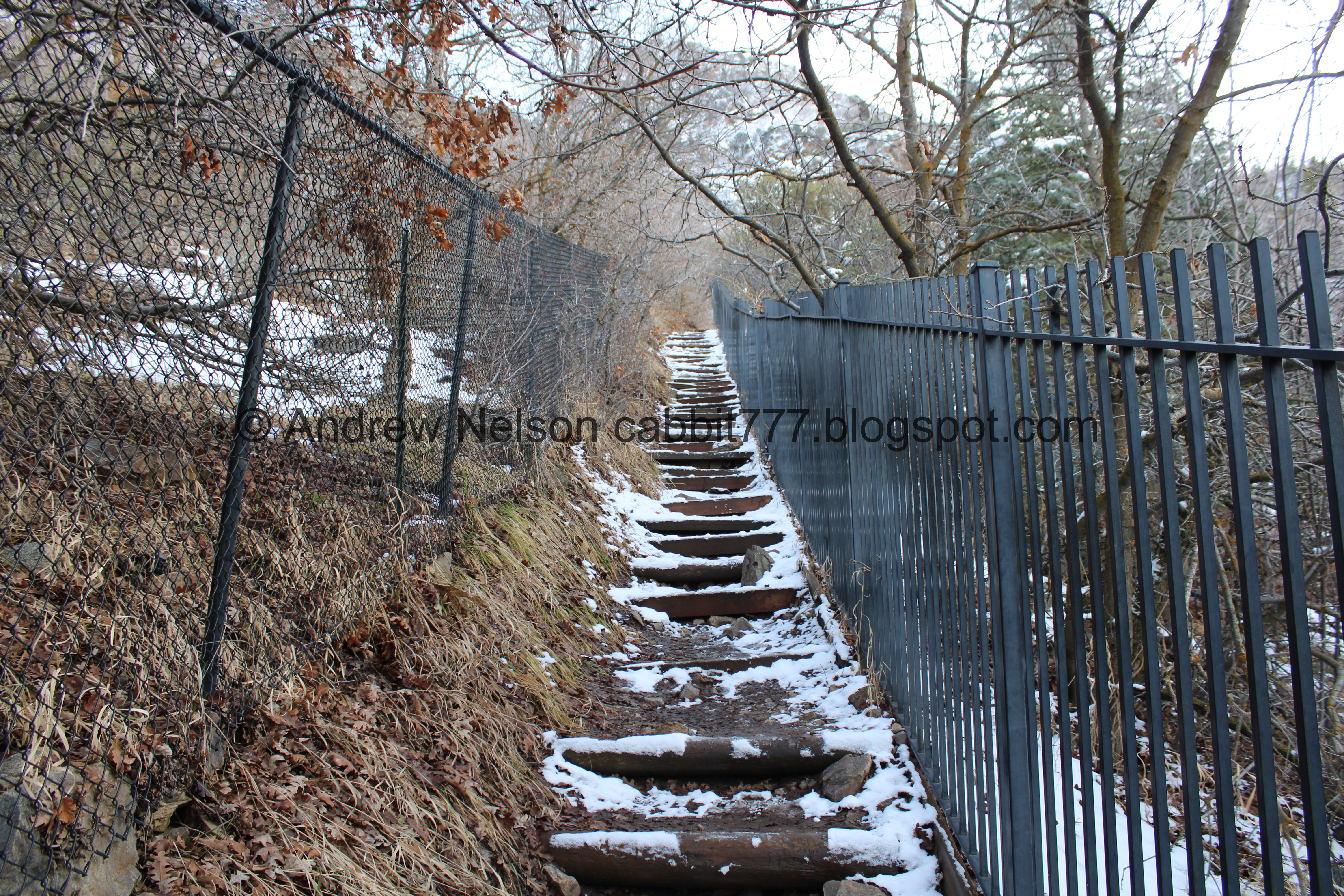
Up the first staircase of doom.

At the top of the stairs it puts you into the neighborhood. You will continue to the right for just a little bit.

Neat old mining cart.

Continuing through the neighborhood. You can see where the Bonneville Shoreline Trail switchbacks up the mountain on it’s way over to Big Willow Canyon. They have not completed the section north of here yet.

As the sign says, you will go left around the corner here.

Before long you will reach the original trailhead on the right. I guess the lovely people who built their McMansions next to a popular trailhead didn’t like us plebes parking on their street. So the new trailhead was built below and 'no parking' signs went up. You know how to not have random strangers parking on your street? DON’T BUILD NEXT TO A PRETTY NATURAL AREA. Sorry, I just find it irritating when cities give in to rich assholes. At least the new trailhead doesn't add a whole lot more.
Anyway... this sign says it closes at 9:00 PM haha. I suppose as long as you finish by dusk, or 9 you’ll be safe.
Onto the 2nd staircase of doom.

View across the valley towards Antelope Island.

Then you get a short break from the climb.

Trail split. You want to hang left. Right is the Bonneville Shoreline Trail. As I mentioned it heads south toward Big Willow Canyon.

Nearing the mouth of the canyon.

Bridge below. It’s kind of a cool bridge.

The creek.

Into the narrow, forested canyon.

Small cave. It doesn’t go very far back.

An old mine. If I remember correctly they have capped it off.

First view of the waterfall. The creek kind of fans out here, so it can be a bit icy. We managed to get up without our microspikes today, but we had them just in case.

The waterfall is set back in a narrow canyon.

A little closer.

Again.

The whole thing.

Cliffcicles.

The bottom tier.

There is a small pool between the tiers. I used to scramble up to it. Now not so much.

The top.

Little closer.

More cliffcicles.

Looking up.

The whole thing again.

Looking out of the narrow gorge.

The bottom tier.

The top tier.
The whole thing again.


Cliffcicles.

From the side.

Looking out again.

Longer exposure.

Just the bottom tier.

The top again.
Vertical panoramic.

The falls again.

Looking up again.

Whoa! There are a ton of cliffcicles on the other side that I didn’t notice until now.
Quick video to enjoy the wonderful sound.

One last image before we head back.

Looking out again.

The creek.

Looking back in.

Again.

With the fanned out creek.

Again.

You can scramble up to the top, but it is definitely a scramble! I have done it when I was younger, but don’t really see a need to do it now.

Heading back down. It probably would have been wise to put our microspikes on for this, but we didn’t and made it back down without incident.

The waterfall and the fanned out creek.

The old mine again.

The creek again.

The little cave again.

Mossy rocks.

Final little hill to get out of the canyon.

The valley below.

Antelope Island again.

Mellow part of the trail.

Antelope Island again.

The upper stairs of doom.

Rotting leaves.

Back down to the original trailhead, and the gate.

Through the neighborhood again.

We noticed a bunch of green lines painted on the sidewalk, and eventually realized they were all along parts that have shifted up and can be a trip hazard. I’m not sure if someone was just pointing them out, or if they plan to fix them eventually.

The lower stairs of doom.

Back to the trailhead.

Old pipe. For a quick second I thought this might be part of the Big Cottonwood Conduit, and then remembered we are way too far south for it to be that. But it might have been something similar.
Well, that was a fantastic adventure, although short. With the unusually warm winter the waterfall was still flowing freely and did not have a lot of ice, but it was still neat. Plus it was really nice to have it to ourselves and not deal with the crowds you see in the warmer months. 9 out of 10 squirrels today.
As for difficulty, it’s short, but it’s always a little bit tougher than I remember it being. The staircases of doom are better than not having stairs, but they are still a climb! DR3 just because it is so short.
Dogs are not allowed due to watershed restrictions. So be sure to leave Fido home.
No comments:
Post a Comment