.jpg)
City Creek Canyon is a canyon near downtown Salt Lake City. It features a creek, some neat rock formations, and pretty views. There is a paved road that can be driven in the warmer months, so in the colder months it is great for pedestrians and cyclists. We do this one fairly often, but it is a good option for muck season.

Quick Details:
Length: It is about 5.6 miles one way. We only did about 1.5, so 3 miles out and back.
Trail Type: Out and back.
Difficulty: It is paved, but it there is a climb. DR3.
Elevation Gain: 750 total, we did about 350 today.
Restroom: Several options.
Dogs? Yes, leashed.
Other Info:
To Get Here:
From Downtown SLC take North Temple east. Once you cross state street it becomes 2nd Ave. You will turn left on B street. Continue up hill to about 11th avenue where there is a fork in the road. Take the left fork which descends into City Creek Canyon on a one way road. The road will start curving east, and there will be a small road on the right called Canyon Road. Take that and drive to the gate and park.

Downtown Salt Lake City (Passenger Seat Photography (PSP)).

Interesting vantage of Ensign Peak, left (PSP).

Heading towards the canyon (PSP).

Heading up Canyon Rd (PSP).
The Trail:

The gate and kiosk. There are restrooms on the back side of the kiosk, however they appear to closed for the season.

Heading up the canyon. One of the neat thigs about this canyon is that it heads generally north, then north east. Due to our topography most of our major canyons head pretty much east/west.

Low fire danger today.
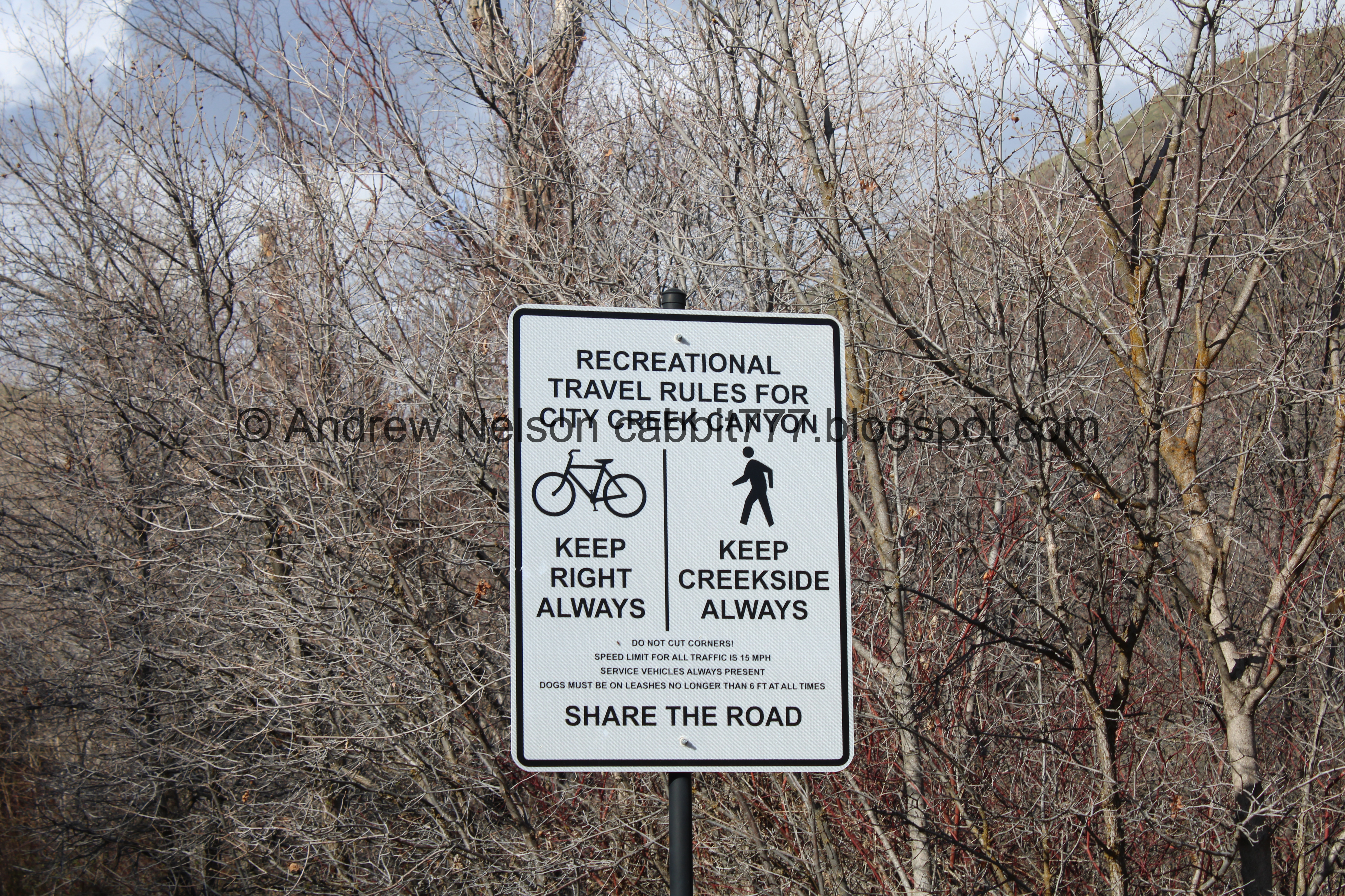
Travel rules for the canyon. Pedestrians must stay on the creek side coming up or down. It seems totally counterintuitive on the way down as the general rule is to always walk to the right. But since this canyon is popular with cyclists, the rule is in place to keep pedestrians safe from fast downhill cyclists.

Big fluffy clouds.

Myrtle spurge. This is a noxious weed that was popular in gardens in the 80’s and 90’s, and now it is everywhere. You definitely want to avoid touching it as its sap can cause burns and rashes.

The creek.

Lots of spurge. Ick.

Hidden Falls, not to be confused with Hidden Falls in Big Cottonwood Canyon. It is pretty hidden though.


Continuing up.

I love the cliffs in this canyon with a bunch of little caves and pockets.

There are half mile markers heading up. Here is half a mile up.

The creek again.

The cliffs again. Give it oh you know, another couple hundred thousand years and this could be the new Bryce Canyon.

Another little waterfall.

Looking back down.

Continuing up.

The creek again.


The cliffs again.

One of a few springs along the way.

Forest.

The creek again.

Another spring.

This one is filled with clover or something.

Can it be?


Yay!!! Glacier lilies! This is one of my personal: "it’s finally spring" signs when I see my first glacier lily.

The cliffs and a big ol hoodoo.

More fun rocks on the other side.

A little bridge. Not sure where it leads.

Another little spring.

Continuing up.

Large conglomerate boulder.

Another rock formation.

Continuing up.

More fluffy clouds.

1 mile up.

Up canyon.

More cliffs.

The big clearing.

I was hoping to go down the little side trail today but it is closed for construction right now.

The big clearing again.

The other side of the canyon.

Up canyon again.

Down canyon.

A little peak with a patch of red rock.

There appears to be a trail on it.

Woo. 1.5 miles. That was our goal for the day because I had a couple other things I wanted to check out while we were downtown.

The road does continue up for a few more miles, and then you can continue further up on foot on The Meadows Trail.

Heading back down.

One of several pit toilets along the way.

Little side canyon.

There appears to be a trail up into this side canyon. I might have to look into that.

The neat cliffs again.

Another pit toilet at picnic site 9. This one is a little closer to the road.

A reminder to stay creek side as a pedestrian (left as you are heading downhill). It still just feels so wrong, but I understand why they do it this way.

The creek flowing under a big boulder.

The creek again.

Now that we are in the shadow of the mountain we can see the neat cliffs a little better.

The shadow line.
It is one of those spring days where we were chilly in the shade, but hot in the sun.

The creek again.

Neat rock outcrop.

Again.

This one kind of looks like a face.

The creek again.

Continuing down.

The creek again.

Construction crews and a couple random scooters. Certainly seems like an odd place to leave them, unless maybe the construction workers used them to get here.

Another fun rock outcrop.

Odd knotted tree.

The creek again.

Continuing down.

Again.

Another aerial target (outside link). Once I noticed one, and looked up what the heck it was, I tend to find them everywhere.

Rock outcrop again.

More myrtle spurge.

A bunch of glacier lilies.

The creek again.
Scrub oaks.

Continuing down.

Holy bird nests Batman.

More scrub oaks.

The creek again.

Back down to Hidden Falls.

I was pretty sure this is the right spot but it didn’t look right. I definitely am at the right spot, it just looks a little different with the creek being higher. Still fun though.

Closer.

Continuing down.

The creek again.

An aerial marker. These balls on power lines help low flying planes and helicopters see the power lines better.

It is still just a baby, but this looks like arrow leaf balsamroot. Hooray for spring flowers!

Some more.

Picnic area #1 is ADA accessible.

I seem to recall there used to be more road painted signs like this to remind pedestrians to stay creek side. I think they are slowly being replaced by street signs.

According to this there will be construction restrictions though 2027! Yikes! I hope they are not too terrible, we like this canyon.

I love this old Smokey Bear sign.

Nearing the gate and kiosk.
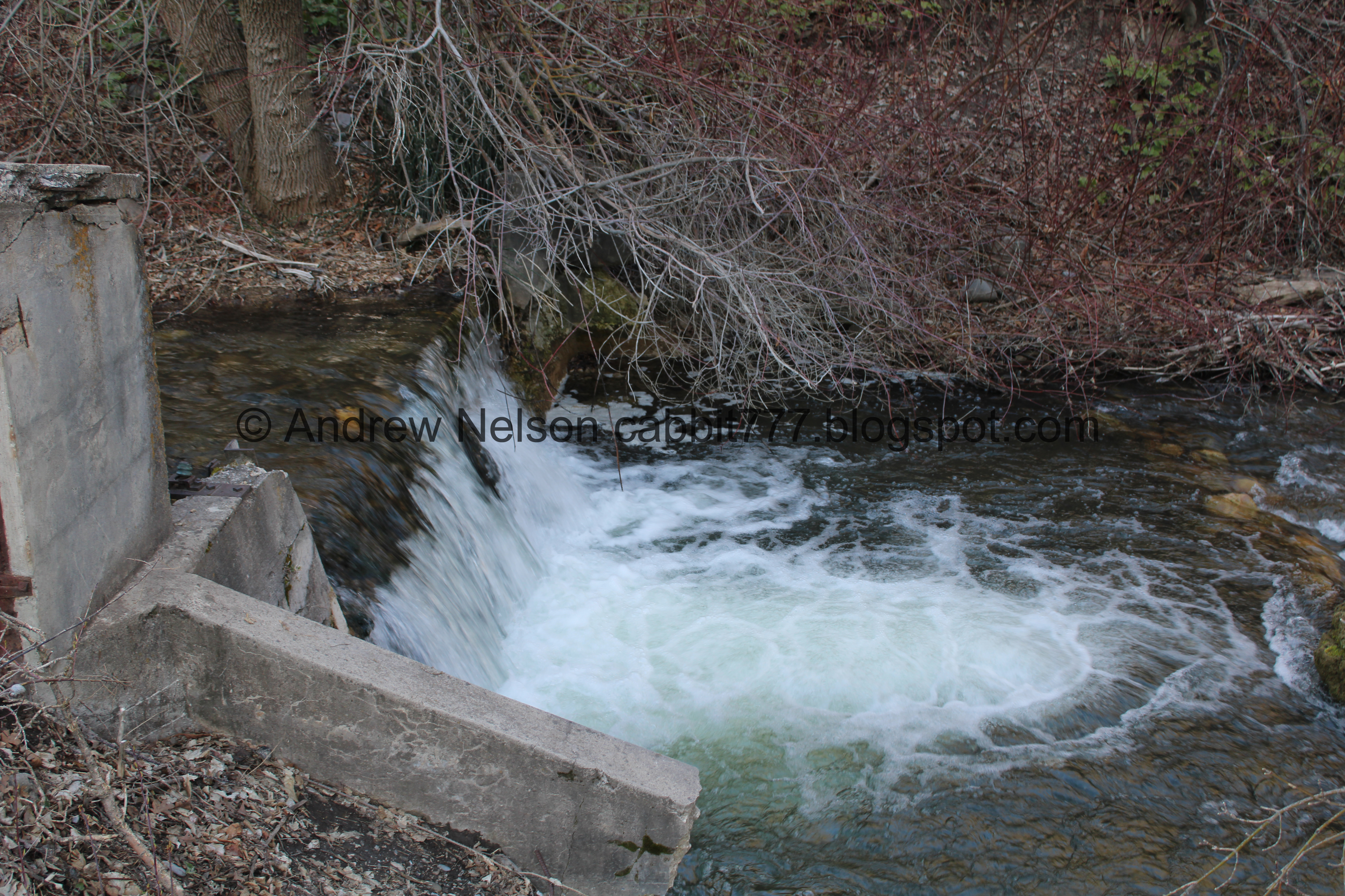
Little manmade waterfall.

Some more flowers starting to come up.

Pressure pipe.
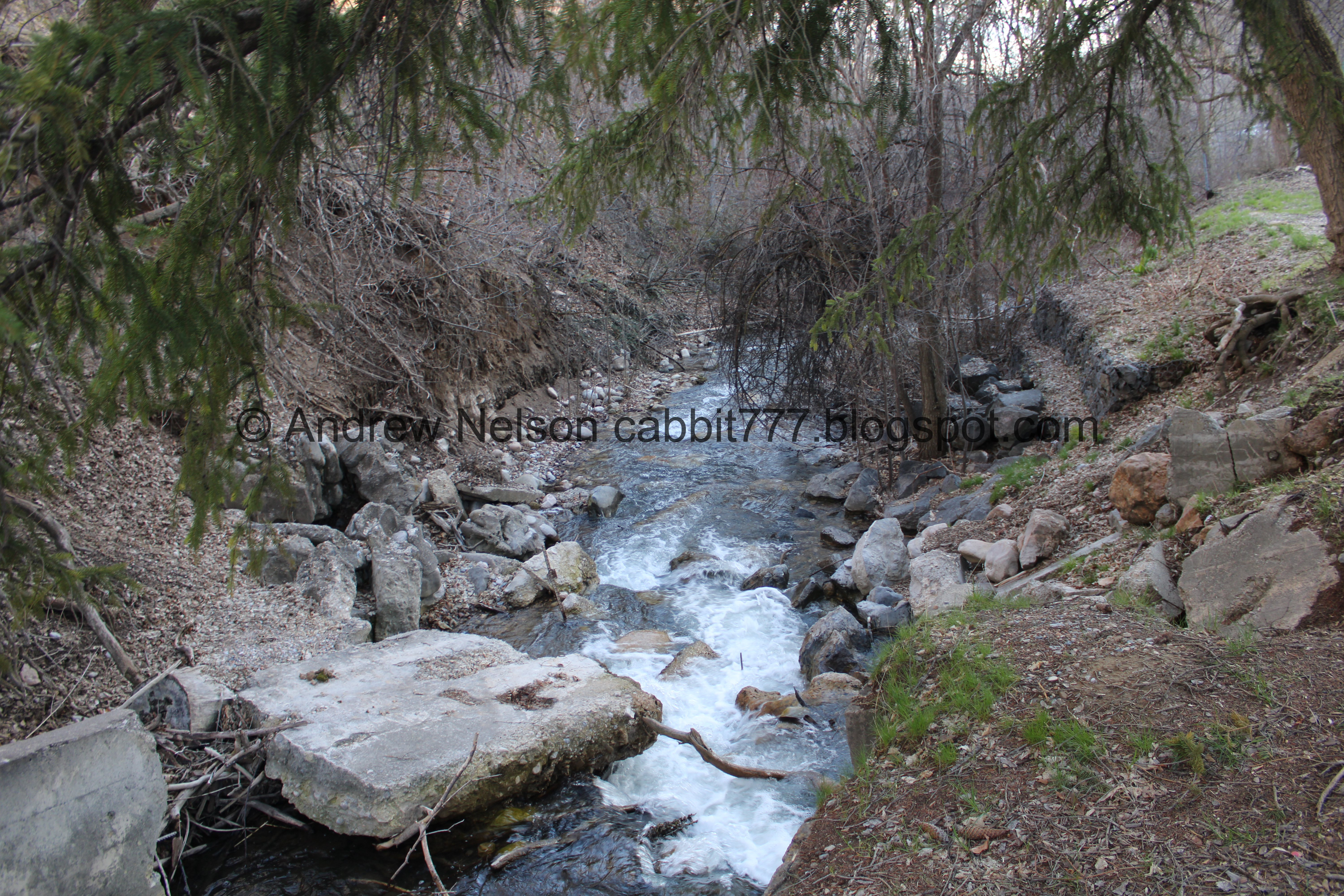
The creek again.

Back down to the gate and kiosk.

Regulations and poison ivy warnings. There are only a few trails that I can recall that have poison ivy warnings. Most prominently in Corner Canyon.

Memorial Fountain: Tony Cannon

Which is currently closed.
A quick google search found multiple Tony Cannons, and I did not take the time to parse out which one this was dedicated to. Maybe I will come back to that.

Landis found what appears to be a chestnut tree and dropped chestnuts.

Picnic table next to the creek. This is not one of the official picnic areas in the canyon.

The remains of an old wasp nest.

Heading back down Canyon Rd. (PSP).


Heading around Memory Grove on Bonneville Blvd. with a view of the Capitol (PSP).
I feel like the barrier is new.
That was a fun adventure! It was a little busy, but not too bad. I think this might have been the latest we have visited this canyon, aside from the time we drove up it in the summer. I love the cliffs, and the creek, and just everything about it. I was a little disappointed I could not walk down the side trail as I had hoped, but I get it, construction and all. Going with 8 out of 10 squirrels today.
As for difficulty, it is paved, with a mostly gentle climb, but there are a few steeper sections. Going with a DR3 today.
Dogs are allowed, but must remain leashed at all times. I want to stress that this particular trail that is really important as the downhill cyclists really cruise down the canyon! So, keep your cuddly friend safe and keep him leashed.

No comments:
Post a Comment