.jpg)
The Bonneville Shoreline Trail (BST) is a long trail that one day will stretch from Nephi, to Idaho. A lot of the sections are complete, and a lot have been planned. This particular section is complete and offers excellent views into Davis and Salt Lake Counties. During this time of year it also boasts a gorgeous wildflower display, which is what brought us out today.

A rainbow of flowers you might experience on the trail right now. Perfect for Pride Month.
Quick Details:
Length: We did a 2.47 mile out and back with a loop, it would be about 2.2 out and back.
Trail Type: Out and back, loop options.
Difficulty: DR3
Elevation Gain: About 300 feet.
Restroom: Yes at Tunnel Springs Park
Dogs? Yes, leashed.
Other Info:
To Get Here:
Take HW89 in North Salt Lake to Eagle Ridge Dr. Head east up the mountains and continue forward through the roundabout. About .8 miles later turn right on Parkway dr. Parkway winds right then back left for about .9 miles. After which you will turn right on Eagle Point Dr. 100 more feet and you will see the park with a parking lot. Address is 1080 Eagle Point Dr. If you want you can drive another 600 feet or so on gravel to a back parking lot.

Moody clouds over Mount Olympus (Passenger Seat Photography (PSP)).

Moody clouds over our destination (PSP). I hope I didn’t screw up and put us into a storm.

I love the giant blue cock at the north point of the mountain (PSP).
The Trail:

I don’t know what these purple cuties are but I love them. The closest I can find is purple sage, which seems right.

It’s June. Look how green the foothills still are!

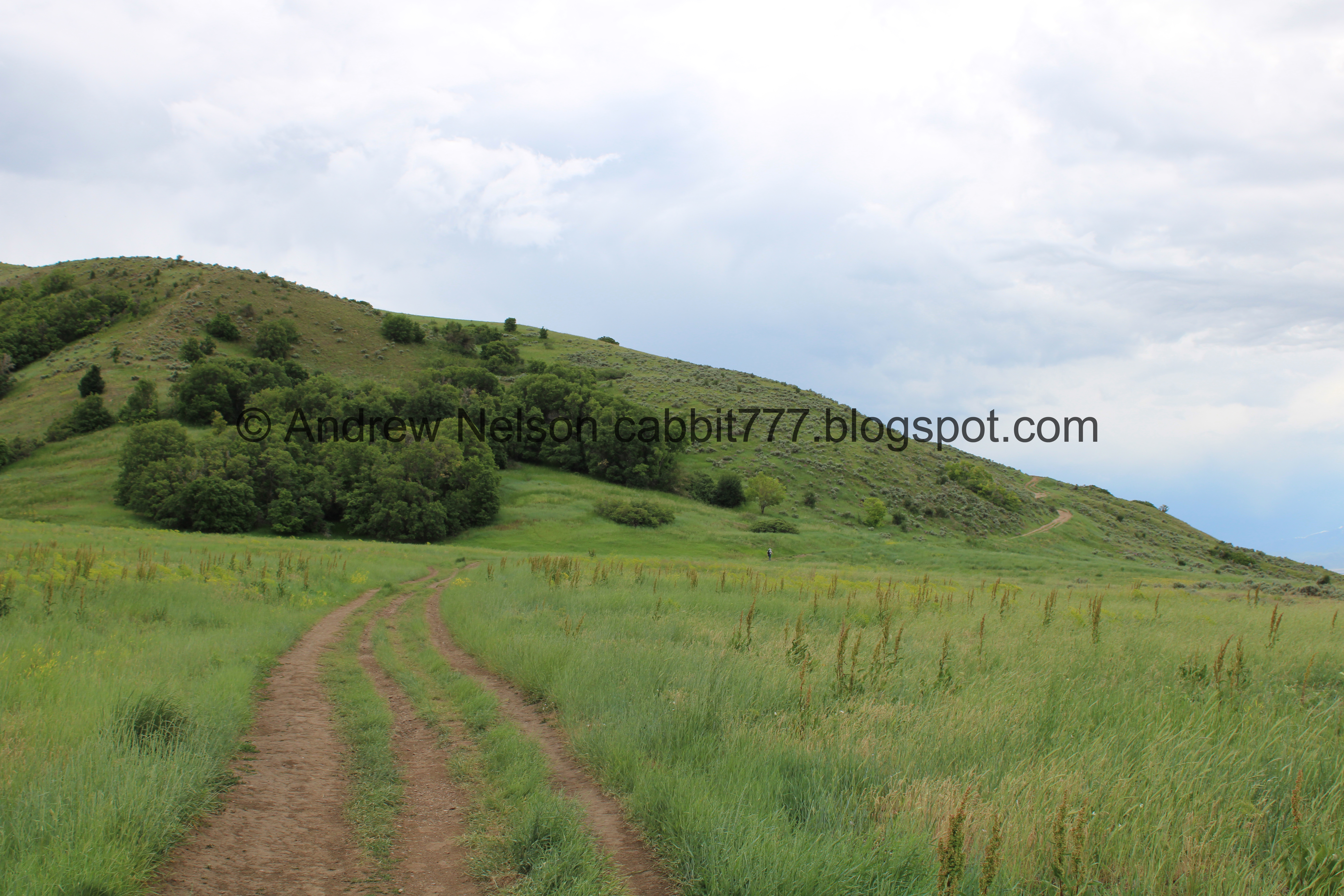
The trail. You can also see the dirt parking lot. That will save you about a 10th of a mile.

Great view of Antelope Island beyond Tunnel Springs Park.
.jpg)
Panoramic.

Going through the fence. I think this technically denotes the county line so you will be back in Salt Lake County.

Little wetland.

Source water. I think this might actually be Tunnel Spring.

Curly Dock.

Moody clouds.

It looks like it has been tampered with, but this is a trail counter. All it does/did do was count how many people pass by it.


Trail signs.

So green and pretty right now.

Not sure what these yellow guys are either.


Striped hillsides. I finally learned that this was an erosion control effort by the civilian conservation corps. Outside link.

A plane taking off. We’ll be able to see the airport soon.

Morning glories.

The pretty purple flowers again.

The amazing green bench.

Something in the snapdragon family.

No idea what these are either.

More moody clouds.

One of several little side canyons.

Drainage channel.

More morning glories.

Flowers on the hillside.

The SLC Airport below.

Sign about the Great Salt Lake.

The airport again.
Just before the climb.

More side canyons. We ended up accidentally kind of exploring them on the way back.

More yellow snapdragon looking flowers.

More angry clouds.

Stunning purple flowers.

Antelope Island again.

Is.. is that lupine? Does lupine even come in this color? I guess it does. I’ve only seen it blue, and one time I saw white. But I am not 100% sure.

It is stunning.

All over the hillside.

Some paintbrush.

Nice mix of color.

Pretty sure this is bitter brush.


More flowers.

Some spots triggered my fear of heights. But the trail is pretty wide so I managed to push through.

Oh boy. I don’t like the look of that.

Sego lilies. We couldn’t decide if this was a twofer, or just two clumped together.

Another.

And another.

There are a bunch on this hillside.

A glimpse of downtown SLC.

Continuing the climb.

More bitter brush.

The wind is really starting to pick up making it difficult to get wildflower pictures. I am stabilizing it here, I did not pick it.

Another twofer. We confirmed a little later they can have multiple blooms on one stem. I thought they were single bloom flowers.

A field full of them above.

We made it to the ridge, where we can see all of the communication towers on the next ridge. My original plan was to continue down to the crossroads, but the wind REALLY picked up, and it looked like it was blowing a storm towards us. So after a couple steps and a little debate, we ultimately decided that we should probably turn around for safety. Not to mention I was tired of holding onto my hat for dear life. I think it would be another 10th of a mile down to the crossroads.
I have continued up to that 2nd ridge before. There are a couple of neat things to see.

Little sub peak. You can see more of this with the link above.

The trail dips down into this canyon before climbing up to the next ridge.
Ok really, time to turn around.

Heading back down.

Bitter brush.

Sego lily.

Antelope Island again.

Moody clouds.

The trail. It’s not as much of a drop off as it looks, but I still find myself hugging the hillside.


More pretty flowers.

Pretty yellow flowers.
.jpg)
Panoramic view.

That looks like lake dust blowing up.

More pretty purple.


Pink and purple.

On the way up we both thought we heard water around here and noticed this little side trail. So we decided to go investigate.


Paintbrush.

Well, we did find what appears to be a small spring, but it wasn’t making the sound we thought we heard.

Some phlox.

Into the trees.

It is a nice little stand.

Some penstemon.

Single bloom.

Random X. I wonder what that is. Could it possibly be an aerial marker? Before now I have only seen them painted on roads.

Penstemon with a couple of bee butts. Actually those kind of looks like wasps, but hey still kind of neat.

The south side canyon.

Again.

The X again.

More erosion control lines.

Approaching the north canyon for this small loop.

The skies are still looking a bit threatening, but I feel better being on lower ground versus being on the high ridges.

Another stand of trees.

Another small side canyon.

Starting to head back to the main trail. Phew! I was starting to worry this random side trail wasn’t going to take us back. But it was an adventure!

Some more yellow.

Caterpillar.

More yellow.

Green hills.

More curly dock.

Starting to bloom.

Looking back at the 2 side canyons we just walked by.


The trail spits us out by the sign about the Great Salt Lake. It only seems to have added a little over a quarter mile.


Incoming storm.

Another side canyon.

Continuing along the nice flat SL/Davis point of the mountain.

Morning glories and sego lilies.

Sego lily with 2 blooms that we can confirm is split off of one stem. Like I mentioned earlier, I was not aware they could do that.

Storm again.

Another side canyon.

Back to the county line fence.

Little spring again.

Lake dust.

More green hills.

Spider with a red butt. Pretty sure it is a jumping spider.
.jpg)
Panoramic.

Where the trail crosses the dirt road to connect to the paved lot.
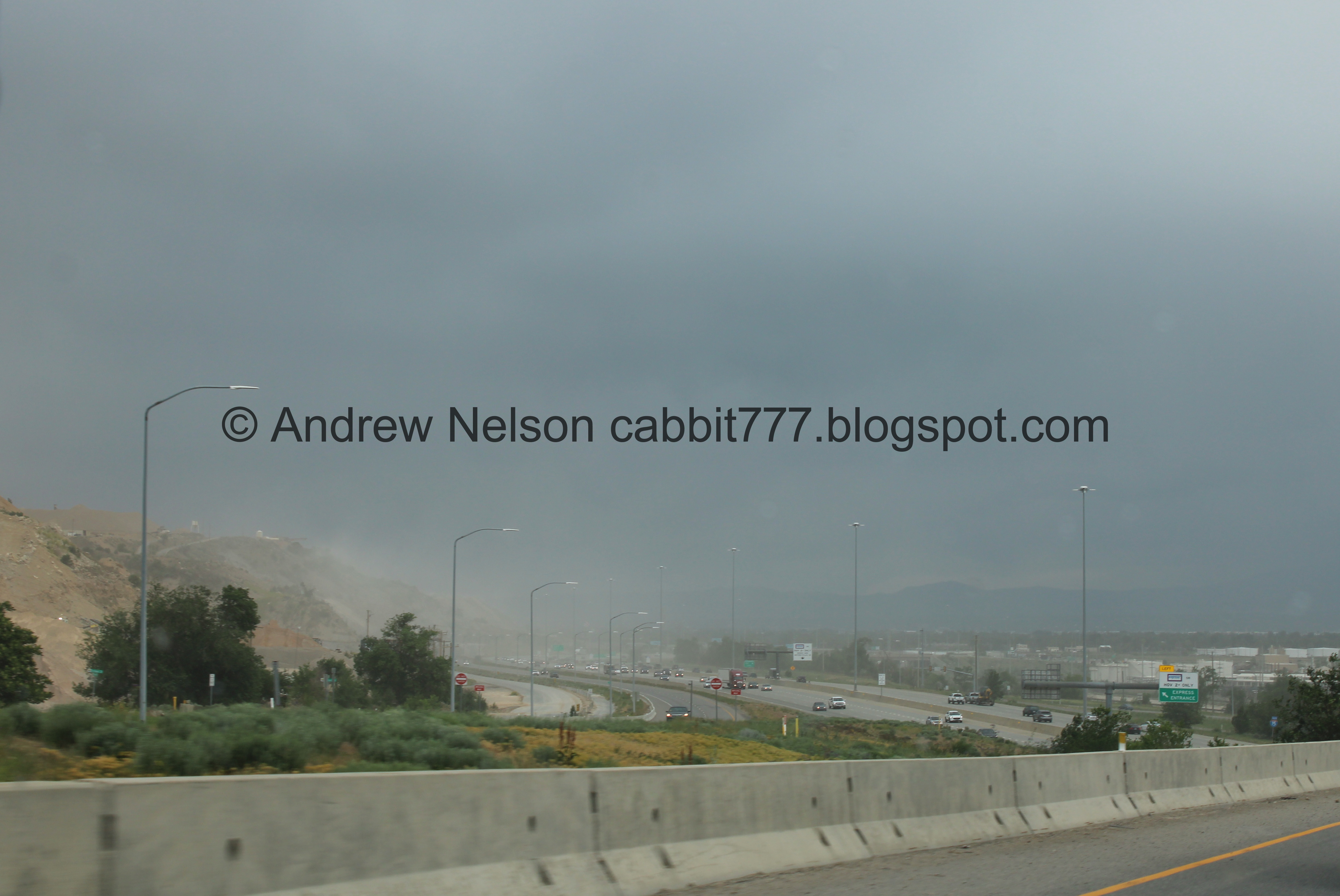
The wind is picking up the sand from the mines at the point of the mountain (PSP).
While we enjoyed the wildflowers we kind of realized we had seen every color in the rainbow today, and then some and well, that inspired me to make this.
Maybe not the best images, but a nice perfect representation of wildflowers for Pride Month. Happy Pride yall!

Bonus extra hues.
Well that was a fun wildflower hunt! I enjoyed what we got to see, and the random detour turned out to be a lovely adventure, plus I just love how green everything still is. It was not too busy today, probably because of the stormy weather. 8 out of 10 squirrels.
As for difficulty, it was a climb for sure, but it wasn’t too bad. DR3.
Dogs are allowed, but should remain leashed at all times.

No comments:
Post a Comment