This section of The Jordan River Parkway is pretty nice. There aren’t many nearby homes and it is mostly wild. You might even see some deer and other wildlife through here. It is a section we do fairly often, but I do enjoy it. I have really enjoying the mild spring we have been having so if I am able to, I am going out in it!
Quick Details:
Length: 3.47 miles out and back.
Trail Type: Out and back, or connector.
Difficulty: DR2. It’s flat and completely paved.
Elevation Gain: About 29 feet.
Restroom: No.
Dogs? Yes, leashed.
Other Info: Cities: Midvale and West Valley. Mile Markers 23 and 24. Accessible via Trax.
To Get Here:
From i15 take the 7200 S exit. Take the first left south towards 7800 S. Head west. You will see the TH on the left just before the overpass. If you pass Gardner Village, you went to far.
7800 S. and approximately 1000 W.
If using Trax: Take the Red Line to the Historic Gardner Station.
The Trail:
The beginning of the trail.
I like that the solar panels are surrounded by plants. I wonder if they planted them or if they just filled in themselves. It's looks like it is mostly yellow sweet clover.
A high bank which is perfect for bank swallows and kingfishes to nest in.
Some damage on the superfund cap.
Hitting a forested section.
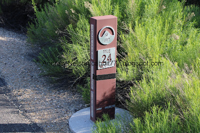
Mile marker 24.
Trees and sagebrush.
Trail split. Left leads to what I for some reason have been calling Valence Pond and a neighborhood connector. You could make a balloon, with some next to the road walking if you wanted. But otherwise, head right.
Bridge.
The last bridge over the Jordan River that completed the trail in 2014. The last bridge though was a tied-arch bridge completed in 2017 over the train tracks near North Temple.
Upstream.
Downstream.
Entering West Jordan.
I don’t know what it is, but I love this purple stuff in the grass.
An American kestrel. Yay!
These guys are kind of hard because they are super small and from a distance they look like just any bird. Plus they generally don’t like to let you get very close. But sometimes I just get a feeling and pull out the telephoto and I get lucky.
Mount Jordan.
Twin Peaks.
Little Cottonwood Canyon.
I love the cloud shadows on the mountains.
Panoramic.
Horse walking along the North Jordan Canal.
Peaks above the Big Bend Restoration Area. They are really taking their time with this. I’ve been looking forward to it opening for a few years now.
I found a cormorant hanging out.
Another panoramic of our 4 main peaks. Grandeur, Olympus, Twin Peaks, and Lone Peak (Mount Jordan).
Again.
Mile Marker 23.
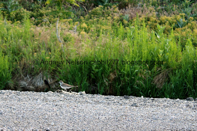
Killdeer.
A family of ducks.
The power sub station.
Another killdeer.
The tunnel under 90th south.
Inside.
It spits you out next to the River Oaks Driving Range and Teaching Academy.
I know it’s silly, I feel l have officially done the entire Jordan River Parkway, but I have a couple random small miniscule bits between trailheads I had glossed over, so when I do those sections again I feel the need to cover that missed bit. So I added the short section from 90th across the front of the driving range.
There is a short crossing across the parking lot.
There, I made it to where I picked up the next segment. Woo. Time to head on back.
I found another trail counter. As I have mentioned, they are not cameras. Just some kind of sensor that counts how many people go by. I feel like I am starting to find them on just about every trail we do.
Back under 90th south.
It is a hidden drive, however it does not get a lot of traffic.
Red-winged black-bird.
Canada goose family.
Another one.
Another.
Some adults Aww, the poor guy on the right appears to have a bum wing.
Mile Marker 23 again.
It has been so long, the sign is quite faded.
Sign about the restoration efforts.
Hummingbird.
Another panoramic.
The pond again.
Again. I can’t wait until I can walk around it!
Little Cottonwood Canyon again.
Critical habitat along the Pacific and Central Flyways.
Horses. I love the cow spotted one.
American kestrel again.
WHOA!!! I don’t think I have ever had the pleasure of watching deer cross a river, let alone a whole herd of them!
Well, maybe not cross, but at least walk in.
So cool.
Upper bridge.
Back to Midvale.
Back to mile marker 24.
The Bingham Creek Confluence. A little hard to see through the greenery.
Continuing along the wooded section.
Bridge to the section that leads to 70th south.
Well that was a fun adventure! I am glad I came out to enjoy the nice day. I am loving the mild, actual spring like weather we are currently having. It was not very busy, and I sure did enjoy the wildlife I saw today, particularly the deer the river, wow that was cool! 8 out of 10 squirrels today.
As for difficulty, it is pretty flat and completely paved, DR2.
Dogs are allowed, but should remain leashed at all times.
.jpg)


.jpg)


.jpg)
.jpg)


.jpg)


No comments:
Post a Comment