.jpg)
Donut Falls AKA Doughnut Falls is a unique waterfall located in Big Cottonwood Canyon. What makes it so unique? As its name implies the waterfall go through a round hole in the rock into a cave below it. Creating a doughnut that the water falls through. They rerouted the lower trailhead a couple years ago and I have been meaning to check that out. The upper trailhead parking fills up very quickly so we didn’t bother with it today. As for the upper trail there is currently a temporary detour, which most people seemed to just completely ignore today. We do this trail fairly often, however this was the first time we have done most of this route.
After the long, brutal winter this is the first time we finally dared to venture up into the canyons.

Quick Details:
Length: With the reroute and detour it is about 3.5 miles out and back. The lower trail reroute is about 9/10 of a mile and the upper trails detour is about 8/10’s of a mile so probably about 9/10ths total since we stopped short of the end.
Trail Type: Out and back.
Difficulty: DR3, DR5 if you scramble up to the falls.
Elevation Gain: About 600 feet.
Restroom: At the upper trailhead, yes. The lower trailhead is out of service but they have a few porta-pottys.
Dogs? No. Big Cottonwood Canyon is watershed.
Other Info: The horrible construction project that results in alternating 1 way traffic starts tomorrow (6/5). I am glad we got at least 1 trip up before that started up again!
To Get Here:
From the mouth of Big Cottonwood Canyon drive up approximately 8.9 miles to the Mill D South trailhead on the right. Park and walk about 0.14 miles up Cardiff Fork Rd and you will see the trail split off the left. It will be approximately 3/4 of a mile more to the upper trailhead.
If you want to try and save yourself 1.8 miles out and back, you can try your luck up at the upper trailhead by driving up about 3/4 of a mile up Cardiff Fork Rd. Be advised: Pay very close attention to where you can and cannot park up there. They are pretty serious about ticketing.

The “Crows Foot” on Mount Jordan. (Passenger Seat Photography (PSP)) According to someone in one of the fb groups I am in: “Early settlers of the Salt Lake Valley knew when the spring runoff would begin and end by observing the crows foot on Lone Peak. When the snow level reached the bottom of the foot the Cottonwoods runoff peak would begin. When the snow level melted to above the foot the runoff is over.”
I found the idea very interesting but haven’t researched it any further, however I did want to watch it for myself.


Into the canyon (PSP) Oh how I have missed it! We haven’t been up in the canyons since October!

Starting to see some snow (PSP).
The Trail:

The new bridge and boardwalk through Cardiff Meadows is coming along nicely. It would appear this will eventually be the new trailhead. It is not open yet and there are signs asking you to stay out of the area.

Mill D South (apparently aka Cardiff Fork) between Reed and Benson Ridge and Kessler Peak. Landis and I were going crazy trying to figure out where Cardiff Fork was, well I guess it is just another name for Mill D South. It appears to be named after Cardiff Mine which is up there.
I do admit, Cardiff Meadows sounds a lot better than Mill D South Meadows.

What I have dubbed to be the Mill D Beaver Dam and lodge as well. I wonder how the beaver have been handling the construction. I know they are pretty sensitive. I would hope they had someone overseeing the process to ensure they were okay.
I think this is Reynolds Gulch.

The beaver dam again. The lodge is to the left, but it just looks like plants growing from here.

Again. This is the biggest and most complex beaver dam I have ever seen.

The pond with the lodge. Like I said, the lodge just looks like plants from down here. It is near the center of this shot.

Heading up Cardiff Fork Rd. I swear it used to be called Mill D South Rd, but maybe I am misremembering. Hah! Vindicated, my post from 2018 confirmed it for me.

The new boardwalk.

Still on the road for just a smidge longer.

The only wildflowers we saw today. They appear to be strawberries.

Oof. Lots of snow.


Before long we reached the turn of for the new lower trail.

Mill D North.

Trail going between 2 large trees.

The trail goes by the Jordan Pines Campground. We uh experienced that first hand. we camped there one year and had the fun experience of people walking by while we had breakfast. 0.o

Crossing the road down to the campground.

View up.

Into the woods!

The first of many snow piles we had to trudge through.

I am just loving the forest through here! This definitely beats walking up the road.

There are a couple little trails that connect to the Jordan Pines Campground, and this official one.

More forest.

Old dead tree.


More forest.

Looking up.

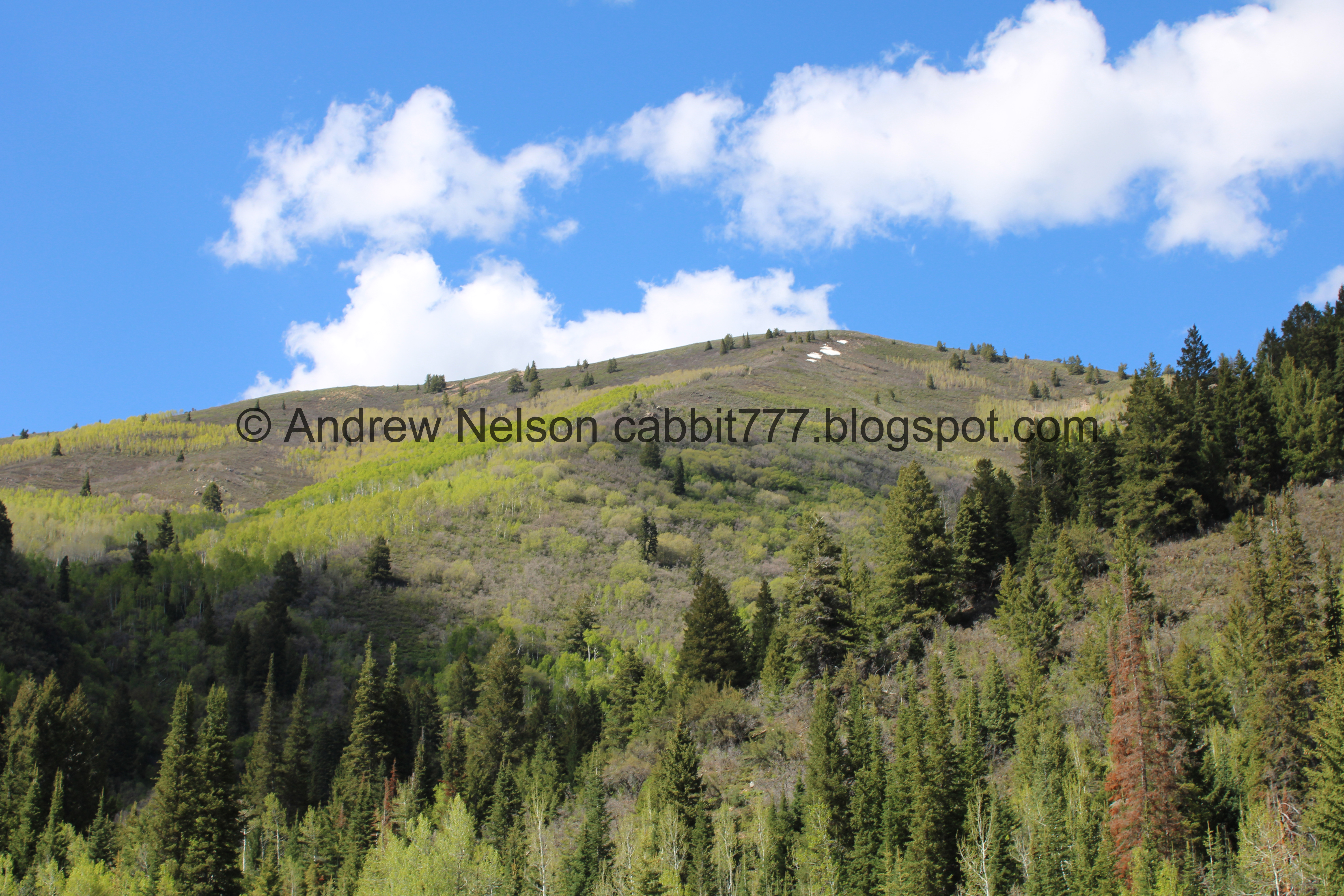
Reed and Benson Ridge.

Kessler Peak.

Again.

The new trail also connects to the Spruces Campground. Although right now uh, good luck.

Snow and mud.

Kessler Peak above the forest.

Starting to see the overflow parking for the upper trailhead. So we must be close.

More forest. I like that this new trail, I didn't even notice the private cabins along the road.

Pretty nice view to the other side of Big Cottonwood Canyon.

More forest.

View again.

Back to the forest.

Giant fluffy cloud.


Loving all the trees.

Kessler peak again.

We made it to the upper trailhead.

Where the new lower trail connects to the upper trail.

Oh. Huh. There is a temporary detour. Alrighty then.
However the amount of people that either don’t read signs, or don’t think it applies to them is rather staggering! So many people going up and coming down the main trail.


So back down through the parking lot, and then to the left. Following forest service road 019.
You know I have often mentioned wanting to go down this way and it just never happened cause I generally just keep to what I know. So it was nice being forced to explore the alternate route. Now that we have done it, I think I kind of prefer it. It is a little more gentle climb, and you get to enjoy the creek for more of the way.

The creek really fans out here.

Another detour sign.


Heading up the dirt road, where there are more snow drifts.

A smaller waterfall.

There are a couple more signs to reassure you that you on the right path.

The creek below.


The canyon narrows a bit and there are some fallen trees to navigate around.

The creek.

Another fallen tree.

Trees above.

The creek and the road. As far as I can tell the creek is still called Mill D South.

I did not like the idea of walking across a snowfield so close to the rushing creek, but we made it without incident.

More fallen trees.

Another section next to the creek. The first one is closer to the creek, this one has a bit of a hill. I can’t decide which one was worse.

The creek again.

Little cascade.

Fork in the road. There is a sign here advising to keep left.

Before long we rejoined the main trail.

Here you can see at least one of the reasons for the detour. The bridge is completely flooded over! Watching people trying to navigate it is kind of hilarious.

Another fallen tree.

More broken trees. This last winter has really taken a toll in our canyons.

Another fork in the road. Again, you want to hang left.

More snow.

Aspens greening up.

With Kessler Peak.

Ugh, more snow.

Avalanche chute.

Reed and Benson Ridge and some cliffs.

As we approached the narrow canyon that the waterfall is in there is a little boulder scramble with a 10-15 foot drop. I don’t particularly care for it when it is dry, but add snow, and throngs of people going both directions (edited out) it was a big fat nope for me today. Not to mention seeing the people going down absolutely soaking wet. With the high water it appears you will have to get soaked to make it to even the base of the falls. So, yeah. I decided I was good, and just enjoyed the trek today without the end prize. So we turned around.
View down.


Squirrel!

View down again.


Aspens.

Snowy trail.
Note: This is a very busy trail! I have edited people out of a lot of these pictures.

Back down to the detour hang a left here. Otherwise…

This could be you. o.O It looks like it is not only flooded, but it looks like some of the actual bridge is missing. Yikes! Very glad I noticed, and heeded the detour sign.
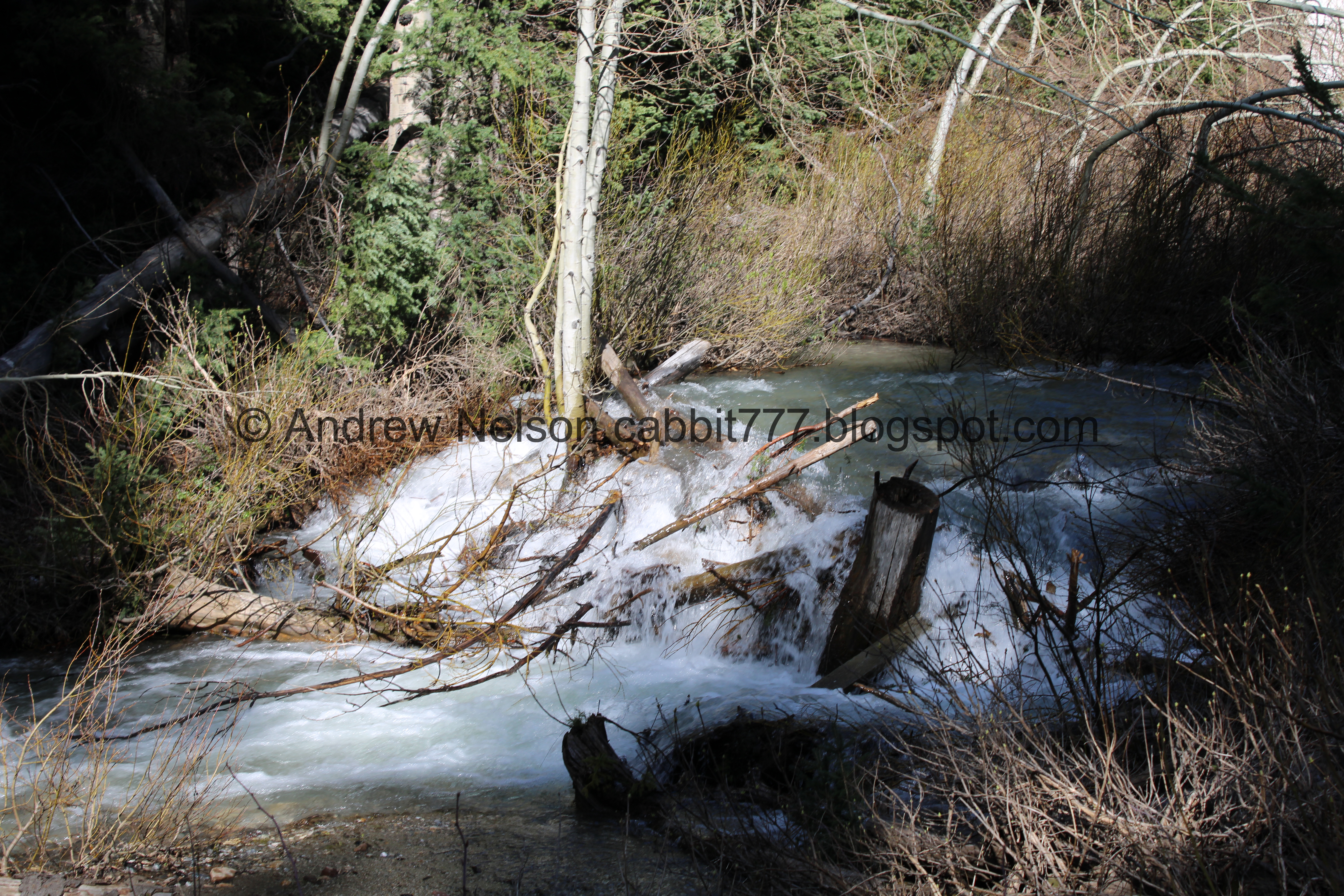
Cascade over a debris pile.

It doesn’t look like anybody’s face is showing here, so here is an example of some of the crowds you will see.

The creek through the snow.

From the other direction.

Fallen trees.

The lower patch of snow next to the creek.

Little rapid.

The creek.

The narrow canyon.

It looks like it is eating into the road a bit.

More fallen trees.

Upstream.

Another little debris cascade.

Small waterfall.

Thick forest.

Again.

The one switchback on the old forest road. Well, aside from the one at the trailhead.

Down to the gate.

Where the creek goes under the forest road.

The other side.

The creek is really fanned out here.

Back to the upper trailhead.

Back to the new lower trail split.

Trail split. You want the one to the right. Left leads to the overflow parking and the old trail down to Jordan Pines.

Lovely forest.

View across the canyon again.

Peak across the way.

Forest.


Chipmunk!

More forest.

The split to the Spruces Campground, which appears to have quite a few hazards at the moment. You want to stay left.

Clear cut for the power lines.

No wildflowers yet, but it looks like they are trying to come up.

A look back at Kessler Peak.

Looking up.

More forest.

There is a lot of damaged trees on this trail. Last winter was really rough!

The worst switchback, which isn’t even that bad. I just psyche myself out sometimes with new trails.

I am amused and confused at the fact that they decided to line the trail with rock, and that it failed.

Signed split down to Jordan Pines.

Crossing the side road that leads to Jordan Pines.

Twin tree gate.
.jpg)
Vertical panoramic.

Mill D North again.

Reynolds Gulch.

Again.

Mill D North above the Cardiff Meadows.

Cliffs above Reynolds Gulch.

Back to the Cardiff Fork Rd.

The new boardwalk again.
There are signs saying to keep out of the area. Again, lots of people missing, or ignoring them.

I wonder if they plan to add a staircase here, or leave it as is, or maybe reroute it.

Back down to the beaver pond.

Duckies!

Both the dam and the lodge are covered in new growth. I imagine the beaver might start trimming things down soon, that is if the construction project didn’t scare them off. Again, I hope there was some kind of specialist making sure they were not terribly affected.

It’s hard to see this is a beaver dam here.

Another view of Mill D South, which I guess is now Cardiff Fork between Reed and Benson Ridge and Kessler Peak.
.jpg)
Panoramic.

A look at the beaver dam and lodge again. The lodge is easier to see from up here.

We decided to drive up to the top of the canyon to see the remaining snow levels (PSP). Here is Solitude.

Just above Willow Heights (PSP).

All of the passes are closed (PSP).
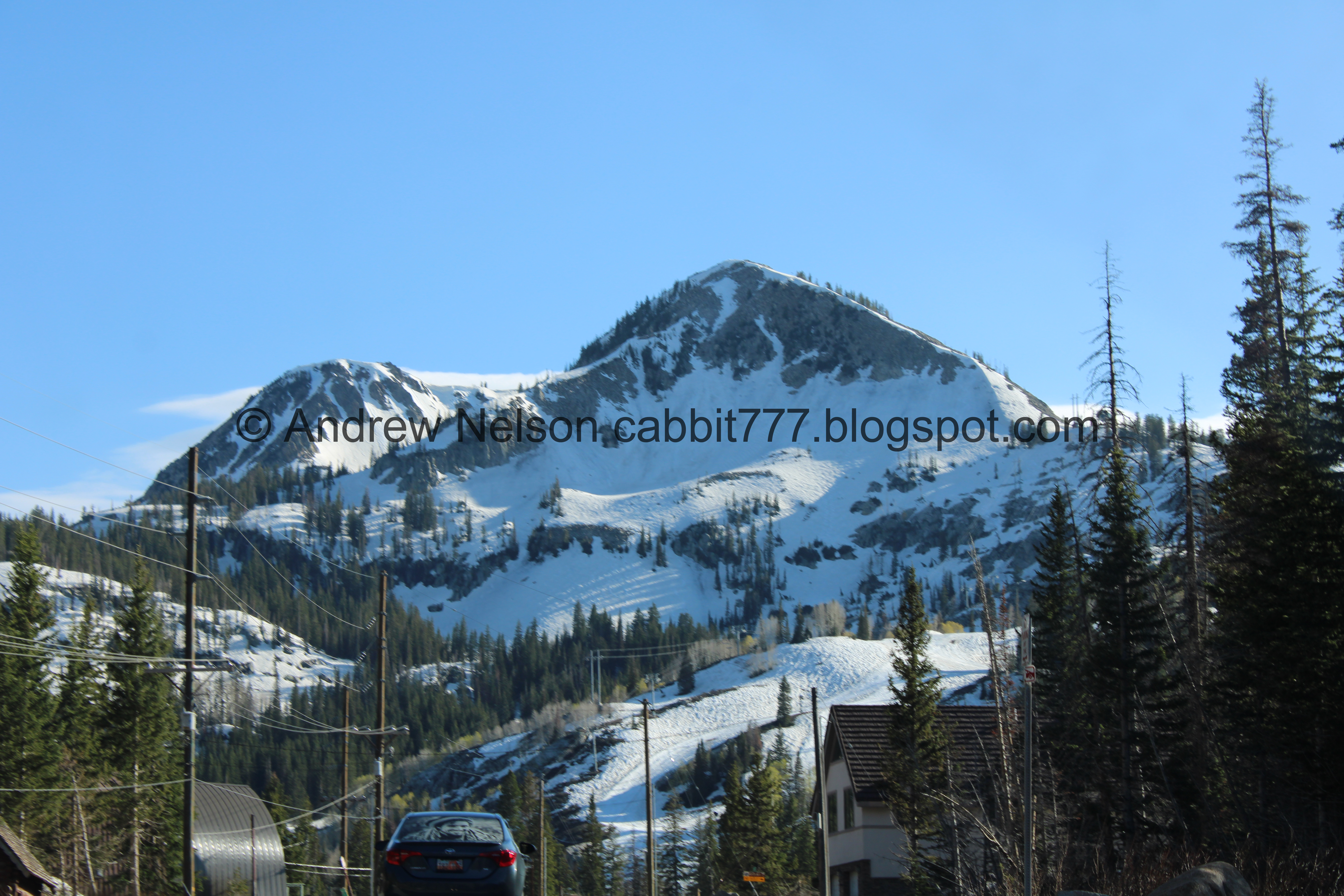
Mount Millicent is still covered in snow (PSP).

We decided to come check out Silver Lake. Uhm, it is still a huge snowfield!

The south boardwalk is still being rebuilt.

Panoramic.

Snow drift as tall as I am. Okay, we saw the snow, time to find something to eat.

Snow drift by Brighton (PSP).

Scott Hill with some snow on it (PSP). Scott Hill is an easy peak to identify with the Mickey Mouse shaped mine tailings.

Aspens starting to green up (PSP).


It is so pretty up here (PSP).

Storm Mountain (PSP).

We weren’t sure if this was a fire, or lake dust or something else (PSP). The consensus I gathered online is that it was a quick burn by some company out west.
I had a total last minute idea for supper! We have been wanting to try The Hog Wallow for a little while now, and well, we’re nearby so why not?

The bar is located along the Big Cottonwood Canyon Trail which is where I first noticed it.

It has some neat wooden carvings. This is Ninkasi: The Goddess of Beer.

Cool gnomes.
It was a cool little bar. I enjoyed the music and atmosphere. My burger was a little bland, but the fries were great and Landis liked his French dip. I’d give them another chance.
Well, todays adventure was super fun! I have always enjoyed this trail and as a bonus it was almost completely new to us today! The new lower trail is great and allows you to enjoy the forest more. I am kind of excited for the new boardwalk to open. I am actually kind of happy for the upper trail reroute. I have been meaning to check that out for a while. I am a little disappointed we didn’t make it to the falls, and by the large crowds. 8 out of 10 squirrels today.
As for difficulty, it is a a pretty gentle climb so DR3. DR5 if you decide to scramble up to the cave.
Dogs are not allowed in Big Cottonwood Canyon so be sure to leave Fido home.

No comments:
Post a Comment