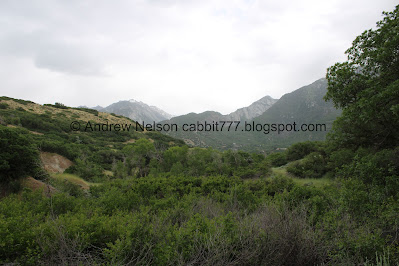
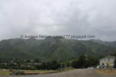
Dimple Dell Regional Park is a large park in Sandy that offers miles and miles of trails to explore it. I was here last week doing the Flanders Loop Trail and I noticed that the normally quite dry Dry Creek seemed to be flowing pretty good! So that and the fact that we had a family activity planned nearby, I thought it would be a good option to explore the canyon today. I had planned on seeing if the pond was full again, and then doing some of the Dry Creek trail but uh, the thing I wanted to see, the creek, blocked our path a few times. So this is kind of a weird path we took, while loosely following the Centennial Trail.
Quick Details:
Length: We did about a 1.57 miles loop, with spurs.
Trail Type: Loop with spurs.
Difficulty: DR2. It was a pretty easy going.
Elevation Gain: About 200 feet.
Restroom: Yes. Flush toilets at the trailhead.
Dogs? Yes, but should remained leased at all times.
Other Info:
To Get Here:
We used the Dimple Dell Trailhead today.
From i15, take the 106th south exit. Take that east to 2000 east, turn left. Pretty quickly the road will sharply curve to the right, going east again and becoming Dimple Dell Rd. Go about 1.1 miles and there will be a large parking lot on the left.
Little Cottonwood Canyon (Passenger Seat Photography (PSP)).
The Trail:
Moody clouds.
Mount Jordan above. We started at the east side today.
ADA improvements.
Including a paved trail out to the restrooms, which are oddly quite a ways off from the trailhead.
Middle Fork Dry Canyon. That, South Fork Dry Canyon, and Bell Canyon are the sources of Dry Creek.
Heading down into the gully.
Taper tip onion.
A bunch of daisies.
They have added a couple of interpretive signs in the area. This one is about ensuring you sure staying on established trails.
It is so lush and green down here.
More moody clouds.
I didn’t realize that Dimple Dell Pond was meant to be an emergency fire control.
Some penstemon.
Dimple Dell Pond. Yep, it is full again!
Quite full.
With Bell Canyon above.
Some purple penstemon.
Dry Creek flowing pretty good.
Another pretty flower.
Bat box.
The creek again.
Fox Point.
Continuing along the trail.
Oh neat! I thought the water was running due to the record breaking snowpack we had this year. But if I am understanding the sign correctly, while that may be a contribution right now, they are working on making the creek run all year when possible. Nice.
The creek again.
Bridge over it. That leads to the Mountain View Trail, which is a nice trail but I was trying to stay near the creek.
Downstream.
Upstream.
Bridge again.
We stayed down on what I thought was the Dry Creek Trail.
The creek again. Man it is so fun to see it flowing.
Ruh roh. End of this trail.
High bank. These provide a perfect nesting site for bank swallows and king fishers.
The creek again.
Okay, I feel a little bad, I am sure this is not one of the official trails. But in my defense, if you want to keep people on the official trails, maybe improve signage. Also, I did stay on already established trails and did not just go off trail.
Okay, now I think we are officially on the Dry Creek Trail.
Through a meadow.
Across the gully.
Sage brush and scrub oak.
More daisies.
The creek again.
Panoramic.
Upstream.
Well, poop.
Another high bank.
I am not necessarily worried about it knocking me over and pulling me downstream, I just didn’t want wet feet because we had family stuff happening afterwards. If they are going to try to have the creek flow more, they need to put in some crossing assistance on this trail. Doesn’t have to be a bridge, some sturdy stepping stones would suffice. I know it crosses the creek quite a few times.
Panoramic.
Whelp, I guess this is our turn around point. Which actually worked out for us. If we had done my original plan we would have been late to our family stuff.
Reassurance that we are on the official trail.
Some lupine.
Closer.
The creek again.
The mountains above Fox Point.
The creek again.
Another panoramic.
More daisies.
Mount Jordan with some gloomy clouds.
I love this little tunnel through the trees.
Mount Jordan.
I think this is yellow sweet clover.
Approaching the site of the, since removed amphitheater.
Now.
From our adventure in 2020.
Sign about the local wildlife.
The final push up out of the gully.
Heading back to the parking lot.
Big and Little Cottonwood Canyons.
Panoramic with Mount Jordan.
Mount Jordan from the parking lot. Middle Fork and South Fork Dry Creek.
Fox Point again. Fox Point is the elbow of Dimple Dell.
Panoramic again.
Sunflower.
Huge wolf spider in the restroom.
I really enjoyed seeing the creek running! I just wish we could have gotten further along than we did. Not too busy today too. And the gully is just really pretty right now. 8 out of 10 squirrels.
As for difficulty, it was pretty easy going DR3.
Dogs are allowed, but should remain leashed at all times.
.jpg)


.jpg)


.jpg)


.jpg)


.jpg)


.jpg)


No comments:
Post a Comment