.jpg)
Willow Heights is a great trail up in Big Cottonwood Canyon. It features a nice aspen forest with some wildflowers, a creek and a lovely little lake. The trail has been rerouted to make it a little easier to access, which made it a little bit longer. But it is still one of my all time favorite trails and we generally do it at least once a year. This year we managed to make it just as the early high elevation wildflowers were starting to bloom.
It’s Juneteenth and our company gives us the day off paid so we thought we’d get another hike in and maybe enjoy a trail without a crowd.

Quick Details:
Length: It is about a mile up the east fork, 3/4 of a mile around the lake and about 9/10ths of a mile down the west fork for a total of 2.69 mile figure 8.
Trail Type: Out and back, balloon, loop de loop, or figure 8.
Difficulty: I think I am going to bump this up to a DR4. There was a long climb!
Elevation Gain: About 650 feet.
Restroom: No. Closest ones I can think of are up canyon at the Solitude Nordic Center, or down canyon at Mill D.
Dogs? No. Big Cottonwood Canyon is watershed.
Other Info:
To Get Here:
Head up Big Cottonwood Canyon about 11.6 miles up from Wasatch. It is just past the Silver Fork Lodge. About halfway between mile marker 13 and 14 there will be a boulder on the left (north) side of the road. If you reach Solitude you went too far, but don’t worry. the canyon ends at a loop that will easily turn you around.

The wind is kicking up a considerable amount of lake dust today (Passenger Seat Photography (PSP)). Yuck!

Heading up Big Cottonwood Canyon (PSP).

The creek that comes out of Stairs Gulch (PSP).

I was not looking forward to the stupid construction alternating one way block (PSP). But it looks like someone decided to let us have the double holiday weekend without the headache.

Reed and Benson Ridge and Kessler Peak above Mill D (PSP).
The Trail:

Bluebells. They were very plentiful up here.

The dedication marker.

The super lush forest.

Elk weed.

They still haven’t updated the kiosk with the trail reroutes.


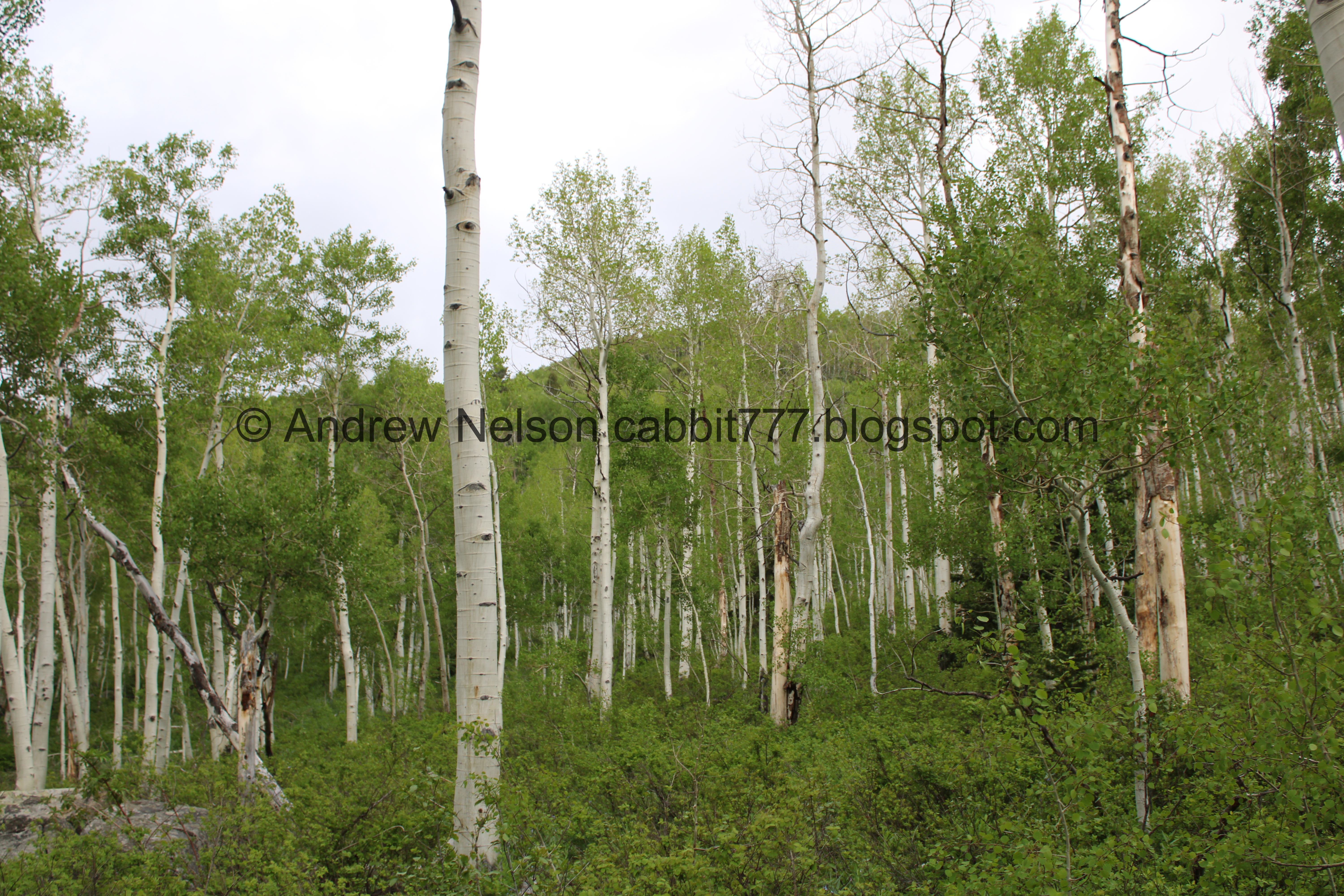
Pretty aspen forest.

The creek is making a lot of noise right now.

More bluebells.

At about a 10th of a mile in you will come to the old trail, and the new reroute. Obviously you want to go left.

More pretty forest.

Forget me nots.

At about .15 of a mile you will come to a split. Right to the east fork is slightly longer, but easier at about a mile. Left to the west fork is shorter but tougher at about 9/10ths of a mile (to the crossroads).

I did decided to pop left to take a look at the creek real quick.

But then we went back to the east fork.

Super pretty forest.

More forget me nots.


Holy crap is is so lush and green!

This first switchback is a beast! Why does it seem like I have been planning the tougher hikes on bad air days? I’m not doing it on purpose, but its been a little rough.

The last part of it triggers my fear of heights and I kind of struggle to get up to the switchback. It might have been the air quality, but I struggled a bit more though it today than normal. I’ll give it another try on a good air day, but I might have to switch to the west fork. Either way, I do find that I always have to plop down at the switchback and catch my breath and calm down. It is a wider spot.

The first switchback. This was about .38 of a mile up. It really seems longer than that.

The second switchback is still a bit of a climb, but not as rough.

I think this is something in the mint family.

More forest.

Down canyon. Look at that dust, ugh.

More aspens.

The second switchback is at about .57 miles.

Continuing up to the third switchback. It is still a bit of a climb, but not as bad as the first one.

View across Big Cottonwood Canyon towards Silver Fork.

The reroute crossing the old route.


More aspens.

Larkspur.

Aspens.

The third switchback. After this, the trail levels quite a bit and it is much less of a climb. This is about 7/10ths of a mile.
I think this is why we prefer to come up the east route, even though it triggers my fear of heights. You get most of the climb out of the way in the first 3/4 of a mile, then the last quarter of a mile to the crossroads, and the 3 quarter of a mile around the lake are a cake walk. So it just seems better. Where as the west route is a non stop climb.

More aspens and the gradual fourth switchback.


More aspens.

The fifth and final switch back.

Oof. a large pair of aspens have fallen over the trail.

More aspens.

Patch of snow.

More aspens.

First glimpse of the big meadow. This means you are getting close!


More aspens.

Into the big meadow.

Aspens below one of the conical peaks up here.

Cute little pot gut.

The big meadow and a few more conical peaks.

Looking down Big Cottonwood Canyon.

There is a little vernal pond here. It dries up when the wet season is done. The first time we came here I thought this was the lake and was very disappointed. Luckily I kept going to the actual lake.

Again.

From the side.

Little break in the clouds.

About a mile later we have reached the crossroads. Left will head down the west route, Forward is my preferred route to the west side of the pond, that has a little beach. Right leads to the east side of the pond that has a lot of foliage and not the best views. So, forward it is.

The little pond from above. Now with a duck.
.jpg)
Panoramic.

Another pot gut.

New fallen trees.

First view of the lake.

Another view of one of the cone shaped peaks.

The lakes outflow.

There is currently a makeshift bridge.

So lush and green.

Nice view of the lake again.

Again. I think that mound in the middle might be a beaver lodge.
.jpg)
Panoramic.

Little yellow flowers.

The lake again.
.jpg)
Another panoramic.
The lake again.
.jpg)
Another panoramic.

Inlet.

Hawk!

I am leaning towards a cooper’s hawk. However they are very hard to distinguish against sharp-shinned hawks. I still am leaning towards a cooper’s but accept I might be wrong.

Puffing up or rousing it’s feathers. They do this for a number of reasons including regulating temperature, and grooming. I have observed this in many birds, from our smallest friends, the humming bird, to our larger friends, hawks.

Such magnificent birds!

Still rousing.

Well, it just seemed to be chilling and grooming so I went to change out back to my regular lens, and of course while I was doing so it decided to fly across and like 10 feet in front of me. Jerk couldn’t have waited 20 seconds to do so. LOL

The trail around the lake doesn’t really follow it’s shores. It goes around the lake and the marshy area behind it through the forest.

Flooded marshland.

Again.

Willows and aspens.

Back in the aspens.

There are a bunch of springs here that lead to the wetland and lake. It wasn’t too bad too cross, it looks worse than it was.

The deepest part.

Coming out of the hill.
I don’t know for sure but I suspect that Dry Lake above might contribute to these.

There are some very large aspens back here.

Looking up.

More aspens.

There are a bunch of fallen trees. Some you have to climb over, so have new paths around them.

I read a recent review about it being muddy up here but uh, this was a bit muddier than I anticipated.

Another fallen tree you have to step over.

Super pretty up here.

Looks like some corn lilies coming up.

I don’t think we have ever seen this creek really going. Wow. This crossing was a little less sketchy.

Downstream.

More forest.

Someone has cut this fallen tree apart to allow easier access.

The stream again. This is neat.

Super pretty up here.

Another super muddy part.

Side canyon.

Another patch of snow.

More cone shaped peaks.

More snow.

East side of the lake.

Islands in the lake. Like I said, I am fairly certain the one on the right is a beaver lodge.

Looks like a raven with that wedge shaped tail.

The lake again.

Across Big Cottonwood Canyon into Silver Fork.
.jpg)
Panoramic.

Moody clouds. I was a little worried about getting rained on. We got a few sprinkles a couple times, but it never really opened up.

The little vernal pond again.
.jpg)
Panoramic from the crossroads. Left will head back down the east route we came up, and right heads down the west route which we will go down.

The little pond again.

Heading across the big clearing.

Back into the woods.

Looking up.

The upper bridge.

What I have dubbed the little meadow.


More forest.

First switchback down at a trail reroute.

Second switchback down is near the creek.

The creek.

Young aspens.

The bottom of the reroute.

More forest.

View across the canyon again.

The 3rd switchback is pretty subtle.

Pretty yellow flowers.

Across the canyon again.

More aspens.

The 4th switchback goes near the creek again. After this you want to keep your eyes open for the turn off to the left. It is a little less then a 10th of a mile from here.

More aspens.

The turn off. If you miss it, its not the end of the world, but it will add some mileage and you will have to walk through a neighborhood and back up Big Cottonwood Rd. Looks like it would be about .12 miles to the neighborhood, .26 through the neighborhood and then .23 for a total of .62 miles. Vs. .21 on the trail.


More aspens.

Pretty purple larkspur.

Bluebells.

The lower bridge.

The creek.

Again.

Right after the lower bridge is the trail split. Left will go back up to the lake, so you wanna go right.

Forget me nots.

Big dead double tree.

More aspens.

Trail counter. Jeeze these really are turning up on every trail we do.


More forest.

Pretty yellow flowers. They look like wallflowers. Looks like that is certainly a possibility as they do grow here. Neat.

Bluebells. I think the pink ones are just not fully mature.

Back down to the trailhead.

Moody skies. I am surprised and glad we didn’t get rained on.

Up canyon.

Down canyon.

Hummingbird resting between zoomie sessions.

Across the way to Silver Fork again.

Heading back down the canyon (PSP).

Storm Mountain (PSP).

Fun light rays below the storm.
I really love this trail system. Its like, the perfect length with just the right amount of effort vs reward. The aspen forest is just so pretty in any season. We almost always see some kind of wildlife, and often see moose up here as well. 10 out of 10 squirrels.
As for difficulty, oof there is certainly a long climb. I am pretty sure I have rated it as a DR3 before, but today I am bumping it up to a DR4. It might have been due to the dust in the air though.
Dogs are not allowed in Big Cottonwood Canyon due to watershed restrictions. Please be sure to leave Fido at home.

No comments:
Post a Comment