.jpg)
At the mouth of Little Cottonwood Canyon there a a bunch of climbing crags. I imagine there has been a trail to these crags since they started being climbed in the 1960’s. However I believe the full official loop is a more recent thing. I will say, if you have a fear of heights and struggle on thin trails on steeper slopes, this might not be the trail for you. I struggled quite a bit, but I managed to get myself through it.
Our previous hike today was kind of blah so we came up the the canyon to see if we could spot mountain goats. No such luck, but we saw some people coming down the trail and I remembered it was shorter so we decided to add it on today.

Quick Details:
Length: 1.2 mile loop with optional spurs.
Trail Type: Loop.
Difficulty: DR3. This was a climb!
Elevation Gain: About 320 ft.
Restroom: Yes.
Dogs? No. Little Cottonwood Canyon is watershed.
Other Info: Probably not a good option in summer as there is not a lot of shelter on the west end of it. Also, as I mentioned, if you have a fear of heights this might not be the best option. But read on for tips on how to do most of it without a problem.
To Get Here:
Head to the mouth of Little Cottonwood Canyon, park in the Park and Ride lot on the north side of the canyon. You can pick up the trail at either the east or west end of the parking lot. Either will get you there, we used the west trail today.
You can also park at the Grit Mill parking lot just a little further up canyon. This will add about a half mile out and back.
The Trail:

The trail at the west side of the parking lot.

Trailhead sign.
There is a blurb about the Grit Mill connector trail, that was named for an old poultry grit meal that was torn down in 2014. The parking lot ws put in just a few short years ago. Anyway, the old grit mill ground down the granite and it was sold to farm to feed to poultry to aid with digestion. o.O I wonder if that is still a common practice cause it doesn't sound pleasant. There are a couple spots on the east end of the trail where you see a bunch of ground up granite. It makes me wonder how much of it is natural, and how much maybe blew down from the old mill.

Heading up.

Little stairway. Note, do not turn left here, it leads to private property luckily it was not a long detour. The official split is signed.

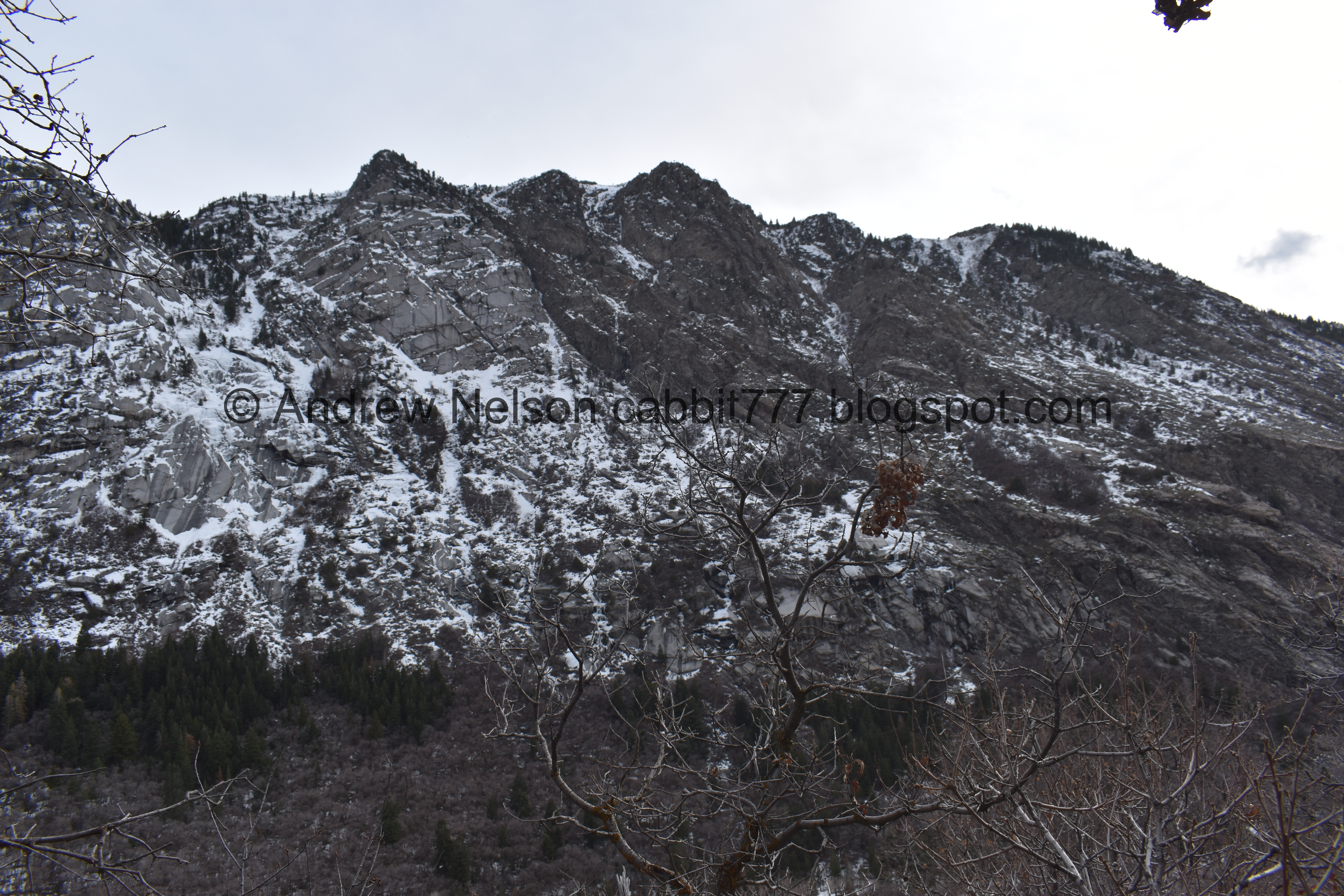
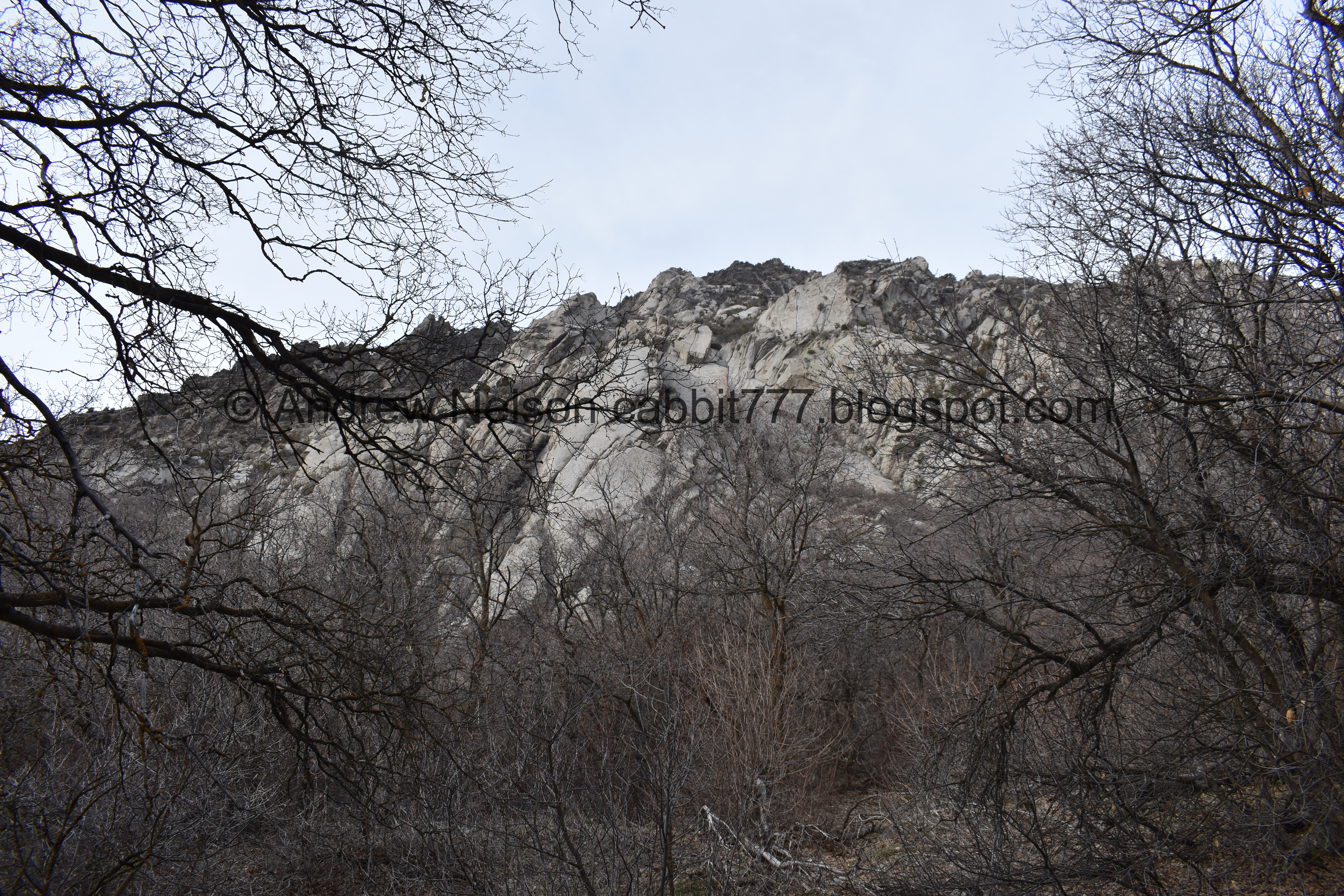
Some excellent views of the canyon.

This is the official. split.
So, I thought it would be wise to head left, and get what I thought might be the worst of it out of the way. I had a feeling it might get up there and freak me out so I figured if it did, I can turn around without investing too much time. I was correct in that, however, if we had gone the other way, I think the climb would have been a lot more gentle, and I do better on the “scary” spots if I am going downhill. So anyway that is your choice. Easier climb up to the right, or steeper climb to the left.

Starting to see some green.

Nice view of the mouth of the canyon and that almost perfect U shape.

One of many scree fields.

Better view of the canyon mouth.

View across the canyon.

The cliffs above us.

Little staircase on the first switch back.

Scree field.

View up canyon.
I am sure the views across the canyon are excellent, however I was just trying to convince myself we weren’t so high up so I didn’t get to enjoy them. It honestly wasn’t even that bad, I think I was more psyching myself out for what might be ahead.

Scree field.

Another one.

View across the canyon.

Smaller scree field.

This larger scree field was probably the worst part for me, and honestly I did almost turn around. I decided to stop and catch my breath before trying it, which I find helps. The fear of heights is worse when you are huffing and puffing, so stopping to catch my breath helps give me a little boost of courage.

Another little staircase.

Then across the scree.

Eventually it flattens out and its like walking across paver stones.

Another small scree field.

View across the canyon again. I guess I did stop to take it in once in a while.

Another little set of stairs.

Another switch back.

The mouth of the canyon, while I take another break. I can see our car from here!

More stairs. This is uh, taking us quite a bit higher than I thought it would. Oi.

Thin trail on a steep slope.

Other side of the canyon.

The final switchback on this side. Phew!

Honestly, for the most part the slope is not that steep. There are a couple small sections, but otherwise it mostly looks like this. But, you know, the irrational lizard brain sees what it wants to.

Another scree field.

The first climbing area, or last if you came from the other way. Bong Eater Buttress. Interesting name. This is approximately halfway, and almost the top of the loop. Landis went up a little ways and confirmed it is some granite cliffs, with long steep staircases up to them. Nope I am good, this is our first good climb of the year and it’s kicking my butt.
I went back and forth about continuing along the loop into the unknown, or turning around. I am glad I decided to continue along, it gets much better.
The mouth of the canyon again. This is a pretty cool view of it.

View across canyon again.

A little bit more intense trail to endure.

Another little scree field staircase.

More scree. More up.

Eventually the trail swings back downhill, and it is just fine afterwards. My nervousness went away and I was doing great again. Phew!


View across the canyon.

Up canyon.

Panoramic.

View down into the canyon.

Approaching the next climbing area.
If you struggle with heights, and approached from the other direction, this would be a good turn around point. Or you can keep going and see how rough it is, and decide for yourself if you want to keep going.

It’s pretty neat to get right up to these granite cliffs.

The cliffs.

Again. If you look really closely you can see a climber way up there.

The sign is a little skewampus, but I guess this climbing area is Mexican Crack and Crack In The Woods.

Fun cliffs.

View across canyon.

Tight fit through here.


Crescent Crack Buttress.

Higher up.

Some signs of quarrying. You can see more and learn more about that at the nearby Temple Quarry Trail.

The sign is missing, but it looks like this side trail leads to the climbing areas called The Egg and Dragon Arch. Dragon Arch sounded interesting to me, and I thought maybe we need to come back. But I looked it up and it does not appear to be a true arch, so while I might try this trail again, I don’t need to go up to that.
Across the canyon again.

It is so, soooo much better coming down this way. I really wish we had come up this way. This is what I get for impulsively jumping on a trail. I had looked into it before, but obviously not enough haha.

Mossy rock.

Across canyon again.

Another granite boulder to go around.

Still kicking myself for choosing to go around the harder way.


Pretty forest.
The cliffs above again.

More forest.

More climbing areas.

More forest.


I didn’t explore any of the climbing areas, but they are plentiful.

Looks like there used to be a pipeline along this trail.

Split rock.

More forest.

Another bouldering area.

With a little stairway.

Another. wow so many.

View up canyon.

More trail.

The U shaped canyon, with some moody clouds.

Terrible picture but, it is apparently it is warm enough for some butterflies to come out.

Back to the split.

Cliffs above.

Down canyon again.

Back to the parking lot.

The mountain we looped below.
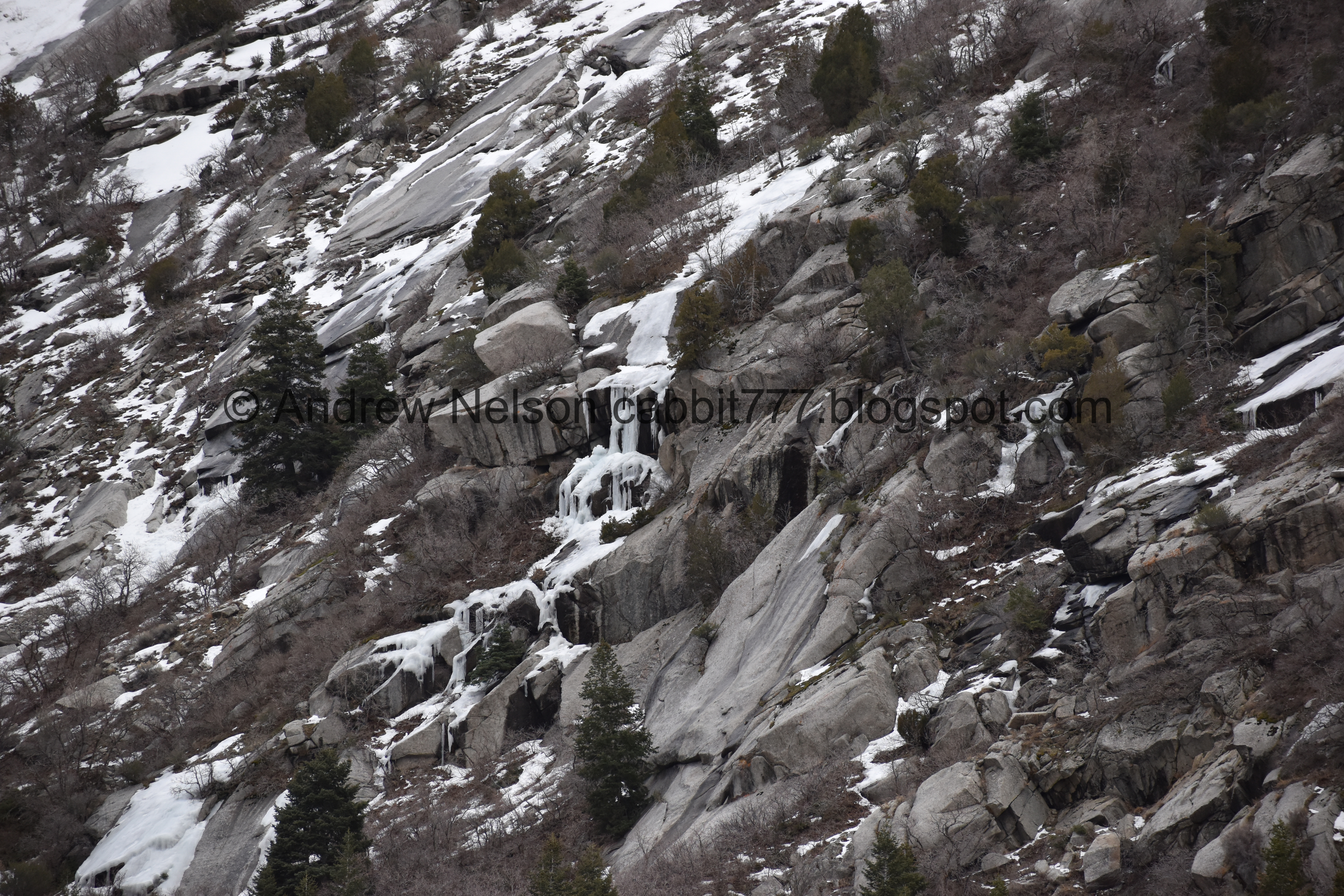
Ice falls on the other side of the canyon.
We still did not have any luck spotting any mountain goats. Its a little harder when there is this much snow and ice. We did see a couple of guys with big lenses looking as well. I’m not sure if they spotted some or were doing what I was and scanning and hoping to find some.
Wow! I am glad we finally got around to checking out this trail. It had some incredible views and I liked the stone staircases. We also only really ran into people at some of the climbing areas, which was nice. Like I said, I struggled with my fear of heights, but I think that would be easier going the other direction. But, I will take 2 squirrels for that. 8 squirrels out of 10.
As for difficulty, Going clockwise was a rough climb, I considered bumping it up, but ultimately I think it still fits my DR3 category, it’s just been a minute since we had a good climb. Counterclockwise appears like it would be a lot easier though.
Dogs are not allowed in Little Cottonwood Canyon due to watershed restrictions. So be sure to leave Fido at home.

No comments:
Post a Comment