.jpg)
The 3 Creeks Confluence along the Jordan River Parkway is a beautifully restored area that daylighted a small section of the man diverted and buried creeks: Red Butte Creek, Emigration Creek, and Parleys Creek. I went back and forth as to whether this deserved it’s own post and well, since it was a restored area, there is a lot of information so I thought it warranted it own post.

Quick Details:
Length: Less than a quarter of a mile
Trail Type: Loop, connector, out and back.
Difficulty: DR2, with some additional exploring would bump it to a DR3. Can be a DR1.
Elevation Gain: NA
Restroom: No
Dogs? Yes, Leashed.
Other Info:
To Get Here:
Take i15 to the 13th south exit. Ge west for about 7/10ths of a mile and turn right on 9th west. Go about 400 feet and find street parking. I did not notice a parking lot of any kind.
If approaching from the Jordan River Parkway, it is pretty obvious and you will just cross over the river between mile 36 and 37. Bend In The River Park is just to the north and might be the closest park with parking.
The Trail:

The bridge from the Jordan River Parkway into the area. It's a neat bridge.

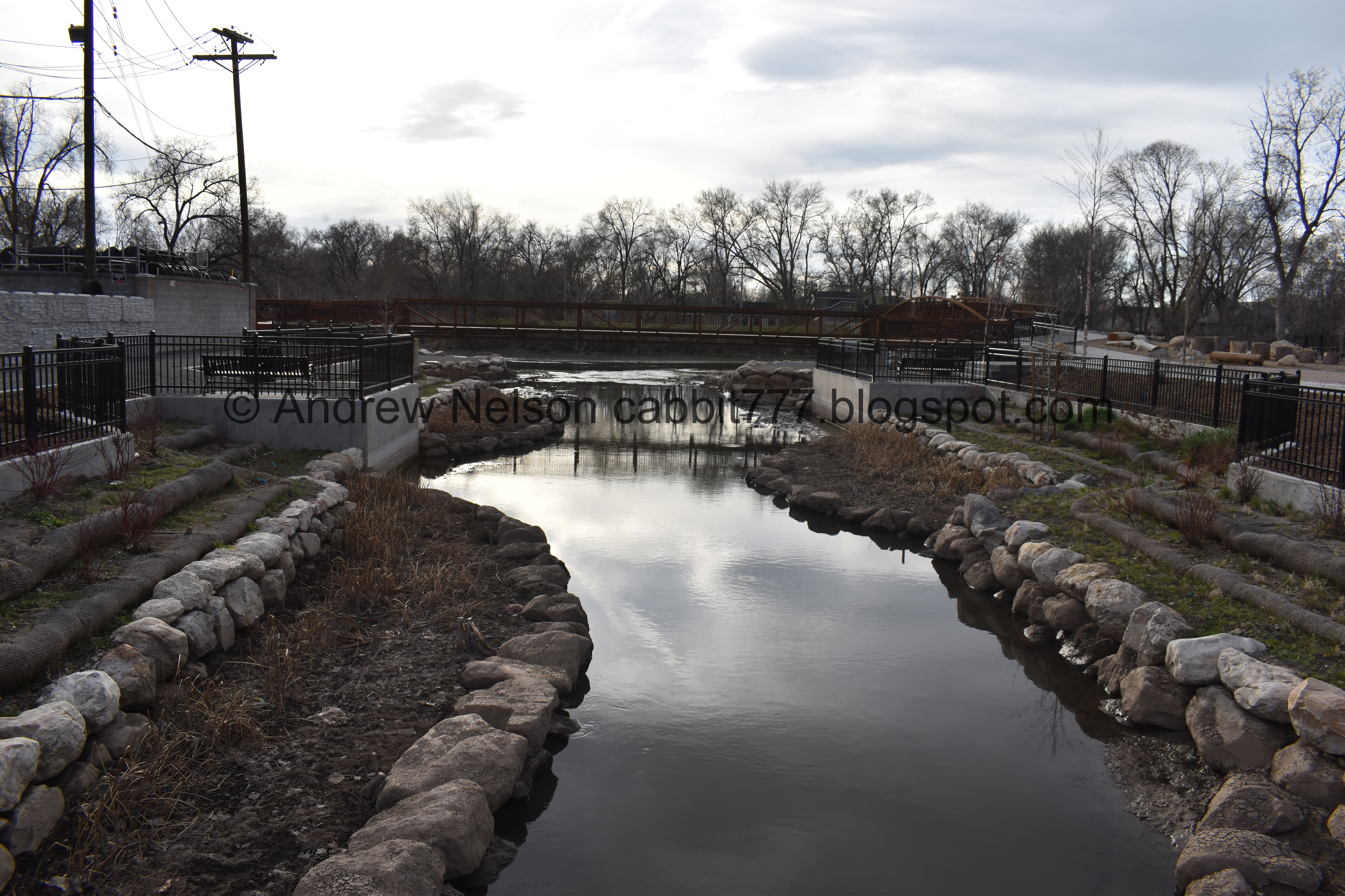
Where the 3 creeks join the Jordan River. This is Red Butte Creek, Emigration Creek, and Parleys Creek. That were diverted and put underground as the city grew.

The bridge over the 3 creeks is neat too.
The 3 creeks joining the river.

It seems odd that it does it on the back side of an elbow. However, I am fairly certain this is not the original confluence for any of the 3 creeks.

They only recovered 100 - 150 feet of the creeks, but I guess that is something. This used to be cement, over a culvert that let out into the river.

They even added a nice picnic area.

The Seven Canyons Trust presented the project to Salt Lake City in 2014. in 2017 they received an achievement award from the Utah American Planning association. I knew this was a pretty recent project, but that is quite recent. The google map views seem to indicate it is even newer than that, closer to 2019. See below.

The confluence again.


This bridge has some neat artistic panels on it.

Neat bridge.

Oh yep. This sign talks about the artists that were selected to have their panels included.
20 artists were selected from 160 by the Utah Arts Council. They represent Utah waterways, and the neighborhood the park resides in, Glendale.

The bridge again.

The artist panels again.

Where the 3 Creeks first see the sky again.

Art piece?

This used to be a culvert sandwiched between an auto shop and a condemned residential property.
Now the streams and wetland space have been uncovered to make a new public space.

Google Maps still shows what it used to look like.


The next step over you see the new view from Nov 2021.

Oh they call it Daylighting.
This sign talks about how in the early 20th century urbanization of the city resulted in burying streams under concrete and diverting them.
There are 3 daylighting processes. One where the creek is restored to it’s natural state, or as close to it as can be achieved. Other forms of it are Architectural Daylighting, which puts the creek into an engineered surface, and cultural daylighting which puts markers, and art to celebrate the original path.
I think I much prefer the first option.
Pollution and declining water quality dubbed the streams a “nuisance” Creeks were channelized as the entered the valley to prevent flooding. A 1921 article mourns the loss of our streams:
“To hide completely the flowing water within a conduit and to make of the street a stretch of ordinary pavement would be to throw away opportunity for which many cities would gladly pay a million dollars.”
Another fun interesting tidbit on this sign: According to the Seven Canyons Trust, approximately 21 miles of the seven main tributaries to the Jordan River are buried in the Salt Lake Valley.
Red Butte and Emigration Creeks merge at Liberty Park from there they flow down 2 miles along 13th south, where they merge with Parleys Creek at State Street, all underground.
It’s been a while since I have been to Liberty Park. Maybe I will make an effort to visit again next winter.
The daylighted creeks. I really hope to see more of this.

Approximately 80% of Utah's Wildlife depend on riparian areas, such as this. It is estimated that only 1.2% of Salt Lake Cities land is riparian area.
The Tracy Aviary has identified 50 species of birds in the 3 Creek Confluence. Including Western tanagers, hooded mergansers, and kestrels (one of my favorites).
It is also a popular pit stop for kayakers, and a popular fishing hole.

The 3 creeks again.


Artists panels on the south end.

The bridge again.

3 Creeks entering the Jordan River.

The daylighted part. It is a little odd to see the creeks emerging from underneath 13th South.

The bridge back to the Jordan River Parkway.

Artist panels at the north side.

Crossing back over to the Jordan River Parkway.

Downstream.
This was actually pretty neat. I am happy to see, even if just a smidge, some of our creeks being daylighted. I really hope to see more of that. Our ancestors really did a disservice to us by burying our creeks, but it is great to see some effort to right that wrong. This was a lot more informative than I thought it would be, and not terribly busy. 10 out of 10 squirrels.
As for difficulty, this can technically be a DR1, Drive up and see, but should be explored, DR2. DR3 if you plan to go down to the river.
Dogs are allowed, but must be leashed.

No comments:
Post a Comment