.jpg)
This, was not my favorite part of The Jordan River Parkway. There were a couple neat things to see but the first half was an industrial area and the very noisy 201 freeway. The second half was basically a big homeless camp. The previous sections had some homeless camps, but they were generally away from the trail, these are right on the trail. Generally I have a if they leave me alone, I will leave them alone attitude towards the homeless, but uh, this was a bit much, and one of them made me particularly nervous.
Quick Details:
Length: The map said this section is 1.2 miles long. My pedometer app put it at 1.5, so 3 out and back.
Trail Type: Connector, out and back.
Difficulty: DR2. Paved, and pretty flat.
Elevation Gain: About 22 feet.
Restroom: It looks like there is one at both parks, but they might be closed for winter. Also, be advised the Redwood Trailhead Park is currently closed to anything but foot traffic.
Dogs? Yes, but they must remain leashed.
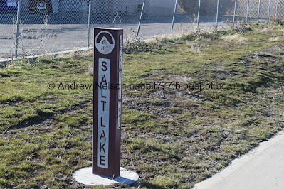
Other Info: Cities: West Valley, Unincorporated, and Salt Lake City. JRP Mile Markers: 35. Lastly this is one of the few trails that are close to a Trax Station.
To Get Here:
Take the 201 to exit 150, Redwood Road. Go about 2/10th of a mile and turn left onto 2320 S. Follow that about 9/10 of a mile to the end. Redwood Trailhead Park is on the right.
Note if coming from the west, when getting off of the freeway, go forward through the light and follow 2200 South until it curves around and crosses 2320 S. Turn left there.
The Trail:

Park Sign. Wait a minute, I thought this was Redwood TH Park? That is what the map, and google says. Guess they renamed it?

Which is closed until further notice. I like that they specifically said walkers are still allowed. We tried to find out why the park is closed and didn’t have any luck.
Anyway, this forced us to park on the street. We were sure to look for any signs banning parking and did not find any. So I think we were good.

Well this sign still says Redwood Trailhead Park.

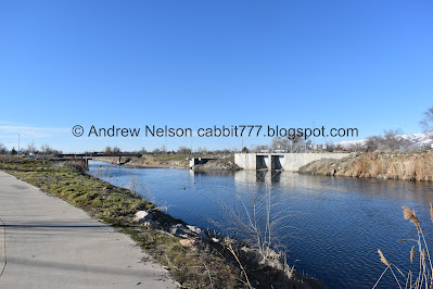
River, bridge, and mountains. Going across the bridge will take you to the Mill Creek Loop, which we did last time. Left and Right is the JRP, we’ll head left today to continue along the trail.
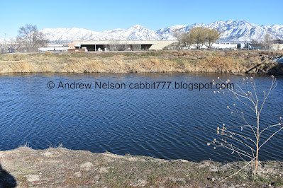
This is probably the widest part of the river, well, this or the section up by the Jordan Narrows. After dinking around on google maps using the measure distance feature, I’m going to call it a tie at about 135 feet across both places. Give or take a few feet due to fluctuations.

Mountains, trains, and ducks. There is a Trax lot back there.

And they’re off!

Geese.

Trax bridge.
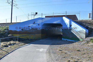
The tunnel under it has a beautiful mural painted on it.

Approaching the 201 freeway. It is quite noisy.

Leaving West Valley and entering an unincorporated stretch. Like how the Jordan River is owned by the state, and is often the border between cities. So no cities own any of the river. Freeways/major arteries, I believe have the same rules/oddities. So, this is state property.
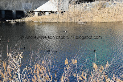
American coots.

Heading under the 201.

Super wide river… for now.

Not 100% sure on my identification, but I believe we watched a cormorant catch a fish.

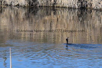
I would have tried to switch to the telephoto, but by the time I would have been able to do that it would be over. So, some digital cropping will have to do.

Though I am regretting not doing so to get a better shot of the bird, but I am fairly sure I have it right.
Entering Salt Lake City.

Shortly afterwards we hit mile marker 35.

Heading under 21st South.
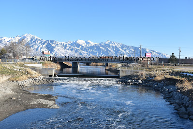
Here is where most of the water splits off from the river and heads on down the SLC Surplus Canal (left) the much reduced river continues to the right.

The Jordan river is 51 miles long and there is just over 45 miles of trail along it.
The sign also, again, claims the river cannot be completely restored (I disagree, but it would negatively affect a lot of people if it were) but some restoration work can be done.
The surplus canal was built in the 1890’s and diverts 80 - 90% of the river out west to control flooding.
There are more than 150 species of birds you can see, more than 50 which live here year round.

Oof. I don’t recall seeing a river hazard sign, but I hope there is one, this is like a double low head dam that looks super dangerous.

Luckily I studied the map before we came today, because there is no signage. You want to go right here, and then right again after you cross the bridge. All the other trails lead into the Glendale Golf Course.

I didn’t notice this on the way in, but caught it on the way back. I guess Salt Lake City would rather paint the path than put in a simple sign. o.O

Crossing the surplus canal.

Southeast towards the mountains, and the dam.

Northwest.
The dam again.

After the bridge, you want to go right again, even if it seems counterintuitive. Again, no sign, and I only noticed this faint paint on the pavement on the way back out.

Again. It really is astounding to see the calm river turn so violent so quickly.

The Glendale Golf Course.
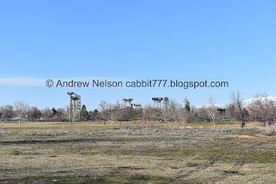
What’s left of the old Seven Peaks later renamed Raging Waters Water Park. From what I understand it changed hands a couple times, and then eventually just failed. Last I heard all remaining structures will be torn out and the land will eventually become a community park.

Bend in the river.

Another bridge.

River and mountains. This is the north end of another oxbow.

The old Seven Peaks/Raging Waters.

The river again. It has been reduced to about 50 feet across give or take.

Oh. There is a railroad crossing here. It doesn’t appear to be active, but still look both ways before crossing.

West.

East.

The river again.

Mountains to the east.

Riverbend.

Looks like there is a boat ramp here.

Mountains again.

Similar information as the previous sign, but with more emphasis on floating along the river, and the surplus canal.

You have to cross 1700 South on the street, but there is a designated crossing light.
Here we reached our intended destination, and the next waypoint on the map at about 1.48 miles. Due to the previous section being kind of blah, and the upcoming section being a little longer, and having some additional things I want to explore, I decided to push on to the next neat feature, the Jordan River Peace labyrinth. However I decided to make that it’s own little mini post.
The Jordan river Peace Labyrinth.
Anyway, after having fun with that, we decided to head on back.

The designated crossing across 17th south.

Heading back down the parkway.

The river again.

Old train tracks over an old bridge. With the defunct Seven Peaks/Raging Waters.

The river again.

I went back and forth for a minute on whether these might be beaver lodges, or just debris. Leaning towards debris.

Bridge.

Goose.

River and mountains.

Panoramic of the mountains.

Seven Peaks/Raging Waters again.

Glendale Golf Course.

Back to the dam into the SLC Surplus Canal.

Seven Peaks/Raging Waters again. I am glad I got to get some pictures of what is left before it is completely torn down.

Crossing back over the surplus canal.

The dam again.

With mountains.

Mountain panoramic again.

Looking northwest.

The dam again.

I was getting a little nervous about these ducks. Then I realized, a) they float. b) they can fly. But still, I wonder how they would feel about going over that. o.O

Oh, there is a temporary connection to Parleys Trail from here. We have only done the upper stretch of that around Tanner Park, and a bit around Sugar House Park, but that might be my next inner city trail network to tackle, after I complete the Jordan River Parkway.

Heading under 21st south.

Mile Marker 35 again.

Back into the unincorporated section.

Under the 201.

Between eastbound and westbound.

River and mountains.

Re-entering West Valley.

American coots.

Reflection of the street sign turned the water green.
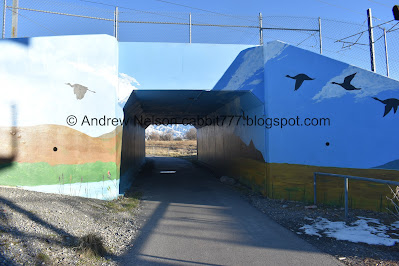
Back to the prettily painted Trax tunnel.

Bunny.

I was hoping to capture the mural on both sides but meh.

River and mountains.

Mountain panoramic again.

The river and Mount Olympus.

Geese.

Bridge.

Back to the Redwood Trailhead Park.

I love the little side sign that shows the river through the cities. We’re almost done traversing this trail.

Old trees in the park.

I caught a Trax train going by.
Like I said, this was not my favorite section. There was a few neat historical things to see, including the surplus canal, and the old Seven Peaks/Raging Waters site, plus some nice mountain views, and it was not terribly busy. But ultimately, it was kind of just meh otherwise. I was leaning towards a 4, but I will bump it up to 5 squirrels due to the interesting historical things and mountain views today.
As for difficulty, it is paved, and fairly flat. DR2.
Dogs are allowed, but must remain leashed at all times.

No comments:
Post a Comment