.jpg)
Donut Falls, AKA Doughnut Falls is a small, but unique waterfall located in Sandy. The trail features an amazing mixed forest, creeks, meadows, wildflowers, and of course the unique waterfall at the end. I have been itching to get up into the mountains, and well, today was the day! We enjoy this trail and do it fairly often.

Quick Details:
Length: It is about 3.3 miles out and back. We did not make it that far today.
Trail Type: Out and back, loop, balloon and figure 8 options.
Difficulty: For the most part it is a mild climb, but there are some UP spots. DR4.
Elevation Gain: About 630 feet.
Restroom: There are flush toilets at the lower trailhead. and vault toilets at the upper.
Dogs? No. Big Cottonwood Canyon is watershed.
Other Info: This is now a fee area. $10 for a 3 day pass. $20 for a 7 day.
To Get Here:
Drive approximately 9 miles up Big Cottonwood Canyon to Mill D South, which will be on the right side of the road. Find parking and start your hike. the trailhead is on the east end of the parking lot, next to the restrooms.
If you want to try to shorten the hike and park at the upper trailhead continue up Cardiff Fork Road (formerly Mill D South Road), it will eventually turn to a dirt road. Park at the end, but again, pay attention to signage! Honestly I would rather hike an extra 9/10th of a mile than get a ticket for parking outside of approved areas. The rangers ticket often. Trust me on this one.

Mountains (PSP (Passenger Seat Photography)).

The snow caps are so pretty right now (PSP).

More snow caps (PSP).

Into Big Cottonwood Canyon (PSP). Man I have missed it!

So pretty up here (PSP).

Beaver lodge (PSP).

I had planned on trying to park at the upper parking lot, but it is still closed for the season. Alright, we’ll hike from the bottom.
The Trail:

First trail sign.

Trailhead kiosk.

The trail heading down into the Cardiff Meadows.

Big Cottonwood Creek.

Looking up Big Cottonwood Canyon.

Bridge over Big Cottonwood Creek.

Again. With Reed and Benson Ridge and Kessler Peak.
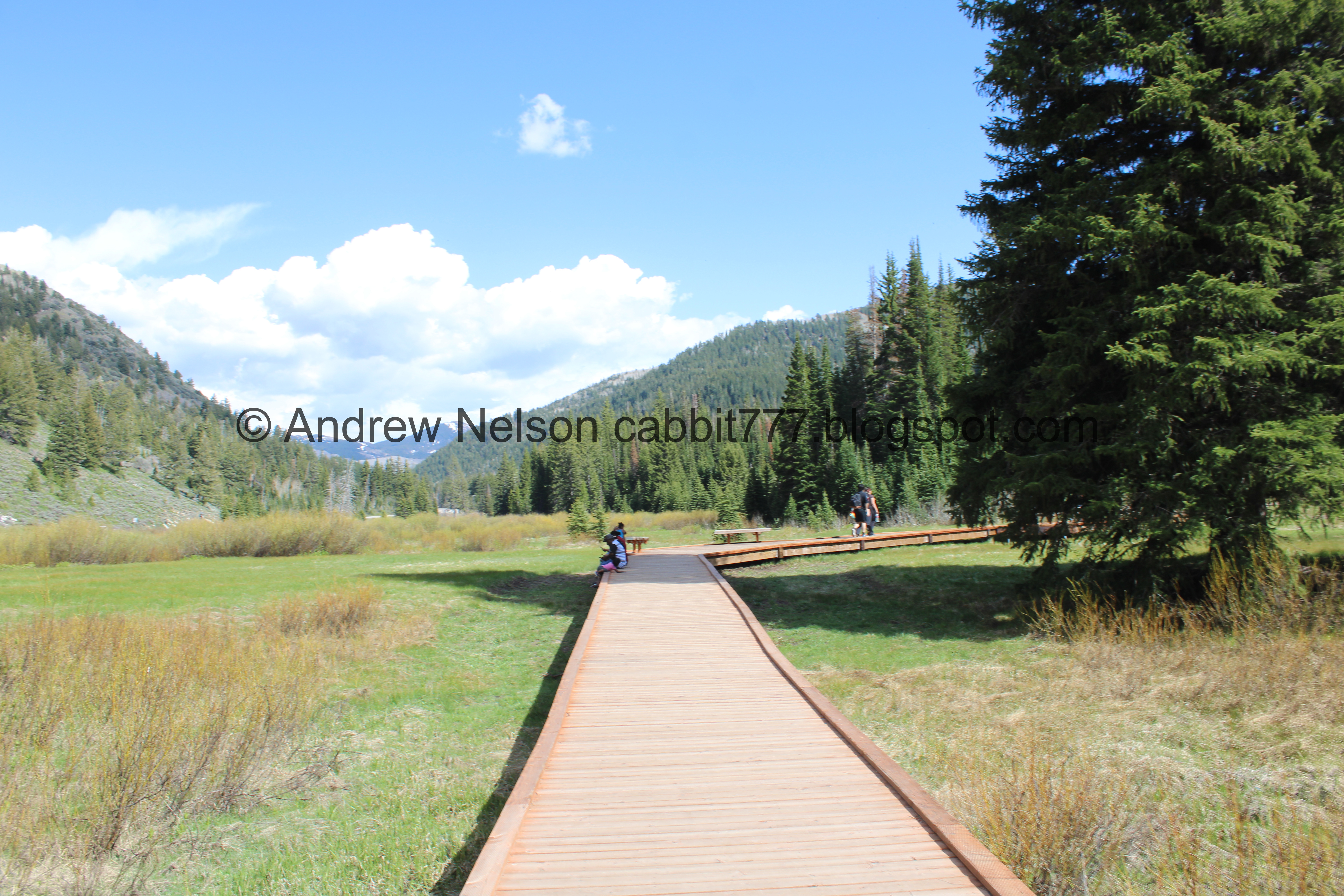
The boardwalk through the meadow.

Into the woods.

Tall twin trees.


Man, I really missed the mountains!


Forest.

The first switchback.

More forest.

Second switchback.

More forest.


I just love it up here.

Random burnt tree. Lightning strike maybe?

Trees and mountains across the canyon.

Across the canyon towards Mill D North.

Reed and Benson Ridge.
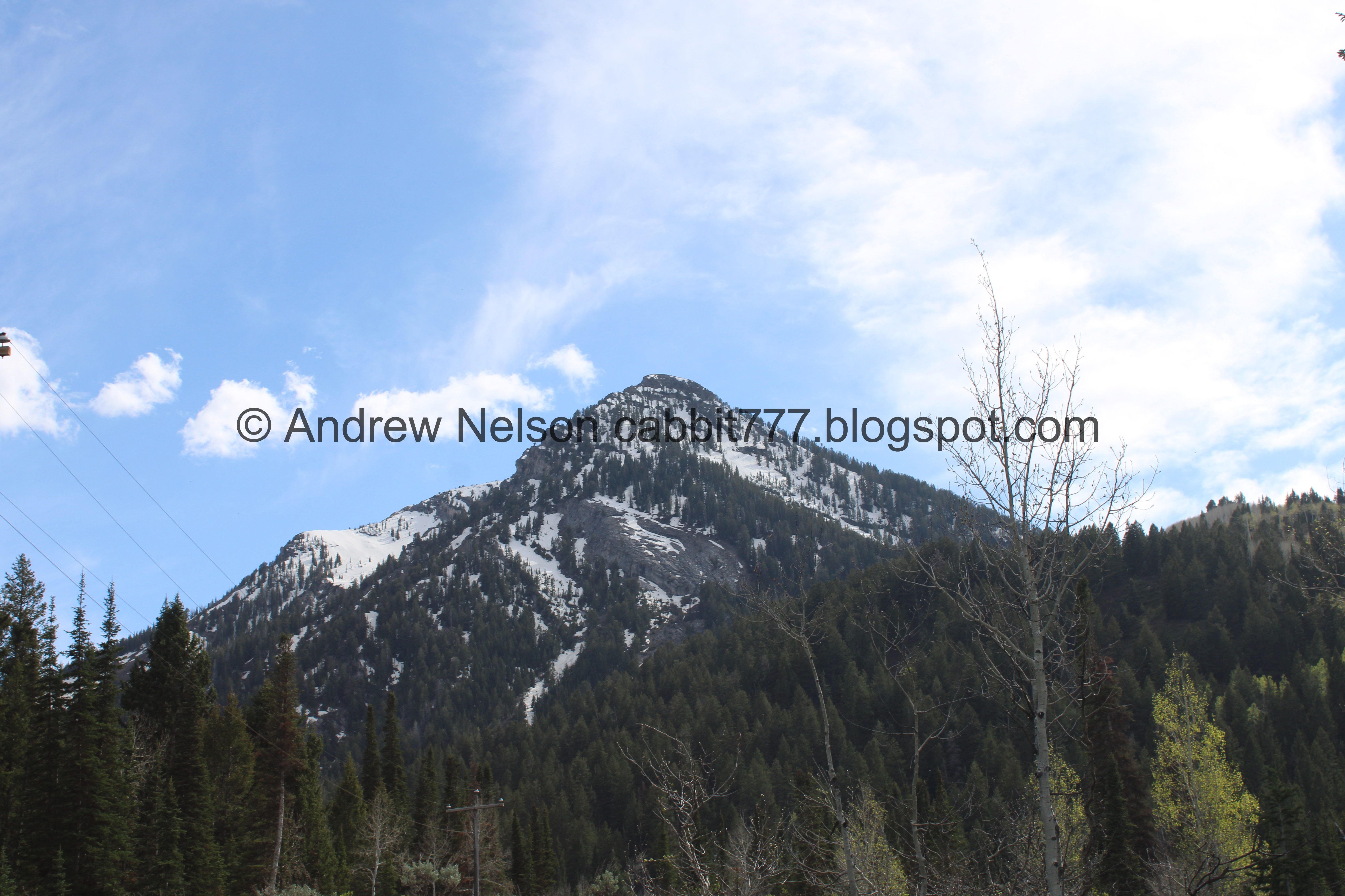
Kessler Peak.

Burned slash pile.

Starting to see some snow.

More forest.

Slash pile. The forest service gathers these piles of dead wood and other debris to burn while conditions are good, and they can be monitored. This helps prevents wildfires from getting out of control.

The 3rd switchback.

Immediately followed by the 4th. Seriously, the switchbacks are not bad at all.

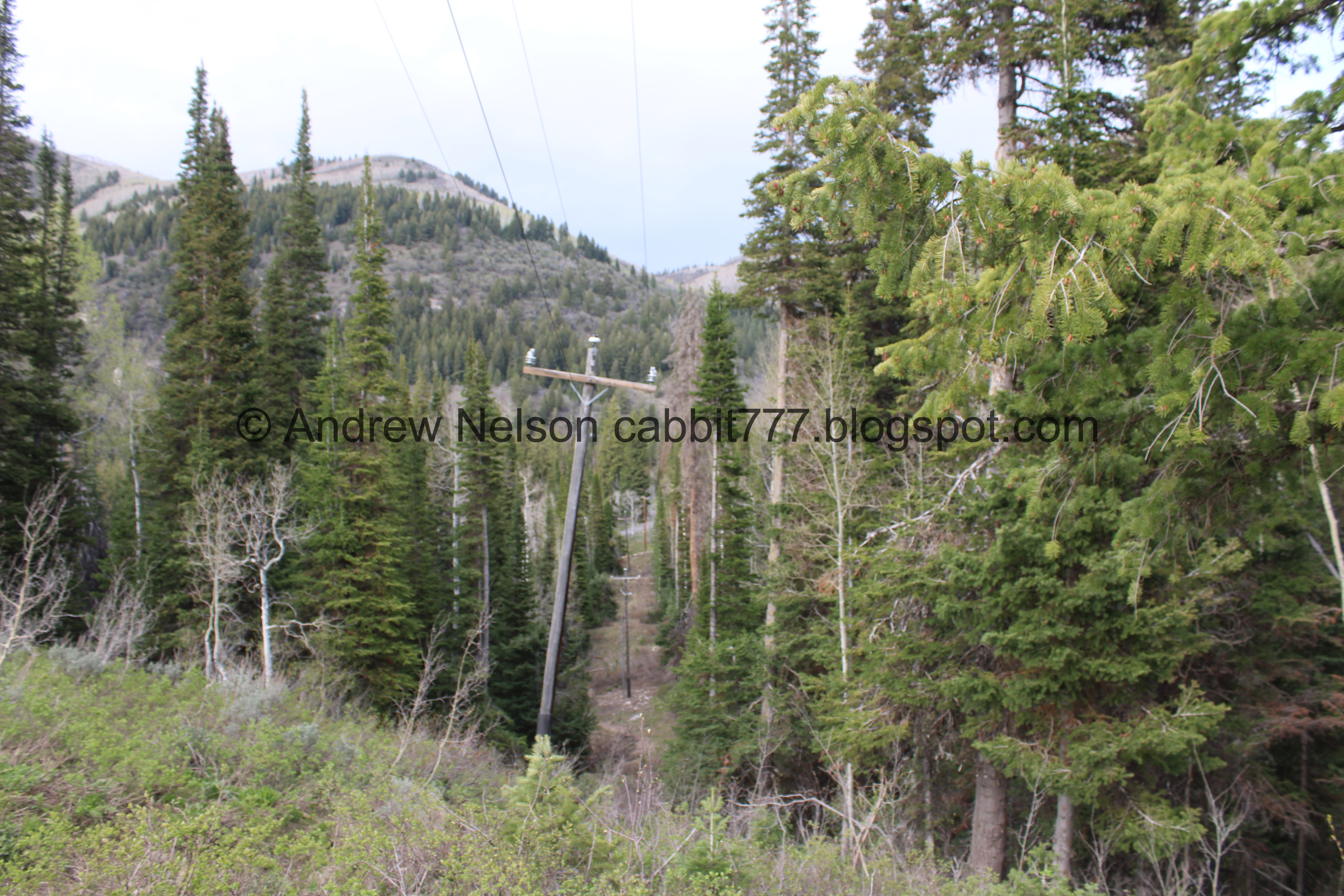
Cardiff Fork Road below.

More forest.


Lots of slash piles.

More forest.

Looking up.

Super pretty up here.

Gigantic slash pile! Holy crap, that is going to be quite the bonfire!


More slash piles.

Forest.

Cardiff Fork Road again. It is a little weird that it is not completely lined with cars!

About 9/10ths of a mile later we made it to the upper trailhead. AKA the Summer Trailhead. Phew!

Empty parking lot. Again, that is super weird to see.

What!?!?! The main trail appears to be be open again! Holy crap, it has been like, 2 whole years since it has been open! Hooray!
Spoiler: The upper bridge is still out. If you have balance issues like I do, I recommend using the alternate route or ‘detour’ along Cardiff Fork Road to the right here.

It looks like they have done some work on smoothing out the trail some. It’s kind of nice.

More smoothed trail.

The point in .8 is quite small.

Another patch of snow.

Continuing up.

Well this is new. Some kind of water tank maybe?

Continuing the climb.

Patch of aspens.

Snowmelt streams.

Big patch of snow.

More snowmelt streams.

Old trail reroute. Head right here. Left is closed for revegetation.

Forest and snow.

Forest.

Plants that have yet to bloom. I wonder what they might be.

Trees.

Forest.

The old forest road below. That is also the alternate route.

With lots of snow.

Forest.

Short snowmelt muddy section.

Reed and Benson Ridge again.

Super short little boardwalk.

Thick forest.

Looking up.

More forest.

And… the upper bridge is still out. Damnit! The bridge was taken out in a particularly rough 2022-23 winter.
Someone has placed some logs across the stream that are honestly probably fine. My balance is not that great on these things. Sometimes I can get myself to cross them, but today was just not one of those days. I hate that we made it this far and didn’t get to the end but honestly we probably would not have made it to the falls anyway. Last time we came up here this early it didn’t happen so not the end of the world. Plus, I mean, this is a really pretty hike and I was just happy to be up in the woods! I do hope the bridge is restored one day though.

Upstream. This is Mill D South BTW.

The crossing is juts fine… but the lizard brain was not having it.

The creek again.

With the peak above.

Closer.

Whelp, I guess we will head on back. I don’t feel too bad. It is pretty. Plus, its been over 2 years since have done this section of the trail so it was nice to see it again.

Pretty forest.

Snowy/muddy patch.

The creek below.

Aspens.

Chipmunk friend.

Forest.

The forest road below, which is also the alternate route.

Gnarly tree stump.

I love how the rocks get worn down and polished by all the hikers on this trail. I wonder what kind of rock this is.

More forest.

More hiker polished rock.

Moss.


Forest.

The short steeper section.

Another chipmunk.

Aspens.

The water tank thingy. Now that I think about it I suspect the detour might have been for this being built rather than the bridge being out.

Back to the upper trailhead.

The trail down is to the right here. You can take the road too , but the trail is prettier.

The mountains on the other side of the canyon.


Forest.

Lots of slash piles.

Trees.

View across the canyon.

Again.

Again.

Clematis.

Closer.

These always feel so fleeting. Like I feel like I am super lucky if I spot them more than once a year.

Chopped tree, ready to be piled into a slash pile.

Forest.

Little clearing. Also, the only spot you can see the cabins up here. They did a good job with the trail.

Left will get us back to the trailhead and to the Jordan Pines Campground. Right will take you down to the Spruces Campground. I haven’t done that yet.

Burned slash pile. Its a little unsightly, but honestly a lot better than a whole burned down forest. Plus, it probably heals a lot faster.

Some flowers getting ready to come out.

Forest.
Clear cut for powerlines.


Little baby flowers.

Mill D North.

Little baby squirrel.

Forest.

Fallen tree.


Oregon grape.

More flowers.

Forest.

Right leads to the Jordan Pines Campground. Forward back to the trailhead.

I suspect the pink ribbons indicate a tree they have identified as needing to come down.

This one does look quite sickly.

Mill D North again.

Reynolds Gulch.

Crossing the road that leads to the Jordan Pines Campground.

Hairy woodpecker.

There’s actually 2 of them. I thought they might have been mating for a second, but uh.. they both appear to be male.

Hairy woodpeckers and downy woodpeckers look almost identical. Hairy woodpeckers are larger. However size is a hard distinguishing feature unless you happen to have one of each side by side. There is another field marker that is a little better. The size of the beak! This guy (a hairy) has a large beak that is almost as long as his head. Downy woodpeckers have much, much smaller beaks.


Both of them again. Man they sure are quick little guys!

I'm not quite sure what exactly they were doing, but it was fun watching them do it.

Oh, it’s faint, but I did get a shot showing the red on both of them.

I just loves them!

Another faint shot showing the red on both of them.

They are just… chasing each other around the tree.

Of course by the time I got my telephoto lens on they flew across the way.

Luckily they didn’t wander too far.

So cute!

Red mark.

Super cute.

Caught him mid hop.

Both of them again. Both showing the red mark.

Hi cutey!

Both of them again.
Alright. As much fun as it was watching these guys do their thing, we really had to get going.

Tall twin trees.

Mill D North.

Reynolds Gulch.

Big Cottonwood Creek below in the Cardiff Meadows. You know… I don’t know where Mill D South joins it… A quick glance at the map, and it appears to be just a bit west of here.

View up Big Cottonwood Canyon.

Mixed forest.

Back down to the boardwalk.

Up canyon.

The boardwalk.

The bridge over Big Cottonwood Creek.

Upstream.

Downstream.

The final push.

The meadow.

Up canyon.

Reynolds Gulch from the parking lot.
We decided to head up to the top of the canyon to see where the snow was at up there.

Reed and Benson Ridge and Kessler Peak with Mill D South between them (PSP).

Heading up (PSP).

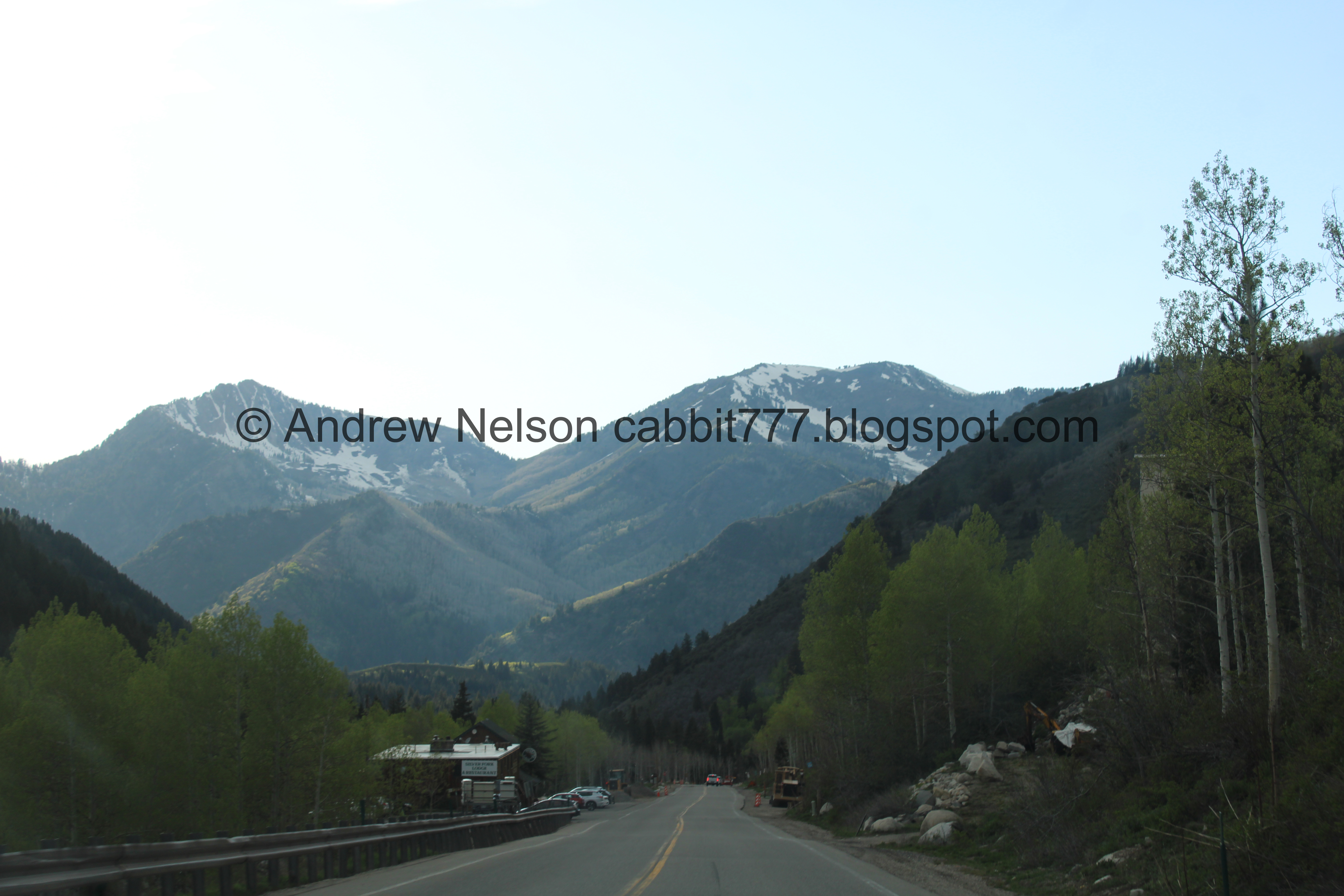
The Silver Fork Lodge and Restaurant (PSP). Last I saw this was up in the air as to what was happening with it due to the owner wanting to retire, and the Town of Brighton had entered an agreement to have first right of purchase I wonder if they got a new owner?
Well, according to this article (outside link), they have rescinded that. So as far as I can tell the mayor still owns it, and it has not been sold yet. I hope whoever buys it saves it. It is a neat historic building.

Continuing up (PSP).

Solitude (PSP). They closed for skiing last Wednesday with a lot of people complaining they didn’t get a Memorial Day ski out of them. But uh hey… what exactly did they plan on skiing on? There is not a lot of snow left here.

The mountains above Brighton (PSP).

I was a little surprised to see Guardsman Pass is open (PSP).

Mount Millicent above Brighton (PSP).

Well, Silver Lake appears to be snow free (PSP).

Brighton Resort seems to have a good amount of snow left (PSP). I am not a skier or snowboarder though so I wouldn’t really knw if this is enough haha. I believe they are closed for the season as well. Looks like they closed on the 18th.

But there is still a good amount of snow up here (PSP).

Scott Hill across the way (PSP).

Snowy hills (PSP). Definitely going to wait a few weeks before we try Lake Mary.

Lots of snow (PSP).

Random snow mobiles strewn about (PSP).

Heading back down the canyon (PSP).

Mixed forest (PSP).

Continuing down (PSP).


I really just missed this canyon (PSP).

Storm Mountain (PSP).

Nearing the mouth of the canyon (PSP).
Well, I am a little sad we did not complete the trail today, but I really enjoyed getting up into the mountains again! It has been too long. I am a little mad they have made it a fee area though. I hate having to pay to hike, and I hate that it means poorer people may not have the same access. But, I also get it. Maybe they can use the fee’s to fix the upper bridge one day. Meh. 7 out of 10 squirrels. Loosing one for the fees and 1 for the crowds, and 1 for the bridge still being out without warning.
As for difficulty, it’s mostly a gentle climb, but there are a few spots that are quite UP. DR4.

Dogs are not allowed in the canyon due to watershed rules. Be sure to leave Fido home for this one.

No comments:
Post a Comment