.jpg)
Liberty Park, established in 1883 is Salt Lake Cities oldest, and second largest park (just behind Sugar House Park). It features your general park amenities such as playgrounds, sports courts, green space, nice old growth trees, and a lovely little pond/lake. In addition to all that, it also has a small amusement park, an aviary, and some historic stuff. There really is so much to see here that I was kind of.. well, squirreling back and fourth haha. Last time we were here we just did the outer loop. This time we decided to explore more.
This time of year I much prefer to get up into our canyons and enjoy the greening up. However, it had been raining pretty hard from last night through this morning and I really did not want to muck it in the mud. I started thinking of some of the usual places I like to do on days like this, when I remembered I did want to come back here anyway, so here we are.

Quick Details:
Length: We did a 3.27 mile loop and spur, but I also “squirreled” a lot today, so it is likely a little bit shorter. The main inner loop is about 1.3 miles, the central trail is about a half mile one way. So we did quite a bit of squirreling haha.
Trail Type: Loop with spur, loop option, figure 8 option.
Difficulty: It is completely paved. DR2.
Elevation Gain: About 75 feet.
Restroom: There are 3 listed on the map, but I don’t know if they were open.
Dogs? Yes, leashed. Please clean up after your furry friends.
Other Info:
To Get Here:
Take i80 to the 7th East exit. head north to 13th South. Turn left, then immediately right. Find a spot and park. Or stay on 7th and turn left on 9th south, then left again into the park.
The park is a one way loop with an entrance/exit on the north and south ends, so plan according to what you want to do.
The Trail:

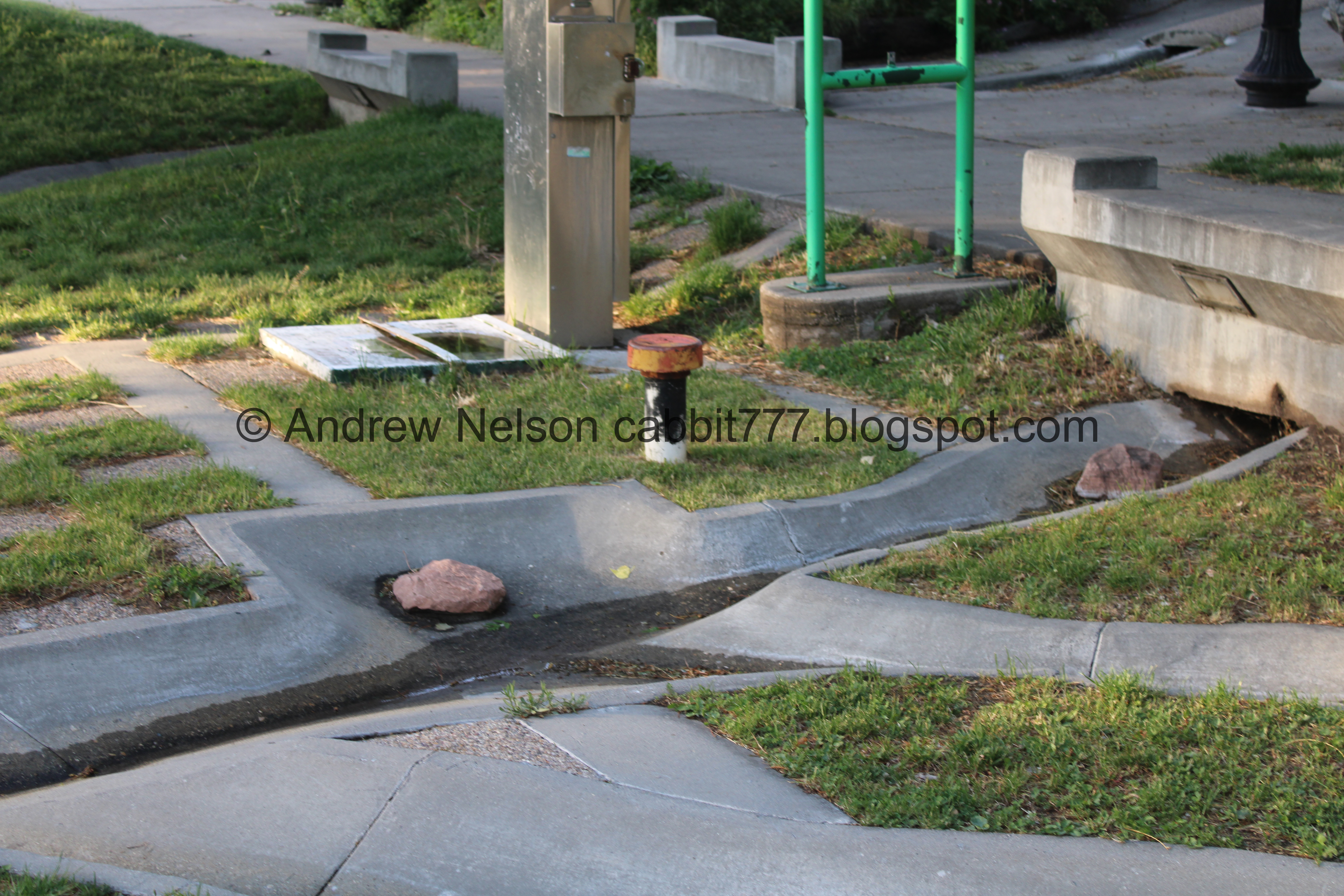
Just because of where we parked, the first thing we visited was the Artesian Well. This is the 3rd Artesian Well we have found. I think they are super neat!
I decided to make that it’s own post. You can see that here.

Liberty Lake. I am super happy to see it full again. Last time we were here it had been drained for maintenance.
.jpg)
Panoramic.

Canada geese.

The lake.

Lots of Canada geese.

Ducklings.

One of the 2 islands. I will call this one South Island since it is more south. As far as I can tell it is not otherwise named.

The northern island is called Liberty Island.

South Island again.
.jpg)
Panoramic showing both islands.

This is where Red Butte Creek and Emigration Creek which have been buried and combined upstream enter and fill the lake. Below the lake they go back underground. Before emerging at the 3 Creeks Confluence.

Lots of ducks and geese here.

Bridge that connects to Liberty Island. We decided to take the short spur out to it.

Lots of Canada geese, and some babies.

Some “teenagers”.

The Canada geese have decided this was their turf, but they allowed us through without incident. Phew, that was a little unnerving. They can definitely be super mean. Particularly when they have babies.

2 families with “teenagers”.

The bridge to Liberty Island.

Again.
We got super lucky today in that there were no people on Liberty Island at the moment.

The lake and the south island.

Back towards the Canada geese nest.

More Canada geese.

Where the creeks enter the lake again.

Onto Liberty Island.

Liberty Island Gazebo is pretty fancy.

Looking up.

The “South Island”.

The lake.
.jpg)
Panoramic.

Lots of Canada geese.

Crossing back over to the mainland.

Lots of “teenagers”.

They allowed us to pass through again without incident.

Babies. As well as where the creeks enter the lake.

The Drum Circle. It was particularly… aromatic today. haha. If you are not aware its where a bunch of hippies sit in a circle banging on drums and do other hippy activity. I don’t know how long it has been happening here but I used to attend once in a while as a teenager, so at least 20 years. I suspect possibly from the 60's/70's.

The little hill. People like to sled down it in winter.

Picnic area. The firepits were built in the early days of the park, their age is not listed on the official park page. They have had to be restored over the years.

The park is surrounded by these old growth trees.

Random pergolas.

The little driveway to YouthCity, which appears to be an after school program.

Lots of trees.

Old growth trees. Also, you can kind of see the volley ball courts on the left. I swear, any sport that has a specific court or field, or whatever, there is one of them here. Well, aside from the main ones you see at most other parks like baseball, football and soccer. I guess we can say more of the niche sport fields are here.

Continuing along.

More park.

Coming around to the north side.

Fun statue.

Lots of trees.

They appear to be adding a bunch of mulch.

The central trail. We explored that from the other side in just a bit.

Again.


Some open space.

Rounding to the west side.

Tennis courts. It looks like there are 16, and 4 of them are covered.

I guess the courts are managed by Liberty Hills Tennis.

Gnarly tree.

There’s even a pool!

Continuing along.

Neat mural of the Trolley Square water tower.

The Tracy Aviary takes up the southwest corner of the park. It’s neat, I would go again.

Again.

Ferris Wheel. We’ll come back to that.

More old growth trees.

One of the few aviary exhibits you can see from the outside, They place signs of any birds you might be able to see.

Rounding to the south end.

I just love the old growth trees.

I thought I might have found another redwood, but upon closer inspection it was not. Although, this seems like a good place for one to be. I just did not find one today.

The southwest corner. After we scoped out the tree we made our way back to the inner loop.

One of the buildings in Tracy Aviary.


Continuing along.

Ducky friend.

We last minute decided to check out the central path. I am super glad we did cause most of the neat stuff is in here.

Liberty Lake. Google maps says this is called liberty pond, and that’s what I have always called it, but the official park sign says lake. So that is what I am going with today.
There is no official distinction between lake and pond other than lakes are generally larger. It largely depends on who named it. However, the consensus I am gathering is if light can penetrate to the bottom then it is a pond.. but even that seems a little fuzzy… so I donno. I got into the same fuzzy area trying to define stream, creek, and river. I just feel like with both of ideas, someone at some point had to be as crazy as I am and decide there needs to be an official distinction. Anyway….

The lake again.

Pelican.

The south island.

Pelican and geese with goslings.
You know, other than ducks and geese, I can’t say that I have ever noticed any other waterfowl babies. I wonder why that is. (le google search) I guess in the case of pelicans it is that they hide their nests pretty well, and they look like adults after fledging, which also happens rather quickly. Huh. Interesting.

I count 13 babies. Wow! The waterfowl are reproducing something good this year.

The south island.
.jpg)
Panoramic.

13 again.

Liberty Island on the northeast side of the lake.


Neat eagle fountain. Also the east gate of Tracy Aviary. Which is not open to the public. I can’t confirm it, but basing on the alternate gates, I imagine it was more open to the public in the past.


The Chase Mill. Built in 1852 it is the oldest commercial building still standing in Utah, and the 5th oldest 19th century building in Utah listed on the oldest buildings list on Wikipedia.

Dedication plaque.

The mill again. It can be seen better in Tracy Aviary.

From further back.

Geese with “teenagers”.

I want to say this is a killdeer, but I am not sure.

Liberty Island again.
.jpg)
Panoramic.

The lake has a little cement ring. The water appears a little high today.

The geese again.

Old building of some sort. Possibly a maintenance shed?

Another Canada goose family. 2 sets of parents and 15 “teenagers”.

We reached the Liberty Park Amusement section where we found a neat little train. There is also a concession stand just to the left.

The Ferris Wheel and a little kiddy ride of some sort. The Ferris Wheel has been fully restored, and from what I can find was built in 1956?

The swings.


The carousel. Wow this looks super old. I have been doing some digging on this, and maybe I need to do some more, but from what I can tell it was placed here in 1980. However it is believed to be originally built in the 1930’s. It also is not the original one. Again, I need to dig some more.

The Ferris Wheel again. I might consider getting on this one, but I probably still wouldn't like it due to my fear of heights.

It looks like they are storing a bunch of junk in here. I hope they clean it up when it is running. It is tiny compared to the ones at Lagoon and Hogle Zoo.

Super old looking.


The Liberty Park Greenhouse. It is neat from the outside, but certainly nothing compared to the Volunteer Park Conservatory we found in Seattle. From what I can tell this is currently not open to the public. At least not right now.
It was built in 1903. And according to the the city page requires health and safety updates before it can open to the public.

The sidewalk out to it.

Cute little rose bushes.

Yep, there is some definite damage to the building. Again, it is certainly no Volunteer Park Conservatory, but it is still neat. So I hope it can be restored and opened to the public one day.

The front.

The Chase Home Museum. We will come back to that in a minute. Did I mention I was squirreling? Cause I was totally squirreling.

The Seven Canyons Fountain This is a really, really neat fountain that represents our 7 main canyons, and thus, 7 main creeks flowing across the valley into the Jordan River. Oddly enough, I just posted an article covering the 7 Creeks. So this was oddly timely.
.jpg)
Panoramic. It is a rather large feature. Sadly, according to the city website they are “reimagining it” as a dry feature. Dang. I would have liked to see it flowing again.

It is a neat feature.
.jpg)
Another panoramic.

“The high mountains and seven canyons
Surrounding Salt Lake
Make it one of the most beautifully situated cities
In all of America
The canyons with their streams of water
Make life possible for the people
Who live in the valley
This fountain symbolizes the seven canyons
It is a gift from all the people of Salt Lake City
And a gift from one who played in Liberty Park
Many years ago
Dedicated 1993”
Weird capitalization issues aside, that is a nice dedication. However, I wish it mentioned the artist.

To me, the upper sidewalk appears to represent the benches, or the Bonneville Shoreline. Nothing says that is the case, but that is what I am picking up.

City Creek.

Red Butte.

Emigration.

Parleys.

I am not really sure, but I think this represents Mountain Dell Reservoir above the Parleys Canyon.

Wow. They even got this right. Red Butte, Emigration, and Parleys all join (underground) before coming out at the 3 Creeks Confluence. I also think that that little square there likely represents Liberty Lake as Red Butte and Parleys come out in it, and Parleys joins them downstream.

Mill Creek.

Above.

Primrose.

Big Cottonwood.

Finally, Little Cottonwood.

I like that there appears to be some representation of the many waterfalls on the south side of the canyon. Nice attention to detail.

Little ski area icon representing the ski areas at the top of Little Cottonwood Canyon.

Lock icon. I suspect this might represent the LD$ vaults in the bottom of the canyon.

Above the fountains, which might be considered the Wasatch Spine.

Mountain goat?

The drum Circle again.

The back side of the fountains. It does not appear to have anything to do with it, but, continuing the theme.. this would be the Park City area.

Another primrose.
Back down to the front.

This would represent the Jordan River.

The top of the fountain. Again, this is my interpretation, but this appears to represent Utah Lake.

A view of the “Jordan River” flowing north.

Again.

Again. As a super nature nerd, this is absolutely the coolest art piece I have ever seen. Like I said, I just posted an article expressing my love of the Seven Creeks so this is totally on my wavelength. I hope I get the chance to see it flowing again, but from the sounds of it, that might be unlikely. :(

A good example of hostile architecture. This was built specifically to prevent people from sleeping here. Specifically homeless people.

Cow. Found of the west side of the “river” which tracks since the west side was/is more farming area.

Where Big and Little Cottonwood Creeks join the Jordan River. I have no idea if this is to scale or not, but this also tracks as the 2 creeks enter the river pretty close together.

“Upstream”.

The 3 Creek Confluence again. I am really amazed by the attention to detail that only a weirdo like me would catch.
What I suspect represents Liberty Lake again.

This appears to represent the Great Salt Lake. This blows the “to scale” question away.

More hostile architecture.

Bird. This looks like a duck to me.

The Chase Home Museum of Utah Folk Art.

Historical marker.
It was built between 1853 and 54 by Isaac Chase. It was traded to Brigham young in 1860. Salt Lake City bought it and the surrounding land in 1881 for use as a park. Park employees lived in the house for 8 decades. In 1964 it was opened as a museum and in 1983 the Utah Arts Council opened a gallery and later the museum.
It is one of the few remaining homes in Salt Lake City from the 1850’s.It is Greek revival style, which was popular at the time. The 2 story porch was added sometime after 1916.

Museum hours. We’ll have to come back on a Saturday sometime.

Pretty fountain.

Another sign.

The front of the old house. Built in 1854 it is the oldest house in Salt Lake City and 10th down on the oldest 19th century buildings in the state Wikipedia article.

Another plaque.

Park sign.

Park map.

More old growth trees.

The central pathway again.

YouthCity. The after school program again. For some reason the windows are mirrored.

The large piles of mulch again.

The Duck Pond.

No ducks, but there are a bunch of koi.

The pond.

Little waterfall.

Some plants.

The pond again.

Oh. There is a duck!
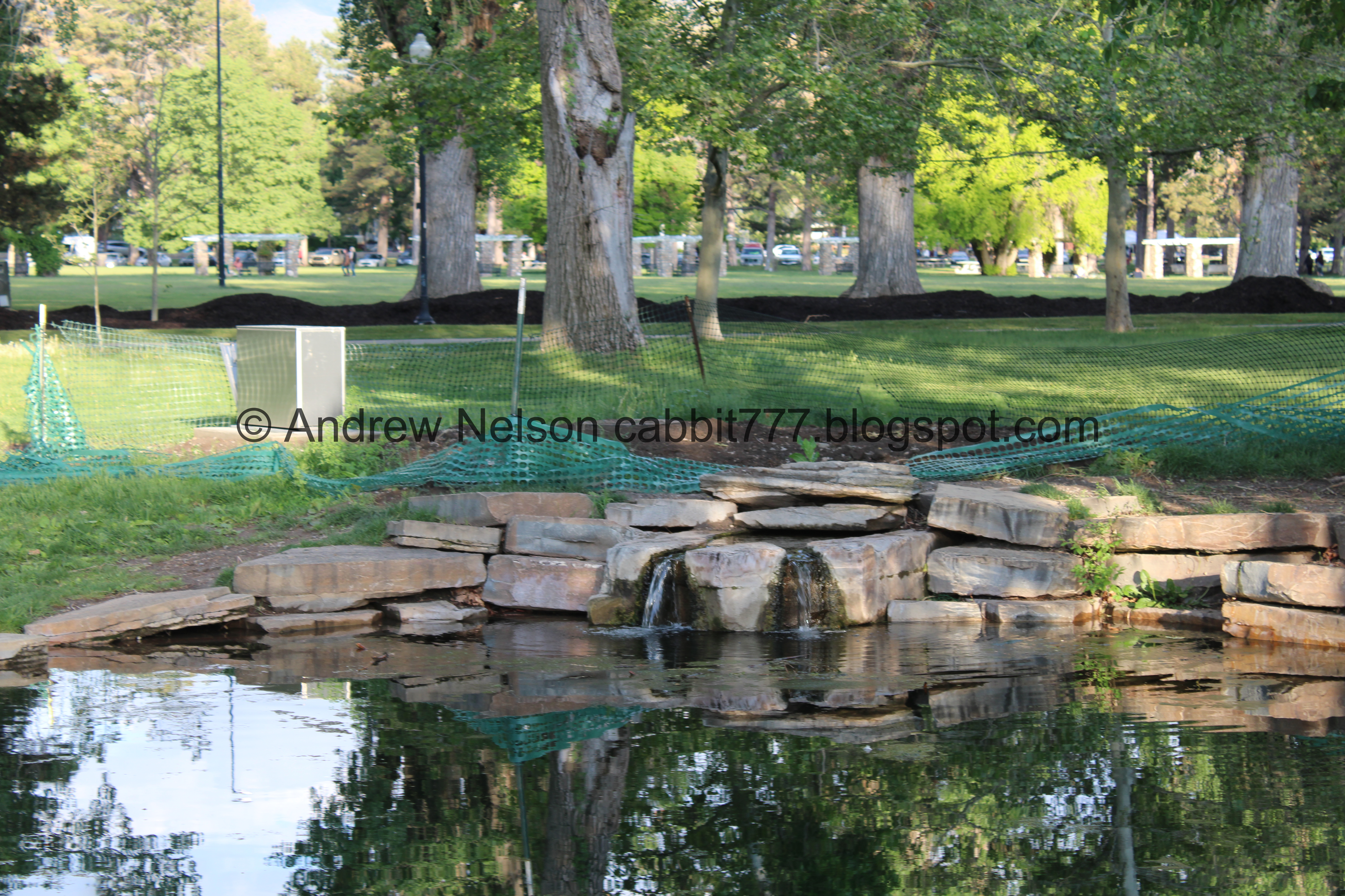
The waterfall again.

Really gnarly looking tree.

Again.

Duck and waterfall.

Fun reflection.

Duck.

More reflection.

The waterfall.

Duck.

Another gnarly tree.

The large piles of mulch again.

The central trail again.

Horseshoe pits, bocce ball courts, and a basketball court.

The central trail again.

Giant mounds of mulch. I am sure they know what they are doing, but right now it seems a little ridiculous.

The trail again.

Since 1883.
Well, we made it back to the loop trail, so we decided to just head back the way we came. Maybe next time we will do a figure 8.

Heading back down the central trail.

I love me a good tree lined path.

Mulch mounds.

The Duck Pond again.


Gnarly tree burls.

Back to the Seven Canyons Fountain.

Again.

S.L.C. Waterworks.

The Drum Circle again.

The concession stand. I kind of wish we had stopped here to eat cause the place we ended up was… not so great.

Back to Liberty Lake.

Again.


Back to the neat eagle fountain.

Rainbow lorikeet in Tracy Aviary. We saw them flitting about but I didn’t manage to catch one with the camera.

The lake and the south island.
.jpg)
Panoramic.

Geese and ducks.

The south island again.

Back to the loop trail.

Canada geese.

Sign asking you not to touch the wildlife.


Geese and “teenagers”.


Oof, they are so cute!

Continuing the loop.


The lake again.

Salt Lake City has chosen to just ask you not to feed the ducks at all, versus educate on what are better options than bread. Like I have seen in such places as Mehraban Wetland Park. I'm a little torn on where I stand here. It's a lot easier to just say don't feed them. But on the other hand, educating people on better options than bread I feel is helpful too. But, I am also familiar with the idea that sometimes you just have to accept that the path of least resistance is best.

The lake again.

Back to the artesian well drinking fountain. I learned there is actually another one within the park, but is currently in disrepair. But, I think I might seek it out next time we come here.

Heading around the one way loop to leave the park (PSP).

I love the pillars on the north end of the park (PSP). I wish I had thought to grab a better shot the 2 times we were nearby and not in the car.
Well, that was fun! This park is something I generally reserve for wintertime, but I am super excited I thought to do it today after some heavy rains. There is surprisingly a lot of neat stuff to see! It is a busy park, but it is a large park so it’s not so bad. Meh, going with 7 squirrels today.
As for difficulty, it is pretty flat and completely paved. DR2.

Dogs are allowed, please clean up after your furry friends.

No comments:
Post a Comment