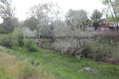
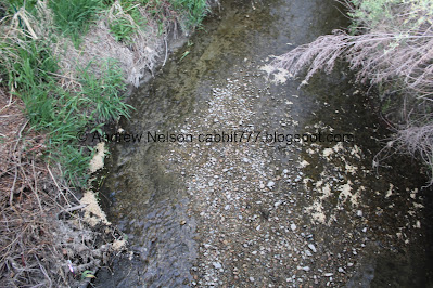
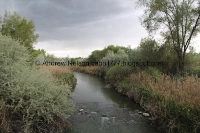
Creekside Park in Sandy (not be be confused with Creekside Park in Bountiful) is a small park that, aside from some general park amenities such as a playground, and picnic areas, offers another view of Dry Creek just before it enters the Jordan River. It is a tiny little park, but I appreciate the additional access to the creek. It was supposed to rain on and off, so after the aquarium I thought of a couple short options we could add on today, that would be easy to run back to the car, just in case.
Quick Details:
Length: The park itself it about 2/10ths of a mile long. But we continued down a little further and ended up doing about 3/4ths of a mile out and back with a few short spurs.
Trail Type: Out and back, out and back with spurs, connector.
Difficulty: The main trail is paved, so DR2. There are a few optional non paved spurs.
Elevation Gain: About 9 feet for the park, 20 feet total.
Restroom: No.
Dogs? Dogs are allowed on city sidewalks, leashed. Please clean up after your furry friends.
Other Info:
To Get Here:
From i15 take the 90th south exit heading west. Turn left on 450 west, Turn right on 9400 South. At about 4/10ths of a mile later the small park will be on the right. There is no dedicated parking lot, so find street parking.
The Trail:
Super gloomy clouds. Well, it’s super short so maybe we can do it without getting rained on.
The park sign. I have noticed that the cities on the south east side of the valley tend to use granite slabs for signs a lot, particularly Sandy. I guess it makes sense since they have a lot of granite in places such as the Temple Quarry Trail.
Dry Creek, being not so dry. The city worked with various water rights back in 2020 to allow the creek to flow more often throughout the year when conditions allow.
Upstream from here it flows through some neighborhoods, and then is accessible again near South Town Mall.
The creek again.
It seems to be eroding this bank quite a bit.
Below the creek crossing the park is pretty wild looking. There is also a nice picnic table.
Small little bark lined path towards the picnic area.
The creek again.
Back to the main sidewalk. The creek through the foliage.
I cannot imagine this particular creek ever having a swift enough current to be dangerous, but I guess the city needs to cover their butts.
The creek below again.
Little rest area.
More gloomy clouds.
The creek below again.
Nearing the end of the park at Riverside Drive.
Where we get a better view of the creek.
Again.
On the other side of Riverside Drive is the River Oaks Golf Course. We decided to cross just to see the creek again.
The creek on the other side of Riverside Drive.
Oh boy, more gloomy clouds.
I didn’t expect to be able to keep going through the River Oaks Golf Course, but this sign seems pretty welcoming, so alright, we shall continue. I know the Dry Creek Confluence is not much further down. So we will go to that.
Continuing down.
The creek through the phragmites.
Again. I might have to come back sometime with better lighting.
Lots of geese hanging out on the golf course.
The creek again.
Metal cut outs of wildlife.
We have reached the Jordan River Parkway (JRP). Funny, I never thought to come this way from that trail, I assumed it was golf course property, and well it is, but it looks like they worked with the city to allow you to do this connector, in addition to the main JRP trail.
First we went to the right (north) to see Dry Creek again.
Dry Creek.
On the other side of the trail Dry Creek flows into the Jordan River at the Dry Creek Confluence.
Then just a little bit south to the bridge over the Jordan River than offers a better view of the confluence.
Upstream.
Downstream, with the confluence to the right.
Better view of the confluence.
Downstream again.
Upstream.
Gloomy clouds.
Well, we saw what we wanted to see, and with the approaching storm clouds we decided it was time to head back. Not to mention, we have already explored both directions on the JRP recently.
Back into Sandy. The River itself, and a few feet on either side of the bank is not city owned, and actually generally acts as the border line.
4 way split. Both right options are private golf course property. You want to go left, then immediately right to get back to Creekside Park.
Sign alerting you to the private property.
The wildlife cut outs again.
Tons of geese on the golf course.
More gloomy clouds.
Little pond in the golf course.
End of the connector trail I guess? I’m not really sure what this sign means.
Crossing Riverside Drive again.
Back to Creekside Park.
Duckies!
About here we started to get rained on. Luckily we are not too far from the car.
Continuing up 94th South. It's weird, this is a much, much busier road a little further east. It does not cross i15 so it is a different kind of road on either side of it.
The creek.
Again.
Again.
The little picnic area.
The creek again.
More picnic tables and the playground.
We made it back to the car just as the skies really let loose. Phew!
Well, That’s the park, plus a little extra down to the Dry Creek Confluence. As for the park itself it a nice little wild patch in the middle of the city which is nice. I wish you could see the creek more though. I was very surprised, but happy to see the golf course allowed a trail through to the Jordan River Parkway where we could see the confluence again. Meh, 7 out of 10 squirrels today.
As for difficulty, it is paved, and very mild climb. DR2.
Dogs are allowed on city sidewalks. Please clean up after your furry friends.
.jpg)


No comments:
Post a Comment