.jpg)
Willow Heights is a stunning alpine lake located near the top of Big Cottonwood Canyon. The trail features a stunning forest, wildflowers, a stream, a lake, of course, and a good chance of seeing wildlife. It’s one of our favorite trails that we do fairly often. Sometimes several times a year.

Quick Details:
Length: Since the trails were rerouted, the east trail to the crossroads is about a mile. The west route is 9/10ths of a mile. And the loop around the lake is about 8/10ths of a mile. For a total of 2.7 miles.
Trail Type: Figure 8, Loop, or out and back options.
Difficulty: DR3.
Elevation Gain: About 650 Ft.
Restroom: No, nearest ones are at the Solitude Nordic Center.
Dogs? No. Big Cottonwood Canyon is watershed.
Other Info:
To Get Here:
Head up Big Cottonwood Canyon about 11.6 miles up from Wasatch. It is just past the Silver Fork Lodge. About halfway between mile marker 13 and 14 there will be a boulder on the left (north) side of the road. If you reach Solitude you went too far, but don’t worry. the canyon ends at a loop that will easily turn you around.

The mouth of the canyon (Passenger Seat Photography (PSP)).


Some more color (PSP).

Some roadside color (PSP). We are stuck in the traffic waiting to go through the 1 direction at a time light. During leaf peeping season this is particularly annoying. We had to sit through at least 2 probably 3 cycles.

Nice mix of color (PSP).

More roadside color (PSP).

Finally to the traffic light (PSP).

Mix of color (PSP). I particularly like the purple.


Some color on those hills (PSP).

The new boardwalk for the Mill D South trails is coming along (PSP).

Some nice color along the road (PSP).

Lovely yellows and golds (PSP).

Lost a lot of leaves since last week, but still a good amount of color (PSP).
The Trail:

Trail marker.

The TH kiosk is set a little further back. It also needs to be updated since the trail reroutes.

We started out in a nekkid section.

Starting to reach some color.

We’re seeing some hints of gold. Noticed a lot of that this year. I wonder if the drought had anything to do with that.

The old trail to the right. Reroute to the left.


Super pretty.
I didn’t get a picture of the trail split due to people being on it. Actually it was kind of cute a family was going to split up and send the teens one way, and the adults the other to see who made it first. I don't know if I helped or hindered, but I basically told them the below information.
Anyway, shortly after the reroute is a split. Left or west is a smidge shorter, but tougher. Right or east is a smidge longer, but a lot easier and less rocky. I prefer heading up the east route and down the west route. So that is what we did today.


Definitely still plenty of patches in their prime.

Couple of nekkid patches.

Looking across Big Cottonwood towards Silver Fork.


Back into some color.

Looking up.


I just love this time of year.

This first switchback is the worst, and where you gain the most elevation.

Looking down from the elbow.

Onto the 2nd switchback.

View down canyon.


More color.

The 2nd switchback is still a bit of a climb, but not too bad.

Across towards Silver Fork again.


Nekkid patch.

The 3rd switchback is a little more gradual.

The old trail. They are trying to revegetate it so that’s why its blocked off.

More naked aspens.

The 4th switchback is pretty gradual as well.

View down again.

Falling leaves.

5th switchback.

Some traces color.

I think we might still be on the 5th switch back, but I might be confused.

The 6th switchback.

Looking up.

Chipmunk!

Some color.

The old trail again. Now we will continue to follow the original trail the rest of the way.

More pops of color.

Up again.

Some nice golds.


More pops of color.

Looking up.


Some thicker color.

Entering the big meadow. This means you are almost there.

Showy hillside.

Nice line of aspens on the other side.

I love the cone shaped peaks up here.

Colorful hills with cone shaped peaks.

The colorful hill again.

Another cone shaped peak.

More color.

We made it to the crossroads! Left will head down the west trail, forward will go around the west side of the lake, and right will go around the east side of the lake. I prefer forward, and the east side of the lake. It offers the best views.

View across the canyon.
.jpg)
Panoramic.

First view of the lake.
Continuing around to the little beach.

The crossing over the outlet. Currently there is no bridge, however it would really surprise me if there is not one here soon.

Some more nice color.

The lake from another overlook.

The lake from the beast on the west side. We ran into the family we encountered before. I asked who won? Both the teens and the parents said they did simultaneously. They bickered back and forth a bit, playfully, before agreeing it was a tie. LOL that seems like a fun family! I hope the best for them.
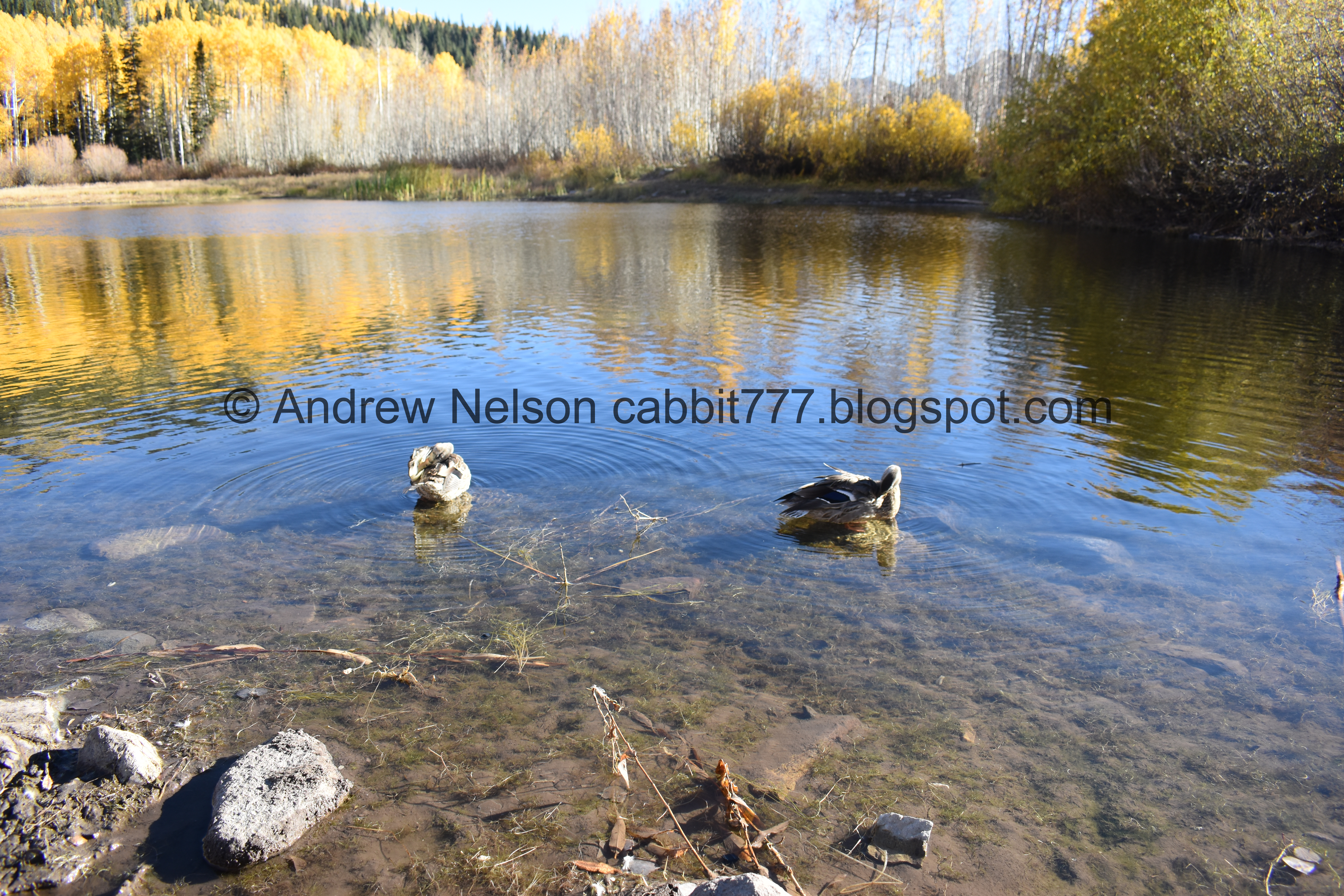
Duckies!

Some great color above the lake.

Cone shaped peaks behind us.

Duck.

More color.

The lake again.
.jpg)
Panoramic.

Lake again.

Got some decent reflection.
A little closer.
.jpg)
Panoramic.

Nice clear water.
Eventually we decided to do the loop around the lake.

Lots of yellow, with a smidge of gold.

The lake and the peaks across the canyon.


Bright aspens.

The other side.


Yellow aspens, purple willows.

Giant wasp nest.


More color.

Slight glimpse of the lake through the trees.


It is incredible back here!

Some of the many trees that fell in some of the major windstorms we have had.

Nice color.

Looking up.

Some of the fallen trees you step over, others have new paths around them.


Just wow!

More fallen trees.

Lots of yellow, little bit of gold.

More fallen trees.


I particularly like that last one.

So pretty.


I take too many pictures this time of year.

Nice little corridor.

Cone shaped peaks.

I love when the colorful leaves decorate a pine tree. I call these fall Christmas trees.

Yellows and purples.

The other side of the lake. This is why I typically go this way. You have to worm your way through thick brush to actually see it on this side.

Little twisted aspen trees.

Back to the cross roads. We decided to head down the west route, as we generally tend to do.

Looking down on the big meadow and the little dry pond. If you come in early enough in the year, there might be a little pond there.

To the east with some nice color a cone shaped peak.

We re-enter the woods through a patch of naked aspens.

After crossing the creek we found another bright patch.

Bright hillside.

Trail reroute. First switchback.

2nd switchback. 1st one by the creek.

Some nice patches of color amongst the naked trees.

The other side of the reroute.

The trail.

The 3rd switchback.


Some nice color.

Across Big Cottonwood towards Silver Fork.

More color.

Some geranium leaves.

4th Switch back, 2nd one next to the creek. I wanted to specifically call this one out as now you need to keep an eye out for the small trail sign soon.


More color.

Colorful trail.


Loving all the color on this trail.

This is the small sign you need to keep an eye out for after the 4th switchback (2nd next to the creek).. It’s not the end of the world if you miss it, but that will involve walking through some neighborhoods, and having to back track back up Big Cottonwood Canyon Road. It looks like that adds about 4/10th of a mile. So, it is better to hang a left here.


More pretty aspens.


So much yellow!


Better lighting.

Lower bridge.

Trail split. Left goes up the East Route, right will get you back down to the trailhead.


Lots more color through here.

Looking up.


More color.

Then another bare patch.

Some color in the underbrush.

Back down to the trailhead.

Some pops of color across the canyon.

More up canyon.
Whelp it was time we headed back down.

Heading down the canyon (PSP).

Some yellows, golds, and reds (PSP).

The newish pedestrian crossing light at Mill D (PSP).

Some nice reds and yellows (PSP).

Yellow, reds, and purple (PSP).

Stuck at the one way alternating traffic light (PSP).

Some more color (PSP).


Storm Mountain Picnic area still looks great (PSP). I have yet to explore that area. One day.

We did decide to stop by Ledgemere Picnic Area. I made that a quick side post.

More color heading down (PSP).

Loads of color at the mouth of the canyon (PSP).
I always enjoy this particular hike, but it is absolutely spectacular in the prime of leaf peeping season. 10 out of 10 squirrels today.
As for difficulty, both routes are a bit of a climb, but not too terrible. The east route is a little easier though.
Dogs are not allowed in Big Cottonwood Canyon so be sure to leave Fido home for this one.

No comments:
Post a Comment