.jpg)
The Buffalo Point trail on Antelope Island is a great trail along the northwest tip of the island. It features incredible views of the The Great Salt Lake, surrounding mountains, wildflowers, and possible wildlife. They have rerouted the trail recently to go around the scary part that I really did not like, so it is a much more pleasant climb for those with height issues like me. Last time we did this trail we got chased off by the mosquitos, and did not really enjoy the top. Today was a much better experience.

Length: It is about 8/10s of a mile out and back. With some extra exploring we did about a 1.3 mile out and back with a spur.
Trail Type: Out and back. Reverse balloon option.
Difficulty: DR3. It is short, but it is quite the climb!
Elevation Gain: About 250 feet.
Restroom: Yes, there are vault toilets at the trailhead.
Dogs? Yes, leashed. Please clean up after your furry friends.
Other Info: Fee area, $15.00 per car. I also recommend checking their website for current conditions like bugs etc. Also, special conditions. Today we were surprised to learn there was no running water in the park. Luckily we brought along plenty for both of us.
To Get Here:
Head to the northwest corner of the island. From the cause way, you can go either way. But left is more direct, then stay forward. Take the 2nd right, and climb the hill. it is signed.
The Trail:

Trailhead sign. I just noticed this sign has also been covered with a new map. I am sure this is due to the reroute though. I guess the people over our State Parks do better than the Forest Service on updating signs when there have been significant trail changes. Cough, Willow Heights, Cough.


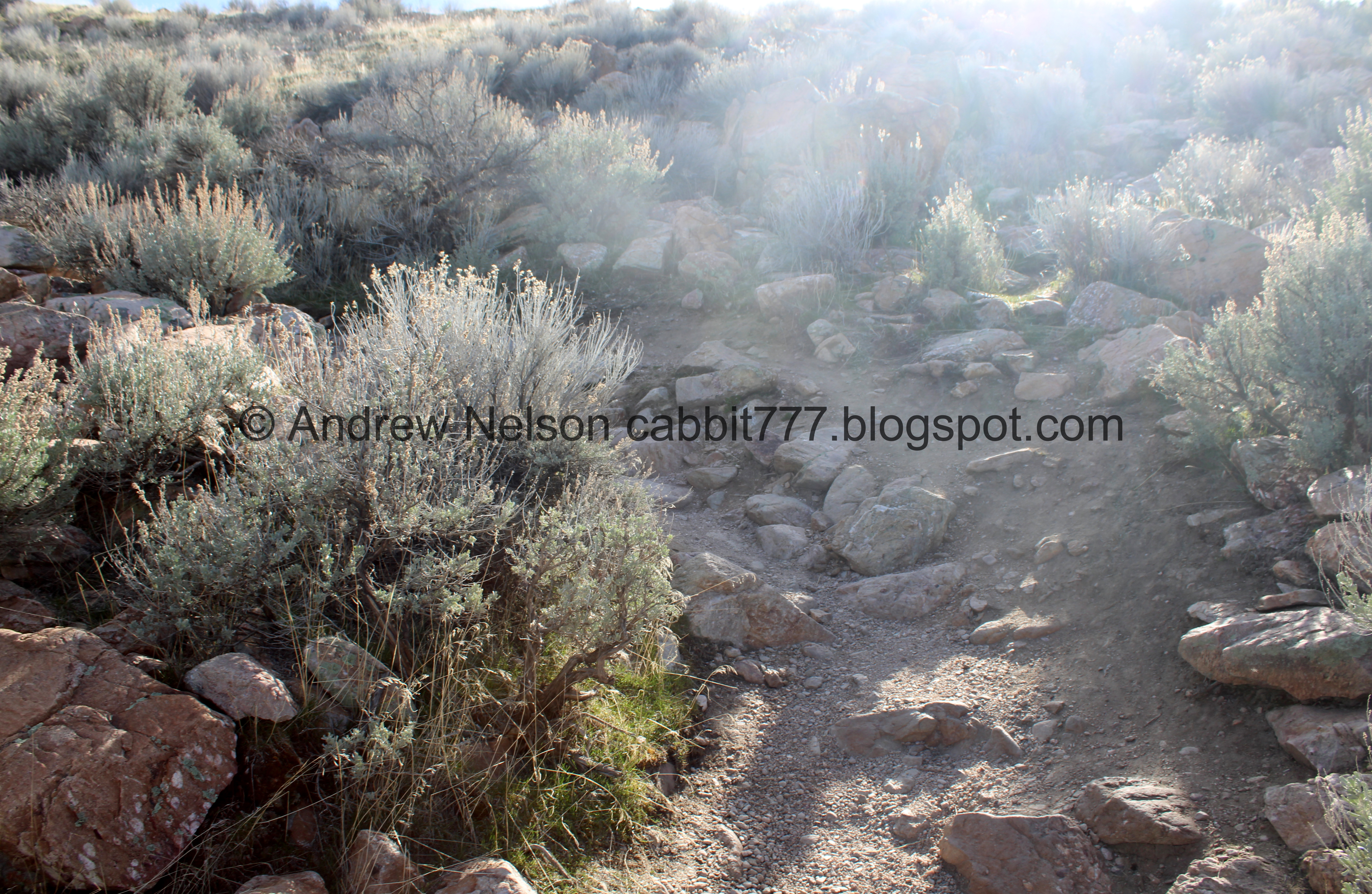
Right off the bat, the trail starts to climb. There are two options at the beginning, and well, we stick to the west route, because it is what we know. The east route looks a little sketchier to me. Maybe one day I will try it, but today I just stuck with what I knew.

Nice view of White Rock Bay to the west.

Closer. I uh, took a lot of pictures of that today. It is quite scenic from up here.

Very rocky climb.

The lake is like glass today.

White Rock Bay again.
.jpg)
Panoramic.

The Visitor Center and the Causeway to the east.

Ladyfinger Point and Egg Island.

The trail, and the peak to the left.

Super rocky trail.

Then you get a break from the climb for a minute.

There is also an old bench here if you want/need a break.

White Rock Bay again.

Another old bench.

View to the northeast.

Looking back at the peak above. About where that group ahead of us is where the two trails connect again.

Another bench on the west side.

With it’s view.
.jpg)
Another panoramic.

East with Ladyfinger Point again.

The peak again. I think this is about where the 2 trails merge.

Back to the climb,

Here is another trail split. The old, now closed trail to the left, and the new and improved trail to the right. The signpost there will direct you to the right and ask you to stay on the new trail.

Despite numerous signs, and physical barriers, there are always those people who think the rules don’t apply to them. Sigh.

There are a lot of little side trails that they have closed, and are trying to revegetate.

Now we start on the switchbacks. As far as switchbacks go, these are not bad at all.

View to the east.

Ladyfinger Point and Egg Island.

Bridger Bay Campground.

Continuing up.
The first switchback.

Nearing the ridge.

The second switchback, with a couple more closed off trails.

I honestly do not know how they could be any more clear. But again, assholes think the rules don’t apply to them.

Continuing up.

Final push.

We made it! With another view of White Rock Bay. There is a bench at the top, which I think is what the park considers the peak. I didn’t get a shot due to a large group resting on it.
It was a little more… peopley up here than I would have liked.
.jpg)
Panoramic.
We decided to head left (south), and see where the original trail popped up here. We were not being harassed by a million mosquitos this time so we could explore more at a leisurely pace today.

Desert parsley.

The lake is so pretty today.

I think this is Stansbury Island.

Some horseback riders below.

White Rock Bay again. Yeah, I took a lot of pictures of it today haha.

Where the old trail is closed off from this end. We did not go beyond the fence. I don’t like that trail anyway, and am glad it was rerouted. So why would I subject myself to that? haha. But I did want to see the view from here.

White Rock Bay.

Again.

Somebody wandered down to that crag below. I am pretty sure there is no trail down to that.

Heading back to the north. See, it is quite peopley up here today. oof.
That little bench is where the new trail goes down. So if you are unsure, it is a good marker to get you back to where you should be.

Ladyfinger Point to the east.

Visitor Center and Causeway.
.jpg)
Panoramic to the east.
.jpg)
The the west again.

More desert parsley.

Now we decided to keep heading north a bit.

I believe this is looking at the high point of the peak, well, short of scrambling up a boulder like these folks did.

We made it to the high point. As far as peaks go, this is easy, and not scary at all. According to the topography map I use, this is 4792 feet in elevation.
The lake is currently at 4193 feet of elevation so that puts us at 599 feet above the lake. But is super wide so not really scary at all.
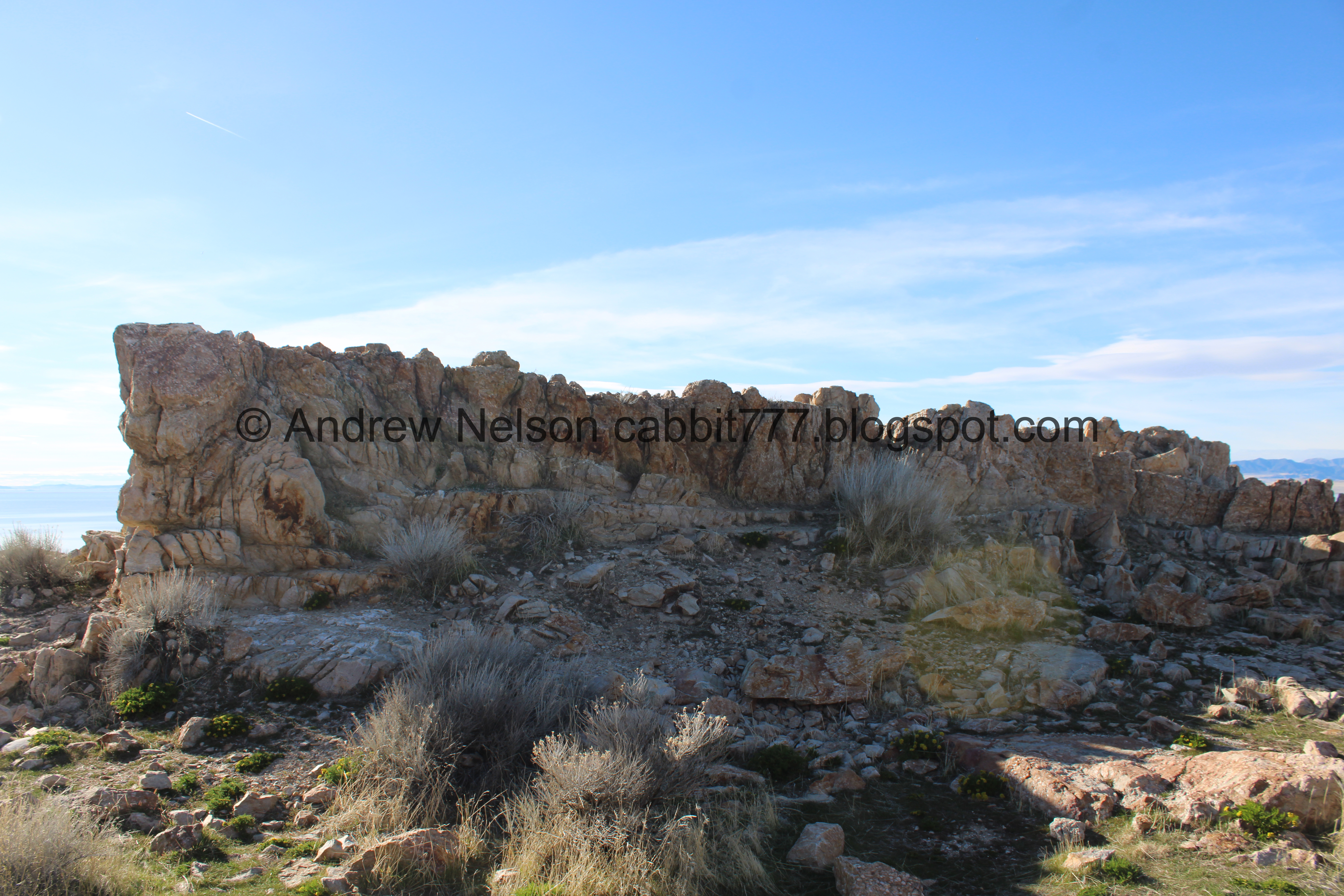
Neat ridge of rocks. It kind of reminds me of the Chinese Wall formation in Bryce Canyon.

Desert parsley in a nest of rocks.
.jpg)
East side panoramic.

Bunny butt.

More bunny. We both individually had quick out of the corner of our eyes sightings of bunnies today, so it was nice to actually catch one.

Neat rock with a little alcove.

To the north.

Again. The trail appears to keep going, but I am not sure how much further. We made it to the high point, and a little beyond so we called it good. As I said, it was much more enjoyable without millions of mosquitos!

Panoramic.
.jpg)
To the west.
.jpg)
To the east.

To the north.

The tip of the point below.

The causeway below.
Alright, we decided to head on back.

Heading back.

Lots of boulders to navigate around.

I love these fun conglomerate rocks.

Interesting rock.

Lots of people.

The causeway.
.jpg)
East side panoramic.

Back to the rock wall.

The high point, looking south.

White Rock Bay.

Continuing along the ridge.
.jpg)
West side panoramic.

White Rock Bay.

The bench to the right, which means the trail down is to the left. This is something the park could do to help prevent people from using the side trails, put a damn sign in that points to the trail down saying "trail down". I am actually kind of surprised they don't have one.

The trail down.

The east again.

Heading down the switchbacks.

The upper switchback. There was a whole group coming down the clearly marked not a trail, trail. Sigh. Although with what I just noticed and mentioned about being no sign pointing to where you should go maybe they aren't such jerks. Except that I know there is a "not a trail" sign at the top of it. Meh.

The lower switchback.

Bridger Bay Campground.

Egg Island and Ladyfinger Point.
.jpg)
Panoramic of the east side.

The park offices and bison corrals to the south.

Looking back up at the ridge, and the old, closed trail.

White Rock Bay.

A line of bison in the marshes below.

White Rock Bay Campground below.

Following the throng of people down. It got really crowded here for a minute.

White Rock Bay again.

Back down to the parking lot.
That was a good hike. I am glad we came back, since last time we got chased off by mosquitos. But, it was a little busier than I would like today. Then again, it was like the first amazing spring day on a weekend this year, so naturally a lot of people had the same idea as we did. Last time we did it I tagged my fear of heights trigger, but now that I am familiar with the rerouted trail I didn't have any issue with it at all today. I really, really enjoyed this trail today, but it was a little more crowded that I would like, so I am going to remove 1 squirrel for that. 9 out of 10 squirrels.
As for difficulty, it is short, but is a rocky climb. DR3.
Dogs are allowed, leashed. Please clean up after your furry friends.

No comments:
Post a Comment