Salt Lake City Cemetery is an old, if not oldest cemetery in Salt Lake City. It is one of the largest city run cemeteries in the US. It has over 120,000 people buried here. It has several notable graves, including a few that have become urban legends, that we explored last time we were here. It also offers some nice views of the valley, and the mountains.
I randomly learned that there are sequoia trees scattered around Salt Lake City, and today was a fun little scavenger hunt to try and locate some of them. The site I was using did not provide the best information, but did provide enough that our random nerdy scavenger hunt was not a complete disaster (like the last time we were here haha). But this one was a little tougher than the others so far.
I thought we were running out of light on our previous stop, but decided to add this one last minute. Well, I am not thrilled with the lighting today, so we might have to come back.
Quick Details:
Length: We did a short bit today, but the cemetery is absolutely MASSIVE and I suspect it will take a few more visits to fully explore it.
Trail Type: Out and back.
Difficulty: DR3. Its grassy, and lumpy, and hilly, but not crazy. DR3. Also, the roads are not in the greatest condition either.
Elevation Gain: NA
Restroom: I thought I found one in the cemetery today, but I don’t know for sure, or if it is even still in use. It has drinking fountain on the outside so it looks like one. But I did not investigate closer.
Dogs? unknown.
Other Info:
To Get Here:
The guide I used mentioned it was just east of the Orson Pratt grave. I then located it on Cypress Avenue about halfway between 245 North and Grand Avenue. This is a good spot to park, but it is a bit east.
The best access into the cemetery to here is via Fourth Avenue and Center Street (the cemeteries Center Street, not the main SLC Center Street, just west of Q Street). I know, that is not at all confusing. We had a heck of a time finding a nearby grave last time due to this.
The Trail:
The southwest corner of the cemetery (Passenger Seat Photography (PSP)).
The guide I used said it is east of the Orson Pratt Grave, so that is what I looked up using findagrave, which got us pretty close.
Sorry for the inside joke, but only our besties will get why this is funny.
So, with the clues provided from the website I was using, I tagged this giant tree thinking it was probably what we wanted. But, no. This is some other kind of conifer.
So now we were left looking around, and wondering where the heck to go. We pushed further east.. We soon realized this big ol tree was in the way.
Then we spotted that perfect cone shape.
The rough needles.
The top.
Neat obelisk for Mifflin.
None of the nearby graves I took a picture of have been mapped. So hopefully these GPS coordinates work: 40.77518214806872, -111.85701298977898.
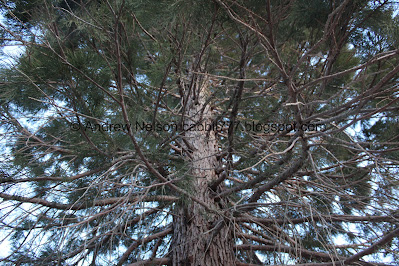
Underneath the tree.
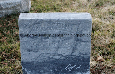
This old grave marker is hard to read, but I think I can pick up 1895? That’s super old.
I did fail on my 2 birds 1 stone attempts here. After the last time we were here, I looked up the oldest grave, and made a mental note to stop by it next time we were here. And well, that just did not happen today. It is Mary Wallace in 1848, BTW.
Back to our redwood friend.
Vertical panoramic. The site I have been using as a guide claims this is the tallest and most healthy in the valley.
Near the Dibble grave.
The tree again.
This grave marker appears to be close to being reclaimed by the earth.
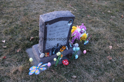
Grave markers surrounded by toys make me super sad.
Tree and moon.
Vertical panoramic.
The tree again.
Well, I guess not all of the Kimball’s were buried in the private cemetery.
However, I have no idea if they are even related, so… I guess disregard that.
Kirby obelisk.
This old grave is being completely displaced by this tree.
Woo. Nice sunset tonight.
More graves (PSP).
Landis noticed the specific shape of the tree, and decided to turn down Grand Ave where we found some other specimens. These were not mentioned in the guide I had been using which leads me to believe that there may be quite a few more around the valley! I do have a few more stops that the guide listed, but now I am going to try to pay a little bit closer attention to see if perhaps there are even more around the valley.
The top.
This part of the road appears to be lined with them!
A happy one.
And a not so happy one.
Some sunset. Sequoia on the right, pine on the left.
The unique and rough needles of a sequoia.
The bark.
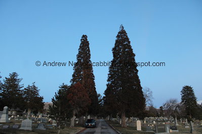
Looking east towards a pair of sequoias. I counted at least 7 along this road. Now that, that I might consider to be a grove.
A bougie family has a fenced in plot.
It’s not very big, but it is neat.
The only date I can make out is 1876.
Isaac Barton. 1916.
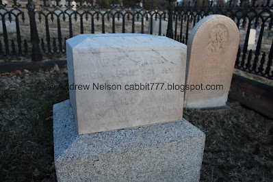
“Will Park died April 21st 1881 aged 26 years. Erected by his sorrowing mother”
Its hard to read, so I assumed mother vs brother, but could be either.
I didn’t get a good enough shot of this one to read it in this light.
Oh. I just realized the main monument in this site fell over. I thought I took a picture of it, but I guess I didn't. It looked like there were some vole tunnels under the stone that may or may not have contributed to it falling over.
Neat bronze plaque on a tombstone. I should have gone to the other side to see who it is.
The valley lighting up below.
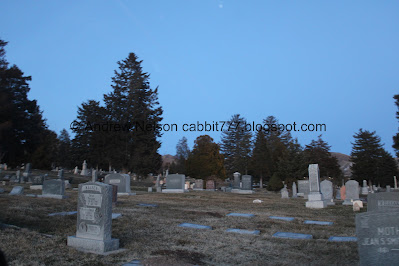
Amongst the sequoias. I think I can see some more in the background. So, we might need to come back sometime, plus with some better lighting.
More graves.
I am a little disappointed in myself that I did not seek out Mary Wallace's grave, the oldest and first grave here from 1848. It was really just a smidge southwest of here at 40°46'32.7"N 111°51'44.9"W, but, it is a big cemetery and we have only seen parts of it, so I am sure we will return eventually.
More sequoias as we make our way back out of the massive cemetery (PSP).
Grand Ave. West of Center Street is where we found the road lined with sequoias (PSP).
Well, I had a couple more stops I was hoping to hit today, but we were absolutely out of light. So, I guess there is going to be another scavenger hunt adventure in our future.
Heading down State Street (PSP). The new tallest building in town, The Astra Tower. It has a light based air quality forecast on the top. It looks yellow, which forecasts moderate air quality.. tomorrow, I think. I am not real clear on how the forecast works, but am trying to find the answer. I was not trying to get the Astra Tower, just downtown, I spaced that I was wanting to see Astra Tower at night tonight haha. So, I guess, hopefully next time I am down here at night I can get better shots.
The City County Building lit up (PSP).
Well that was another fun adventure in the Salt Lake Cemetery. We’ve done it before, but today, instead of chasing ghost stories, we were chasing redwoods, and we found many more than we anticipated, so that was pretty amazing! It was not very busy, as cemeteries tend to be. 8 out of 10 squirrels.
As for difficulty, the roads are in serious disrepair. Cemetery grounds in general are lumpy and awkward to walk on. DR3.
As for dogs, I am not sure. When in doubt I generally leave them behind.
.jpg)



.jpg)



.jpg)








No comments:
Post a Comment