Antelope Island is a HUGE State Park that is only about a half hour from downtown Salt Lake City. The park features excellent mountain and lake views, more wildlife that you’d ever imagine, and miles and miles of trails of varying length and difficulty. It is crazy it is this close to the city because it feels like you have been transported to somewhere else completely. This post will be mostly a stub to show the Passenger Seat Photography (PSP) photos I take while we drive around between hikes. I really, really love coming out here and make it a point to do it at least once a year.
Scenic Drive Details
Length: The causeway is approximately 7 miles. Then the island can be split into two sections for driving. The north end has a 4 mile loop with about 2 miles of spurs up to Buffalo Point and down to White Rock Bay. Then the East side down south is about 10 miles down to Fielding Garr Ranch with an additional 4.5 miles further south on dirt roads, if the gate is open, as well as a few spurs out to a few items of interest.
Time Needed: At least 2 hours, depending on how much exploring you do.
Road Conditions: Mostly paved, standard 2 way roads. 4.5 miles of dirt roads.
Summit: NA
Restrooms: There are a mix of flush and pit toilets scattered throughout.
Interesting Things: Wildlife, history, and loads of trails to explore.
Other Info: Fee area, $15.00 per car. I also recommend checking their website for current conditions like bugs etc. Also, special conditions. Today we were surprised to learn there was no running water in the park. Luckily we brought along plenty for both of us. Also, be sure to have bug spray handy if needed.
To Get Here:
Take i15 to Antelope Drive (exit 332) in Layton, head west. Pay the fee just before the causeway, then cross that onto the island.
Or if coming from the south, you can take the new West Davis Corridor, and get off on Antelope Drive.
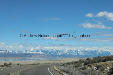
The mountains are looking great right now (PSP).
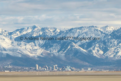
Downtown SLC (PSP).
Again (PSP).
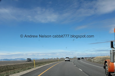
The new West Davis Corridor (PSP). I don’t like that they built this through primary bird habitat, but it does make getting to the island a lot easier.
The FAA Radome (PSP).
The West Davis Corridor again (PSP).
The Great Salt Lake Shorelands Preserve (PSP). You know, I haven’t been there since the West Davis Corridor opened up. I wonder how much it affects the area. I might have to come back soon.
I love this house with the cute Angry Birds buoy art (PSP).
Just before the causeway we noticed a historical marker for a bathing resort?
I was not quick enough with the camera so I used this image I found on google maps. Apparently this is the site of the Syracuse Bathing Resort.
It opened in 1887, it had the largest dance pavilion, bathing resort, and recreational center in Utah. it closed in 1892 due to receding shorelines and land disputes.
Man, I am learning about so many random resorts I never knew about recently. So, another fun thing I need to go down the rabbit hole about.
The Adventure:
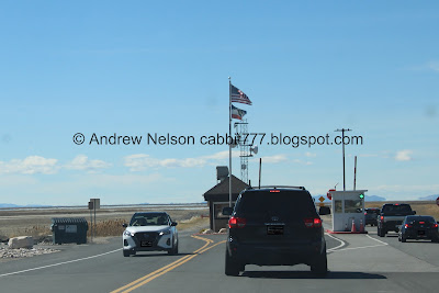
They had both booths open today (PSP). We used the main one, so I don’t know for sure, but I think they finally figured out how to operate both properly.
Heading across the causeway (PSP).
Again (PSP).
Starting to see some wetlands (PSP).
Nice reflection (PSP).
Frary Peak (PSP).
The island and reflection (PSP).
The Great Salt Lake and Mountains above (PSP).
The other side (PSP).
The newish park sign and one of the bison statues (PSP). These painted bison statues were all over SLC during the Olympics, and have since been scattered around. There are a few on the island.
Here is what the old sign looked like in 2009. Looking back through my blog, it looks like it was replaced in 2022.
A quick adventure on Ladyfinger Point. You can see more of that with the link.
The Visitor Center is currently being rebuilt so it isn’t much more than a pile of rubble right now (PSP).
Bison wallow.
Bridger Bay (PSP). We'll come back to that.
Bridger Bay Campground below Buffalo Peak (PSP).
Looking towards the east (PSP).
We decided to head towards the south end of the island via the East Side Road (PSP). This is the "south island" side of the island, which is quite a bit larger than the north island side.
I was hoping the road to the South Island Trail would be accessible, but no. So we made due and just enjoyed our random adventure today.
Well, what do we have here (PSP)?
Just our absolute best and most amazing coyote encounter yet! Wow!
Hello handsome.Super cool.
Just wow! I have never been this close to a coyote before. (Note, still using the telephoto lens, and in the car. We are totally safe, and not harassing him).
Again.
He looks a little thirsty.
This is absolutely the best coyote encounter we have had yet. Wow!
We hear them on the island all the time, but this is only the second time we have seen one on the island.
Super cute.
Bison.
Back to the coyote.
Eye contact. Hello cutey! We are still in the car so I was not terribly concerned.
Not to mention he/she immediately went on to doing coyote things.
Like sniffing.
Well, We decided we got a really good look today and decided to continue on our way.
Bison on a ridge (PSP).
Continuing along the East Side Ranch Road (PSP).
It is a very scenic drive (PSP).
Downtown SLC (PSP).
Digital crop.
Bison on a ridge.
Beacon Knob (PSP).
Frary Peak (highest peak on the island) and Dooley Knob (PSP).
The bison from the other side of the ridge (PSP).
Beacon Knob again (PSP).
Frary Peak and Dooley Knob again (PSP).
The neat unnamed rock formation in front of Frary Peak (PSP).
Dooley Knob again (PSP).
The unnamed formation again (PSP).
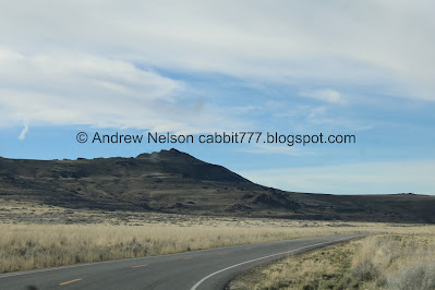
Frary Peak (PSP). Again, the highest peak on the island at an elevation of 6596 feet!
A northern harrier hunting (PSP).
The Great Salt Lake is just the Jordan River flowing across the lake bed through here (PSP).
The mountains and downtown SLC (PSP).
Digital crop of downtown. It looks like lakefront property from this vantage.
Frary Peak again (PSP).
More mountains (PSP).
Another digital crop of downtown (PSP).
Fun clouds (PSP).
These caution, bison signs are new (PSP).
Continuing along (PSP).
The Oquirrh Mountains (PSP).
Daddy Stump Ridge.
The Sentry. Another great hike.
Whelp, I guess we will head back to the north side of the island.
I thought of all of the hikes we could still do, and was not feeling any of the longer ones. So, I guess we will see what will happen as we continue along.
Mountains to the east (PSP).
Heading back to the north (PSP).
Looking back towards downtown (PSP).
Digital crop of downtown.
One of the many springs along the shoreline (PSP).
Dooley Knob (PSP).
Beacon Knob (PSP).
Jordan River and Mountains to the east.
Holy bison on a ridge, Batman (PSP). I am pretty sure that is a good chunk of the bison on the island. Wow.
Mountains to the east again (PSP).
With downtown (PSP).
Digital crop of downtown again.
Usually I use one of the pullouts to get a good shot of downtown with the telephoto lens, but I totally forgot my tripod today. But I am not hating the random PSP crop shots I am getting of it today,
Another little spring (PSP).
The Jordan River widening out and the mountains (PSP).
Again (PSP).
The opening in the causeway that allows the Jordan River to join the lake (PSP).
The current state of the Visitor Center (PSP).
This fence is the official boundary between the South Island, and North Island (PSP). The north island is a lot smaller, but has much more to explore.
Bridger Bay (PSP).
Heading toward Buffalo Point (PSP).
The temporary gift shop is in the Park Headquarters above the White Rock Bay Campground (PSP). We found the signs to not be adequate for our likings today. But it is a temporary thing so meh.
We got stuck in a bison jam (PSP). I get it, wildlife is exciting, particularly if it is wildlife you have never seen before. But PULL ALL THE WAY OVER if you want to stop. It is not okay to block traffic because you saw an animal. I am obviously a wildlife enthusiast and I get super excited and ask Landis to pull over frequently in places like this. Sometime I make him stop so I can get out, and then he immediately pulls away and finds a place to pull over. Other times I have to wait for a good spot to pull over. Can people just stop and take 2 seconds to consider how their actions might affect others? No, no of course not. Old man grumbles.
Bison with bird friends.
Again.
Whoops. I may have caught him taking a dookie.
The road up to Buffalo Point is a bit steep and windy and freaks me out just a bit, so I didn’t get any pictures along the way up.
Our next adventure was the Buffalo Point Trail.
After our hike we decided to check out The Buffalo Point Interpretive and Picnic Area, since it is right there. I can’t find anything to really back this up, but I am like, 99% sure this was where the Buffalo Grill used to be.
Great Salt Lake - The wanderer.
Bison below. You can also see the Lakeside Trail below.
White Rock Bay.
Panoramic.
White Rock Bay Campground below.
Heading down the Buffalo Point Road (PSP). I don’t like this road at all, but it is short.
White Rock Bay (PSP).
Heading down into White Rock Bay.
Looking back towards Buffalo Point.
Bison (PSP). We got stuck behind another inconsiderate jerk who couldn’t be bothered to you know, pull off of the road.
The white rock of White Rock Bay (PSP).
Lots of bison (PSP).
Again (PSP).
Well snap. I found a pair of Great Horned Owls.
I thought my dogs were the kings of giving side eye, but these guys come close.
Man these guys can sure look angry.
From the side.
The other side.
Back to sleepy time.
Bison on a ridge (PSP).
Bison next to the road (PSP).
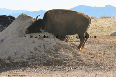
Well. This is interesting behavior I have never witnessed a bison do before (PSP). He/she appears to be rubbing his/her face back and fourth into the sand mound.
Really going to town (PSP). I guess if I think about it, our dogs do something similar, humans enjoy washing our faces, its a universal thing.
When he/she was done we were worried they were going to come at us for a moment (PSP).
Back to doing bison things (PSP). Phew! Okay, time to move on.
Bison above the lake (PSP).
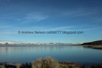
Mountains and lake (PSP).
Ladyfinger Point and Fremont Island.
We spotted a burrowing owl! Hooray!
The Visitor Center construction (PSP).
Long billed curlew.
These guys were very aptly named, but seriously, that is a log ass bill!
Poking at the ground.
Very weird, but handsome birds.
Open bill.
Then I spotted a second one, but it was a little further away.
Next I randomly decided we should check out Bridger Bay which, as often as we come out here, surprisingly we have never done.
If you want to have a nice lunch, or early dinner the one restaurant on the island is the Island Buffalo Grill. Seasonal, Mar 1st to Nov 1st.Current posted hours for the 2025 season:
Saturday 12-6:00 pm
Sunday 12-5:00 pm
Monday 12-5:00 pm
Tuesday 12-5:00 pm
Wednesday-CLOSED
Thursday 12-5:00 pm
Friday 12-5:00 pm
We haven’t timed it right to try them yet, but I really want to try the buffalo burger sometime.
Short of this, the closest restaurants are 18 minutes to the east in Syracuse.
Heading back towards the causeway (PSP).
Another northern harrier hunting.
The under construction Visitor Center (PSP).
As expected, there is no public access right now (PSP).
Lady Finger Point (PSP).
The Visitor Center again.
The Marina (PSP).
The Visitor Center again (PSP).
A final bison (PSP).
The new park sign again (PSP).
The lake as we head down the causeway (PSP).
I wonder what construction project they are doing here (PSP).
One of the 2 openings in the causeway (PSP).
The lake looking towards downtown (PSP).
Digital crop.
The lake again (PSP).
Digital crop on downtown.
Then, the lake ends (PSP). There are a few more miles of marshland before we hit the end of the causeway.
Continuing along the causeway (PSP).
Marshland (PSP).
Looking back towards the island (PSP).
Eh, not the best shot, but some American avocets in a pond (PSP).
Continuing along (PSP).
The fun Angry Birds buoys again (PSP).
The new West Davis Corridor (PSP). We opted to skip it in lieu of finding better dinner options in Layton.
Well, hooray! Another successful daytrip out on the island. We saw loads of wildlife, and did some nice, easier and shorter trails today. It was probably the busiest I have ever seen it though! Holy crap was it busy, but it’s a big island, and if you get peopled out, you have other options. Generally most people avoid the longer trails, so if I was feeling really annoyed by people I know how to avoid them. But, all in all, I would call it a success!
.jpg)











.jpg)






No comments:
Post a Comment