Arrowhead Park is a small park in Murray that is a great starting point to explore the Jordan River Parkway. You can even do a loop on both sides of the river which is neat. My friend group decided they wanted to resume our regular walks, now that is is warming up, but before it gets too hot. This is a section that we do regularly, so I don’t always post about those adventures through here. However, we noticed some pretty big changes today so I thought I would post again, cause, well, I am weird and like to document significant changes I notice.
Quick Details:
Length: We did a 1.65 mile loop today.
Trail Type: Loop. There are shorter or longer out and back options.
Difficulty: DR3 due to uneven windy dirt paths. However, there is a totally paved and board walk option you can do as well by staying on the east side of the river.
Elevation Gain: About 16 feet.
Restroom: Yes, and it was even open today, so unless it was a fluke, I assume it is open year round.
Dogs? Yes, leashed. Please clean up after your furry friends.
Other Info:
To Get Here:
If coming from the north, take i15 to 4500 S, go west. Turn left on 500 west. Take that to Murray/Taylorsville rd (4800 s) hang right, then immediately left.
If coming from the south, take the 5300 S exit. Go west, turn right on Murray Blvd. Turn left on Murray/Taylorsville rd (4800 s), then immediately left.
The Trail:
The Little Cottonwood Confluence, where Little Cottonwood Creek flows into the Jordan River.
Upstream Little Cottonwood Creek.
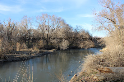
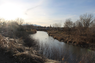
The Jordan River.
Here you have the choice of staying on the main path, which is a boardwalk through here, or taking the more wild dirt path to the right. We generally opt to do the latter.
There used to be an actual bridge here. According to Elise there has been some drama between the city, and residents, but since it was not an official bridge, Murray deemed it to be a liability and tore it out. So, now all we get is some rickety cinder blocks.
The old bridge from 2021.
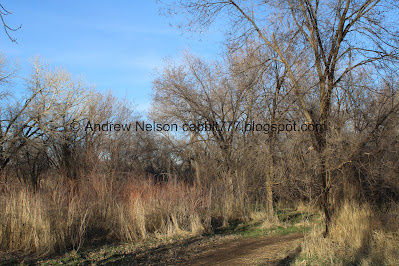
Some lovely groves of trees. They call this forest the Hunters Woods.
The river.
The river has cut into the bank here quite a bit since the last time we were here.
From approximately the same location back in 2021. There used to be some pretty primrose bushes here that appear to have washed away. Sad.
2021 again.
I am not sure, but I think that might have been caused from the extended release from Utah Lake last year. KSL Article (outside link). Followed by a longer runoff season. Looks like they are doing it again this year. I thought the river seemed high. KSL Article (outside link).
I also decided to take a gander at google earth and I found these. Here is 2023
And 2024. So it looks like the damage happened in 2023 mostly. I found they also did the release from Utah Lake that year as well.
Another bridge that was removed and has since been replaced with cider blocks.
This little stream comes out of a cute little pond on the other side of the reeds.
They also removed the super sketchy bridge at the end of this little stream, closer to the river. That’s okay, I did not like that one much.
What is looked like in 2021.
More forest.
The river.
A startled American coot. I love how they run across the water.
More forest.
It looks like they have cleared some of it out. Probably removing invasive species.
And planting native species.
The Kennecott Nature Center of Murray.
Duckies.
The river.
The Education Center again.
Native Plant Revegetation Area. This has been going on for a minute.
At the top of a high bank.
Greenery starting to come up.
The river.
Upstream.
Downstream.
On top of another high bank. I think we are on top of the “bird wall” here.
There is a short spot on the south side of this that I am not a fan of, but we found a short detour that bypassed it today, so that was nice.
Back down to the river level. Phew.
More forest.
Reeds and blue skies.
Up to the bridge, where we will cross and head back down along the west side of the river back to 48th south.
Upstream to the south.
Downstream to the north. Well, northerly.
Mount Olympus above the river.
Currently dry swamp area.
River and mountains.
The “bird wall” I mentioned earlier. This high bank provides perfect nesting grounds for cliff swallows and kingfishers (one of my favorites).
More woods.
Fun bent tree. I learned this can happen to trees when there are heavy winters that bend the tree over, which can snap off the leader branch, so a new branch takes over as leader branch or sometimes a few branches do it.
The creek.
The woods.
More of the swampland through here.
More woods.
The river again.
More woods as we eventually hit the wider path.
American robin. A lot of people think these guys are a sign that spring is here. Personally I find the first glacier lily to be my indicator.
The riverbank appears to have eroded a bit more here as well.
Upstream.
Downstream. Man look how much of it is falling into the river.
O man, it is sure eating into the trail here. This spot made me a little nervous, so I kept as far left as I possibly could. I mean, you never know when another chunk of it will go. Water is super powerful.
Back down to the Little Cottonwood Confluence.
After this there is a cute little garden, but not much appears to be coming up just yet.
Back to the crossing at 48th South.
American coots.
On the way home we stumbled upon a new Maverik. I suspect this may have been a Kum & Go before Maverik bought them because it doesn’t look like most Maveriks.
Well, google maps history for the win! Here it is in 2022 as it was being built. Definitely Kum & Go signage. I am still a little salty that Maverik bought them out just as they came to Utah. We had so many good 5 year old mentality jokes to play with, and then just gone. Buttholes.
Before Kum & Go acquired the lot it was a car wash (which I cannot find the name of, I guess it was just a generic car wash) and a flower store called Flowers on Vine. Google image from 2019.
Haha, sorry for the random history. But, as I mentioned, I get hung up on weird things like this.
Then of course there is this. Some good ol Utah humor. Snort.
I always enjoy my walkies with friends. We take it easy, shoot the breeze, and generally just have a good ol time with each other while doing something healthy for all of us. Plus we get some nature in. It is also neat to see how all of us get a little nerdy on various things, and like to nerd out with each other. If you can’t completely nerd out with your besties, are you even besties? Anyway, this is probably one of my favorite sections along the Jordan River since it is pretty wild, and there are a lot of options to do whatever you want. 8 squirrels today.
As for difficulty, the wild trail we did is hard packed, but has ups and down, wonky creek crossings, etc. DR3. There is a flat and paved option to do as well for an easier stroller friendly option too if that is what you need which I will say is a DR2.
Dogs are allowed, but must remain leashed at all times. Please clean up after your furry friends.
.jpg)


No comments:
Post a Comment